Multibeam Sonar Survey of a Brine Cavity (H222)
Holford Brinefield, Northwich, Cheshire
A multibeam sonar survey of a 1.2 million cubic metre brine-filled cavity to assess and log its size, depth, location, and condition.

The Brief
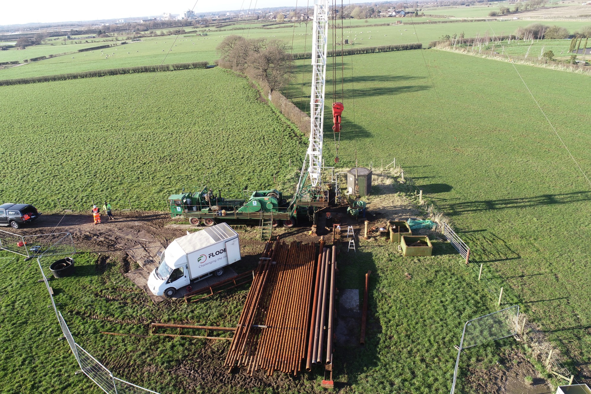
We were appointed by INEOS Inovyn to survey a brine cavity (H222) of approximately 1.2 million cubic metres located beneath a 1,600-hectare brinefield, as part of their brine cavity logging programme.
Northwich is a historic salt town where brine mining and processing continue today by INEOS to supply essential raw materials to Inovyn in Runcorn and Tata Ash in Northwich.
Survey Objective
The survey was required by INEOS Inovyn engineers to assess the size, depth, location, and condition of the brine-filled cavity.
It was also required to identify any changes to the cavity’s size, shape, or condition since its last survey, which we had previously carried out.
Survey Methodology
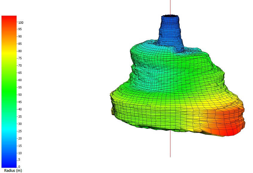
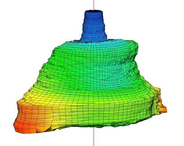
Due to the cavity being filled with brine water, a multibeam sonar survey was the only viable option to survey the void.
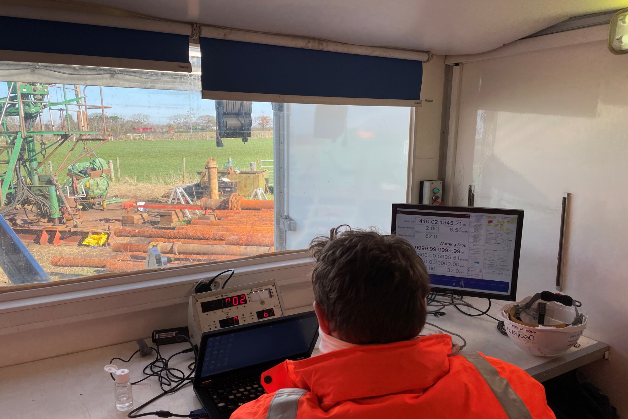
Before we deployed the sonar, essential checks were carried out using FLODIM’s Explorer G2 to inspect the integrity of the brine cavity. This included assessing the depth of the void, confirming the presence of brine water, and determining whether conditions were suitable for the deployment of the sonar.
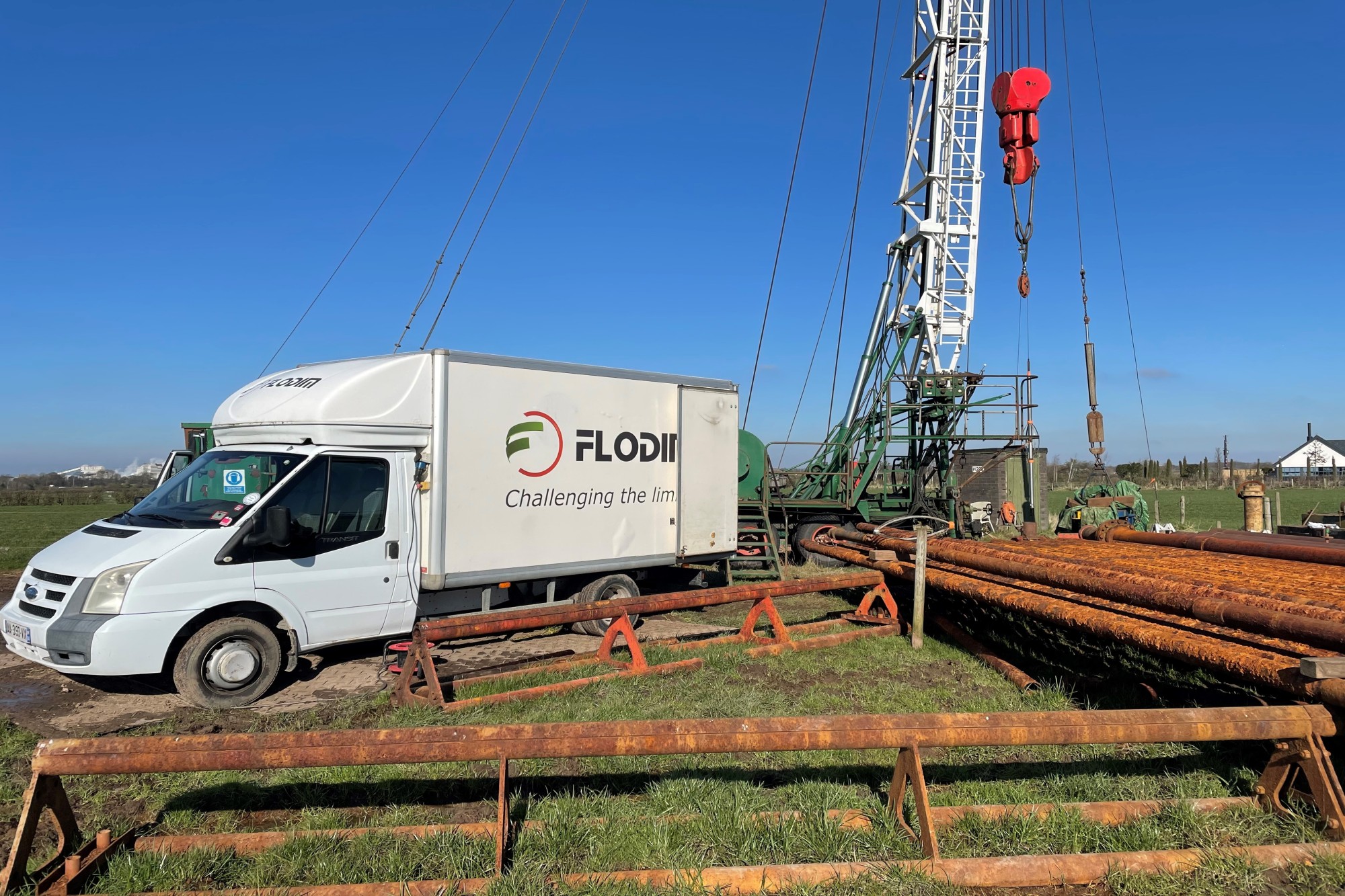
Once conditions were confirmed as suitable, we lowered FLODIM’s multibeam sonar down the well head, which had been isolated, to capture a fully georeferenced, 360-degree domed survey of the cavity.
In addition, a 3D laser scan survey of the terrain above the brine cavity was carried out using a Leica RTC 360 laser scanner to provide the client with an updated topographical plan.
Both surveys were georeferenced to OSTN 15 National Grid.
What We Provided the Client
Geoterra delivered the following to the client:
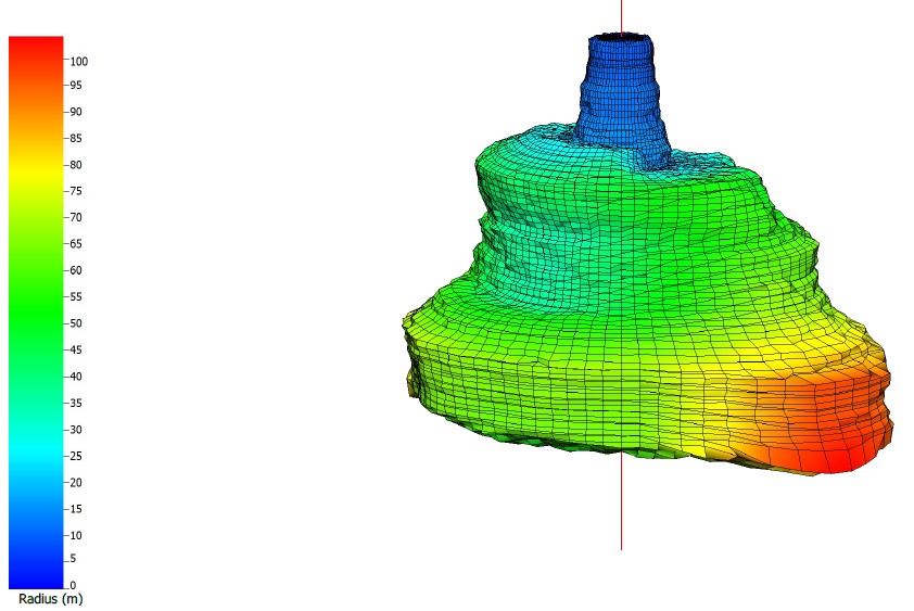
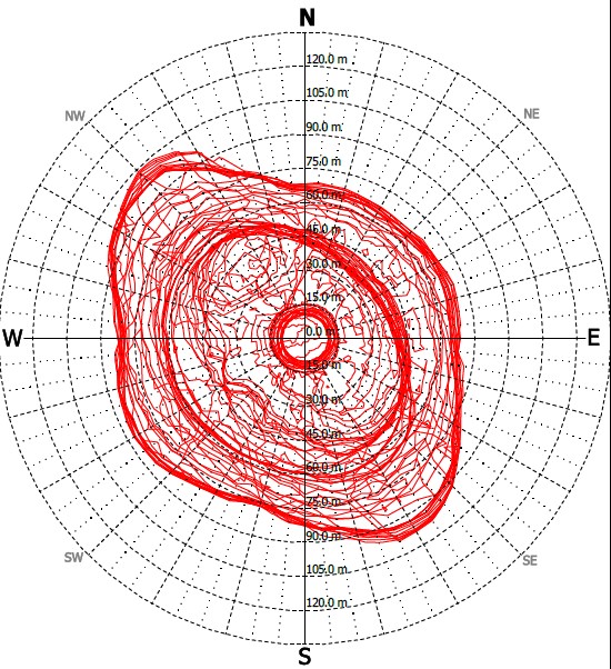
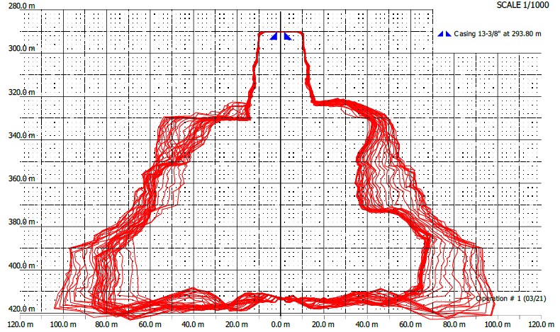
- Combined georeferenced 3D point cloud model of the brine cavity for viewing in Cloud Compare.
- 3D cross sections, plans and a mesh of the brine cavity.
- Comprehensive written report setting out our findings.
- An updated topographical plan.
Using the survey data, INEOS Inovyn was able to properly assess the condition of the brine cavity and plan any remediation work if deemed necessary. The data will also be used to compare against future surveys to monitor changes.