From topographical surveys through to complex three-dimensional surveys, we provide operators in the mining and mineral sector with precision survey data for planning and engineering purposes.
Geoterra has unrivalled experience and expertise in the mining and mineral sector.
We have a proven track record in carrying out land surveys for mine and quarry operators, planners, land owners and developers, and government agencies.
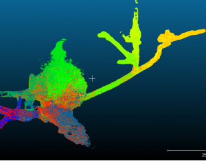
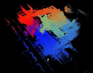
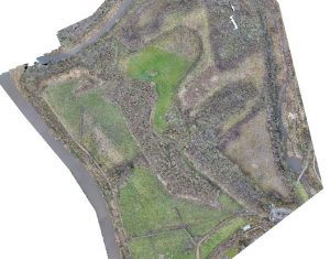
In addition to carrying out traditional topographical surveys for the UK’s mining and mineral sector, Geoterra provides a range of specialist surveying services including 3D laser scanning, underground surveys of voids and cavities, volumetric surveys and, together with our partners Skycap, a fast, cost-effective aerial survey, mapping and photogrammetry service using UAV technology.
Geoterra’s Managing Director, Mark Hudson, a Chartered Land Surveyor and former mining surveyor, also provides independent expert advice to legal professionals to help resolve boundary and volumetric disputes, and to act as an expert witness for complex litigation in court.
Geoterra are active members of the British Drilling Association.
Our land surveying services for the mining and mineral industry include:
- Consultancy & Project Management
- Geospatial Engineering:
- 3D Laser Scanning
- Subsurface Laser Scan Surveys
- Sonar Surveys
- UAV Aerial Surveys & Inspections
- UAV Aerial LiDAR Surveys
- HD CCTV Surveys
- 3D Modelling & Visualisation
- Expert Witness
 Civil Engineering