Creswell Colliery Historic Mine Shaft Survey
Creswell, Derbyshire
A partially submerged historic mine shaft survey to assess its condition and structural integrity prior to the installation of a closed-circuit geothermal system.
The Brief
We were appointed by the Mining Remediation Authority (MRA) to survey a historic mine shaft at the former Creswell Colliery.
After the colliery closed in 1991, the shaft had been mothballed and slowly filled with water once the pumps were turned off. As a result, it was partially flooded at the time of the survey.
Survey Objective
The survey was required by the MRA to check the condition and structural integrity of the shaft before a closed-circuit geothermal system was to be installed in this single vertical shaft.
The Creswell Colliery geothermal project, developed by Bolsover District Council and the University of Derby, aimed to use warm water from the flooded mine shaft to provide renewable heating for local communities, reducing the reliance on fossil fuels.
Survey Methodology
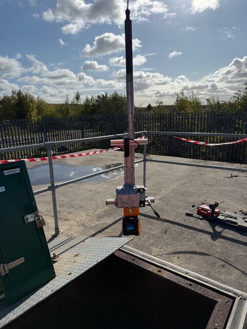
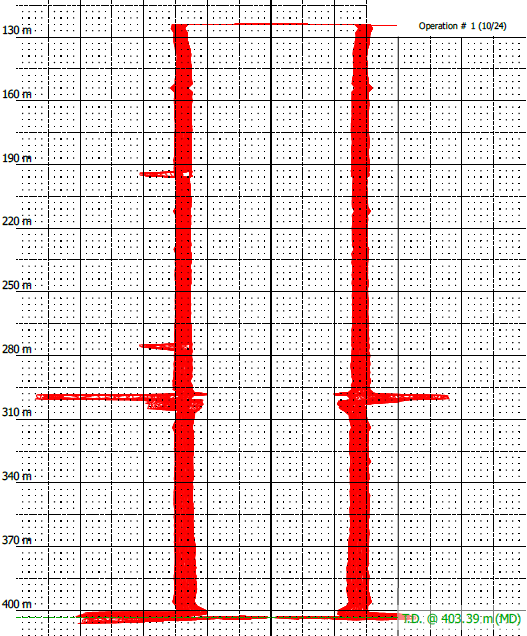
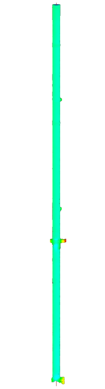
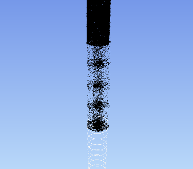
The mine shaft extends to a depth of 402 m below ground level. Access to the shaft was gained via a 1 m2 hatch.
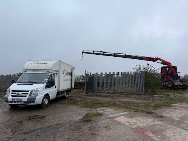
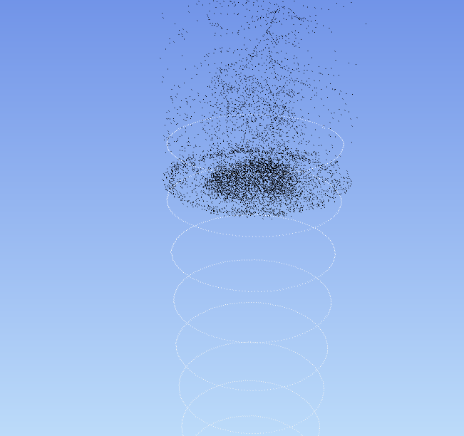
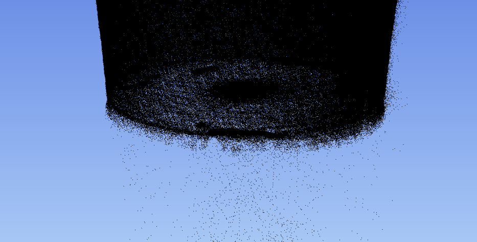
The upper 125 m of the shaft, which was not submerged, was surveyed using a FARO Horizon mobile mapping laser scanner. The scanner was mounted on a winch cable and lowered vertically into the shaft using a crane.
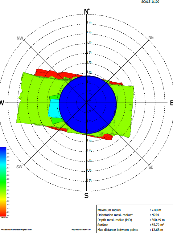
The lower 375 m of the shaft, which was filled with water, was surveyed using FLODIM’s multibeam sonar.
Before we deployed the sonar, essential checks were carried out using FLODIM’s Explorer G2 to inspect the integrity of the cavity. This included assessing the depth of the void, confirming the presence of water, and determining whether conditions were suitable for the deployment of the sonar.
Once conditions were confirmed as safe, the crane was used to lower the multibeam sonar into the mine shaft via the access hatch to survey the submerged section.
In addition, a 3D laser scan survey of the ground surface above the shaft was carried out using the FARO Horizon mobile mapping laser scanner. This enabled all datasets to be combined into a single, fully georeferenced 3D model showing both above- and below-ground features after processing.
Both surveys were georeferenced to the OSGB OSTN15 National Grid.
What We Provided the Client
Geoterra delivered the following to the client:
- Combined georeferenced 3D point cloud model of the mine shaft – above- and below-ground – for viewing in Cloud Compare.
- Comprehensive written report setting out our findings.
Using the survey data, the Mining Remediation Authority was able to assess the condition of the historic mine shaft ahead of any works to install the closed-circuit geothermal system, ensuring the project could proceed safely.