Geoterra carry out urgent subsurface laser scan survey following major road collapse in Scotland
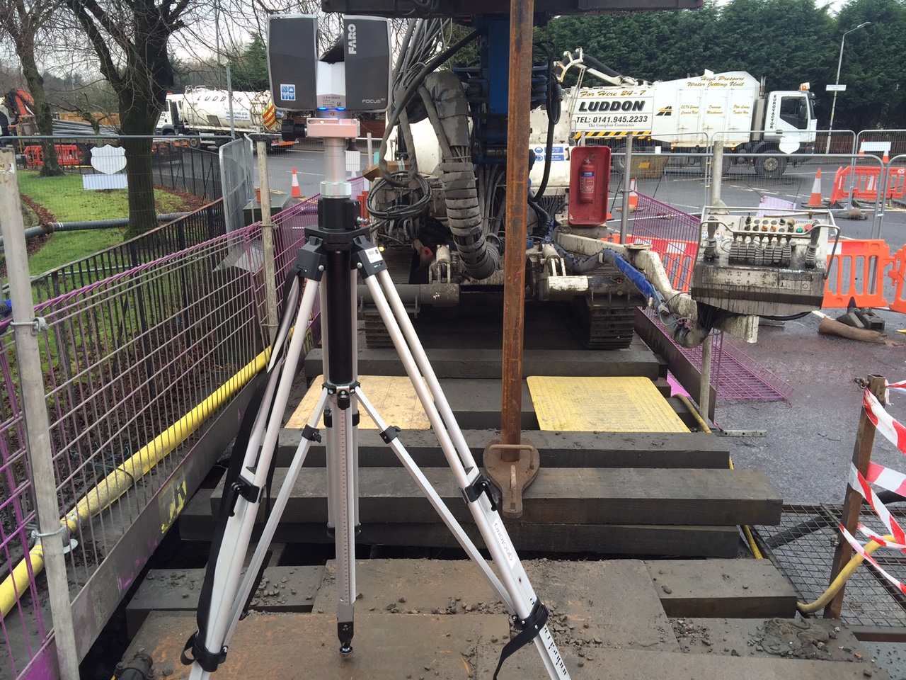
Following a major ground collapse on Kilbowie Road in Clydebank, our emergency response team were called to site by ground investigation experts Soil Engineering and The Coal Authority to carry out an urgent subsurface laser scan survey of an unrecorded mine shaft.
If you’re familiar with Clydebank, you will be aware that Kilbowie Road is a major artery road into Glasgow city. The collapse resulted in the immediate road closure.
The old mine shaft, which was not detailed on historical mining records, is understood to have been used to extract coal, limestone and iron ore over 100 years ago. The first discovery of this redundant mine shaft was made when a six-metre diameter hole became visible on the road surface.
Subsurface laser scan survey of legacy mine shaft
“Without understanding the full extent of the problem, no remedial work could begin. Our client needed to know the exact size, location and condition of the shaft before a solution could be designed to make it safe,” said Geoterra Managing Director and Chartered Land Surveyor, Mark Hudson.
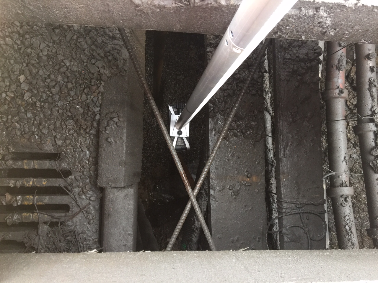
Using the Faro Focus 3D, we carried out a laser scan survey of the road surface, together with a C-ALS subsurface laser scan survey of the redundant mine shaft.
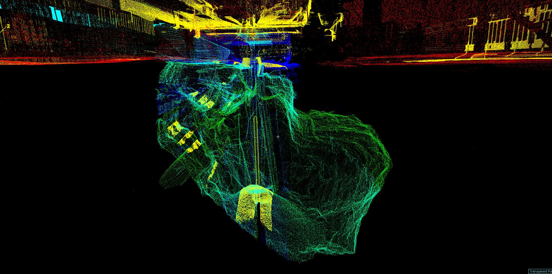
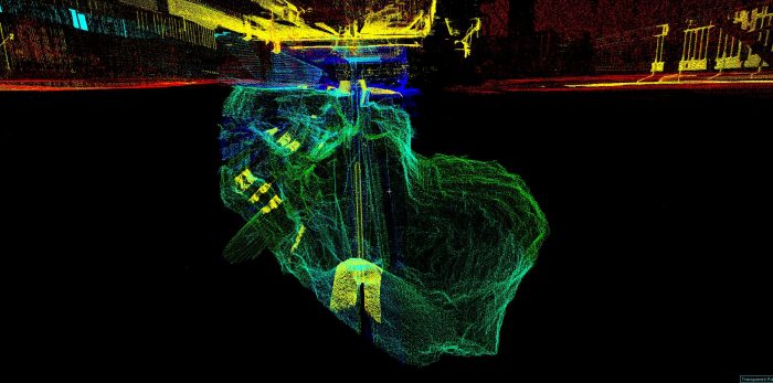
“We discovered a 200-cubic meter void positioned on top of the mine shaft which went down 56 meters,” added Mark.
“When you start exploring below ground level, you never know what you might discover and this survey was no exception. The survey identified a number of utility services that would need to be protected and repaired during the remedial works.”
3D model produced of mine shaft
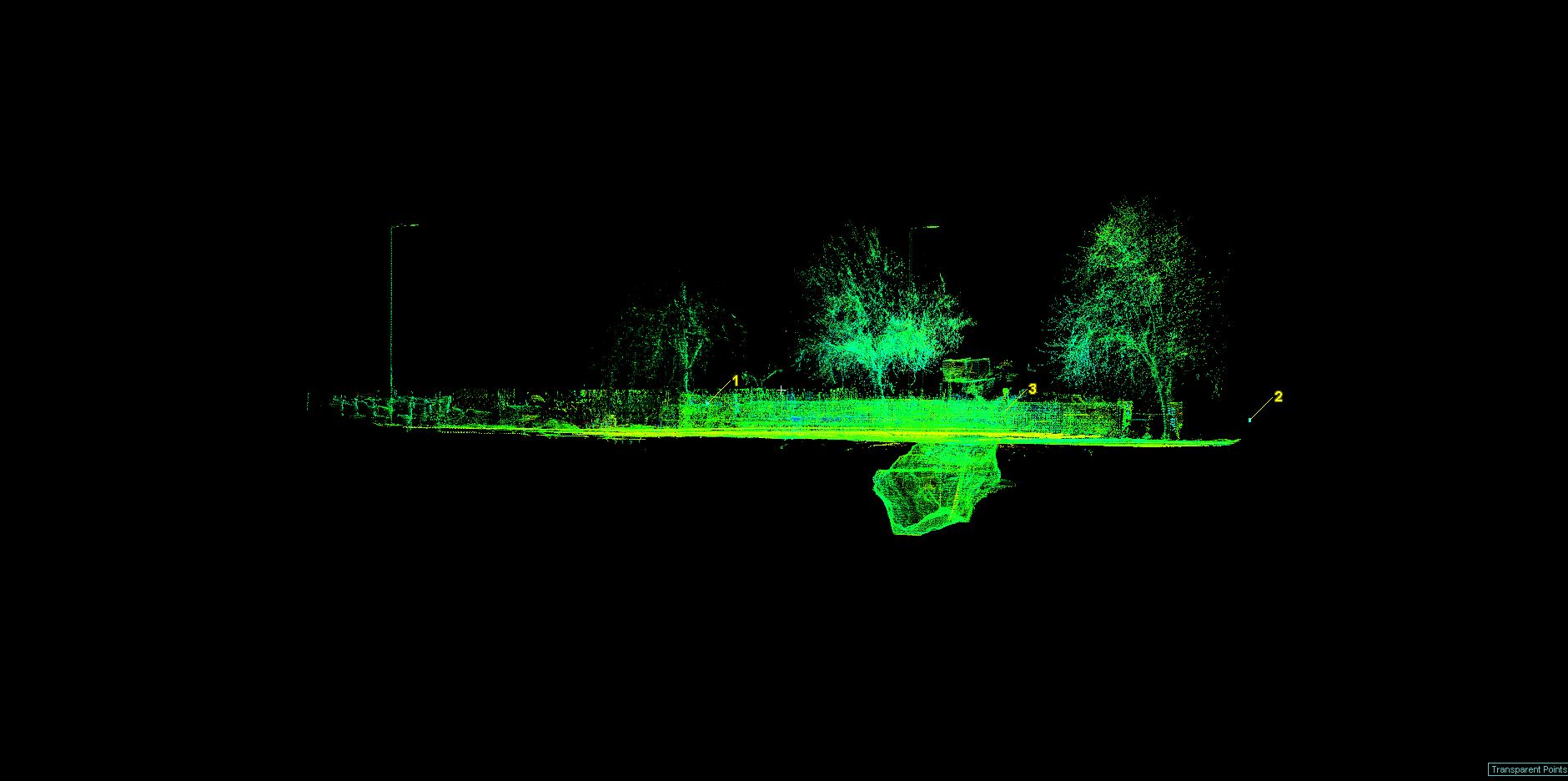
Geoterra provided Soil Engineering and The Coal Authority with geo-referenced laser scan survey data and a 3D model mapping the location of the mine shaft in relation to the road surface. Samples of the quality of the deliverables can be viewed in the gallery below. A subsurface laser scan survey was the only way to identify this unrecorded mine shaft beneath the road.
The proposed remedial works including shaft infilling and repairs to a fractured foul water sewer and storm water drain.
This project was published on the gov.uk website as part of The Coal Authority’s commitment to keeping the public informed about mining legacy issues.
Need a void, shaft or cavity surveying?
For more information about our void, shaft and cavity surveys and to request a quotation, contact our Subsurface Laser Scanning team on 01606 75755.