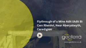
Historic Lead Mine Adit and New Drainage Tunnel 3D Laser Scan Survey
Cwn Rheidol, Near Aberystwyth, Ceredigion
An above- and below-ground 3D laser scan survey of a historic lead mine adit and new drainage tunnel on behalf of civil engineering contractors, Walters Group.
The Brief
Geoterra was appointed by civil engineers, Walters Group, to carry out an above- and below-ground 3D laser scan survey of a historic lead mine adit (Adit 9) and a newly installed drainage tunnel connecting to the adit. Walters Group was acting on behalf of the Mining Remediation Authority and Natural Resources Wales.
The new drainage tunnel had been installed to divert water draining on the disused lead mine. A historical partial collapse in the mine adit caused a blockage in Adit 9, leading to a build-up of pressure. This created a risk of a potential blow-out, prompting the installation of the new drainage tunnel to reduce the hazard.
Survey Objective
The survey was required to allow the civil engineering contractors to determine the structural condition of Adit 9, specifically in-bye and out-bye beyond the intersection with the new drainage tunnel.
This section of the adit had not been surveyed previously due to the blockage. The aim was to take proactive measures to ensure that there were no future risks of collapse in the old adit by carrying out an engineering assessment and, if needed, planning for remediation works.
Geoterra carried out both above- and below-ground 3D laser scan surveys to confirm the location and alignment of the new drainage tunnel and Adit 9 relative to surface features, as well as an assessment of the condition of the old adit.
Technology Used
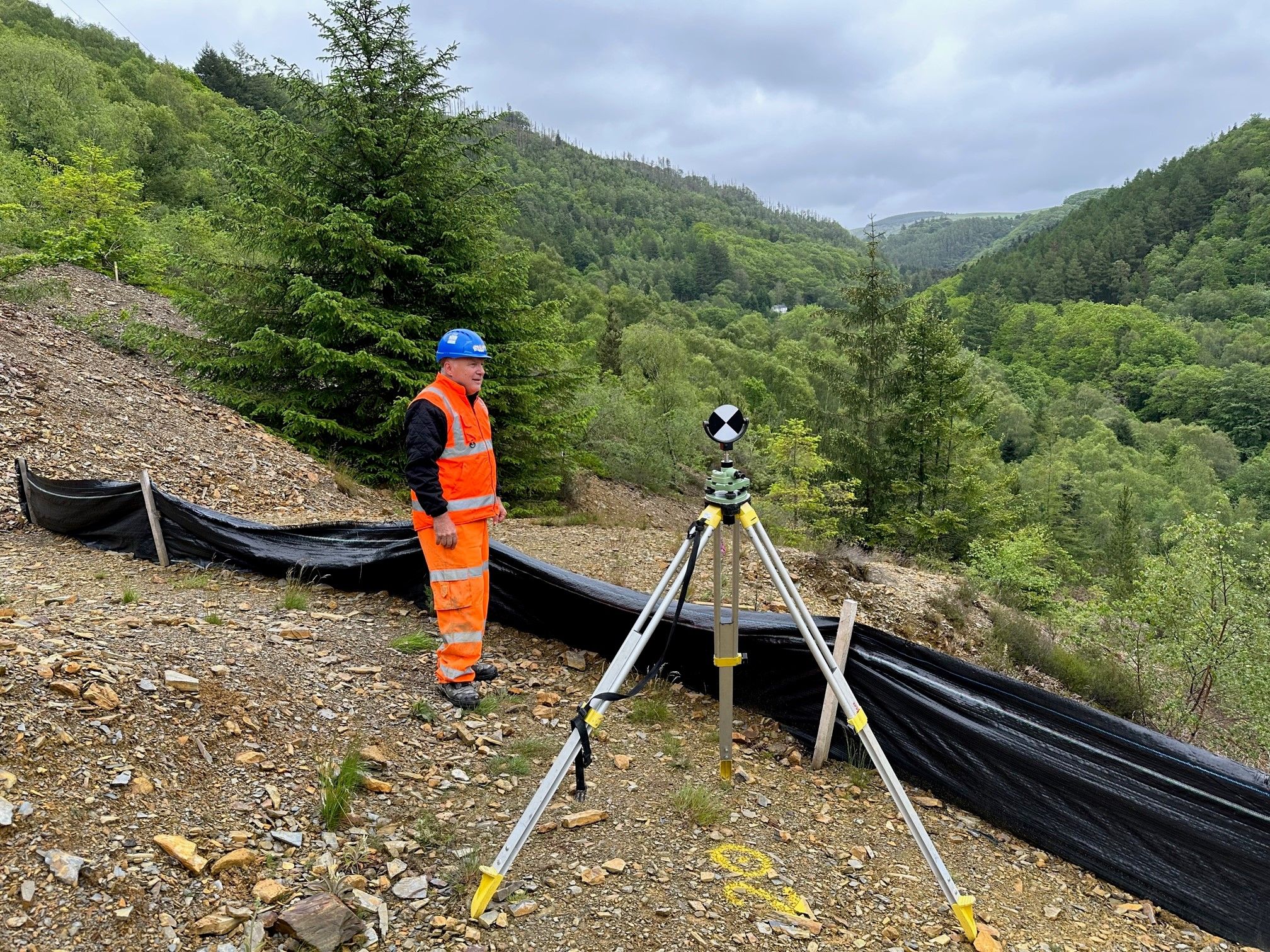
We installed survey control outside the drainage tunnel and at the end of the drainage tunnel.
A Leica RTC 360 laser scanner was used to carry out a 3D laser scan survey of the drainage tunnel portal and into the drainage tunnel up to the intersection with Adit 9.
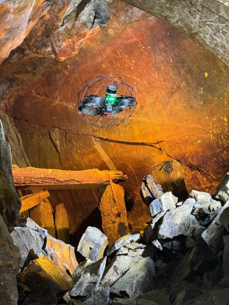
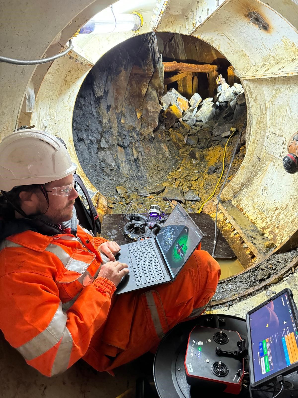
In partnership with FlyThru, the Elios 3 UAV was used to capture HD video footage and a 3D laser scan survey of Adit 9, in-bye and out-bye of the intersection with the new drainage tunnel and old adit.
The surveys were georeferenced to OSGB OSTN15 National Grid and level datum.
What We Provided the Client
Geoterra delivered the following to the client:
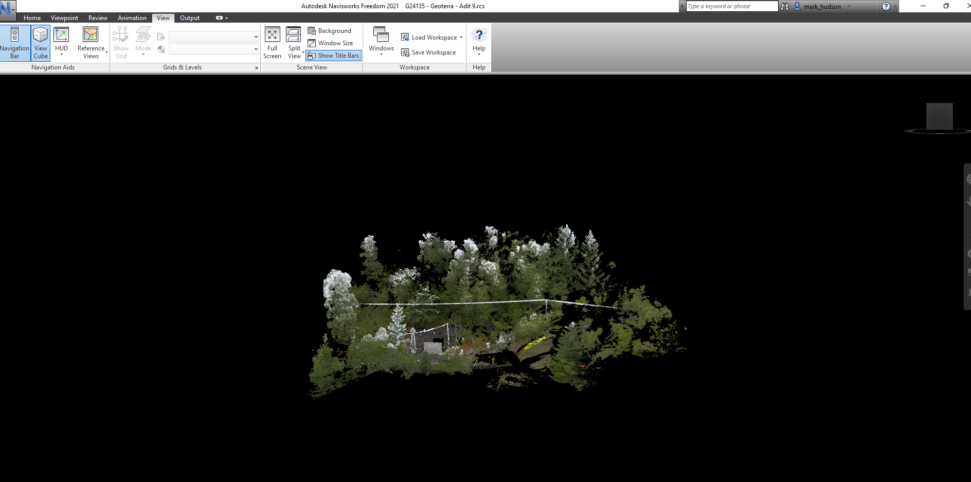
- 3D point cloud of the new drainage tunnel and Adit 9.
- Data supplied in RCS, RCP, and LAS formats for viewing in Navisworks.
- Updated topographical survey plan of the surface locale.
- High-definition flythrough videos of the drainage tunnel and Adit 9.
-
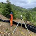
- The set up of external survey control at Adit 9.
-
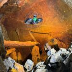
- The Elios 3 UAV entering the old drainage adit to start the survey.

-
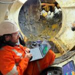
- Flying the Elios 3 UAV from the end of the pipe jack.
-
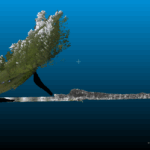
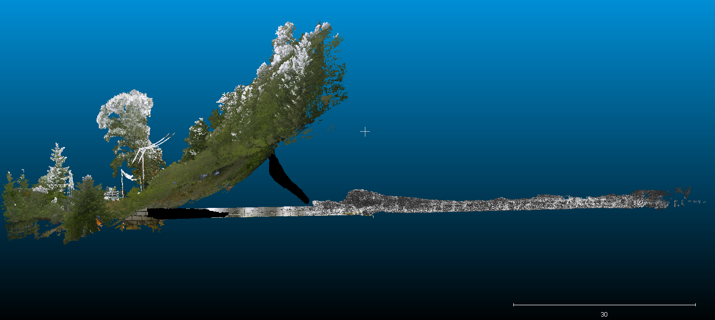
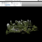
- A combined 3D point cloud model of the old drainage adit and surface features above.
-
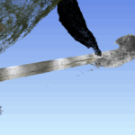
- A combined 3D model of the old drainage adit, pipe jack and surface features above.
-
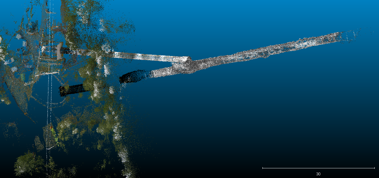
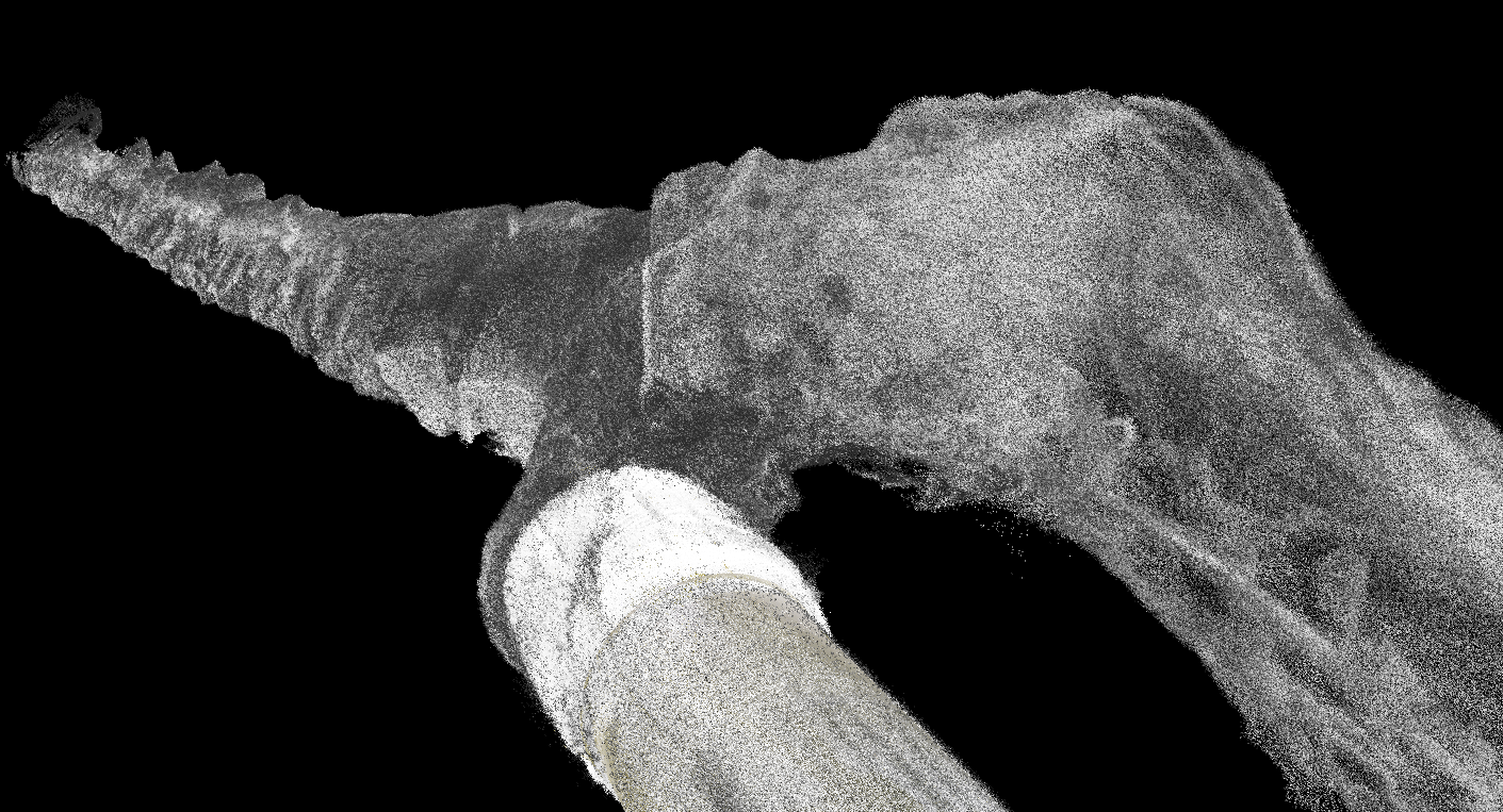
- A 3D point cloud model of the old drainage adit and pipe jack intersection.
-
- A 3D point cloud model of the old drainage adit, access shaft and surface.
-
- A UAV LiDAR survey of the ground above the old drainage adit and pipe jack.
Watch this flythrough video inside the old mine adit: