Multibeam Sonar Survey of an Old Mine Shaft and Drainage Adit
Goshen Park, Skewen, South Wales
A subsurface multibeam sonar survey of an old mine shaft and drainage adit following a significant 'blowout' event.
The Brief
We were requested by the Mining Remediation Authority (MRA) to survey a legacy mine shaft and connecting drainage adit following a significant ‘blowout’ event in a residential area.
The drainage adit, originally built to channel water away from the mine workings, became blocked and could not cope with the volume of water that had accumulated over time, much of which was understood to have originated from the nearby Drummau Mountain, and following a period of heavy rainfall. This caused a surge of ochre-laden mine water to rise to the surface through a mine shaft, flooding the streets and properties above, and triggering a ground collapse that exposed the shaft.
As a result, residents of around 80 homes on Goshen Park in Skewen were temporarily displaced, with the support of the MRA, while an investigation was carried out, and remediation works were planned and undertaken.
Survey Objective
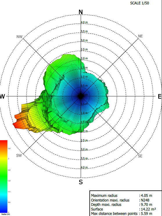
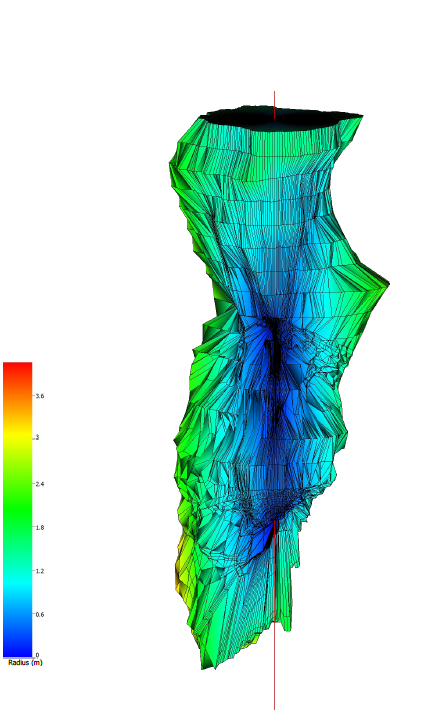
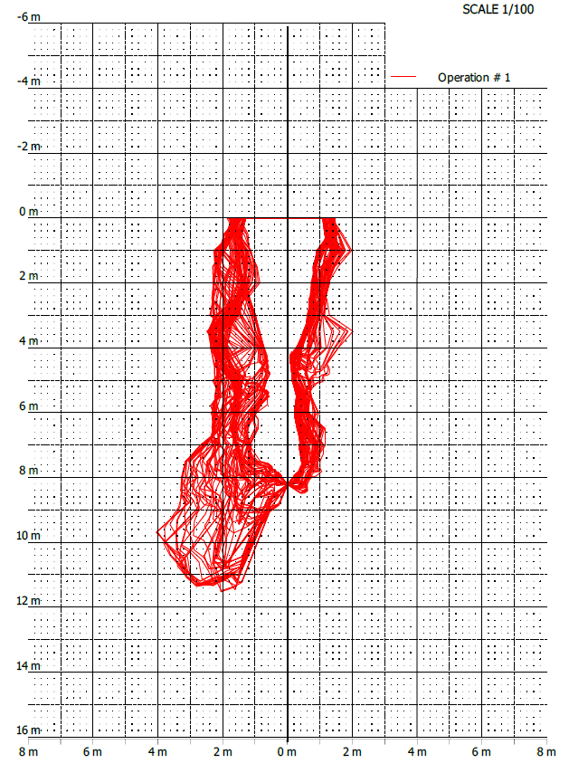
The survey was required by the MRA to assess the size, depth, location, extent, and condition of the submerged mine shaft and drainage adit.
It was also required to identify any additional adits or other old mine workings to support the planning and design of safe and effective remediation works.
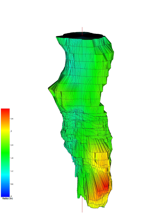
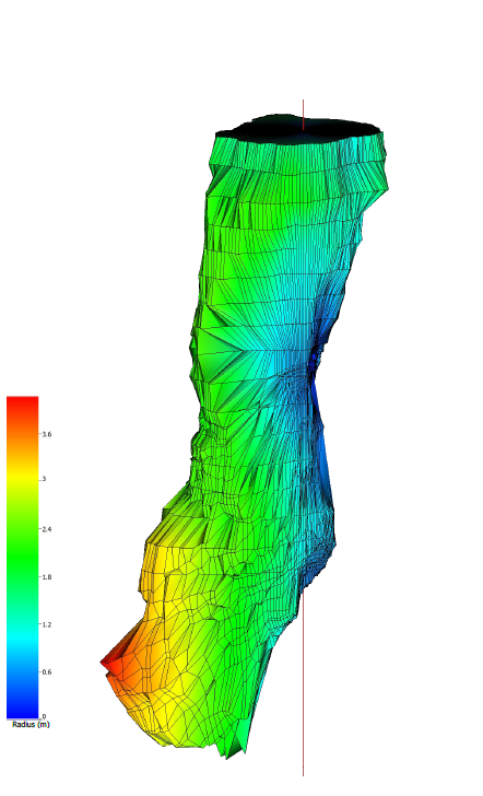
Survey Methodology
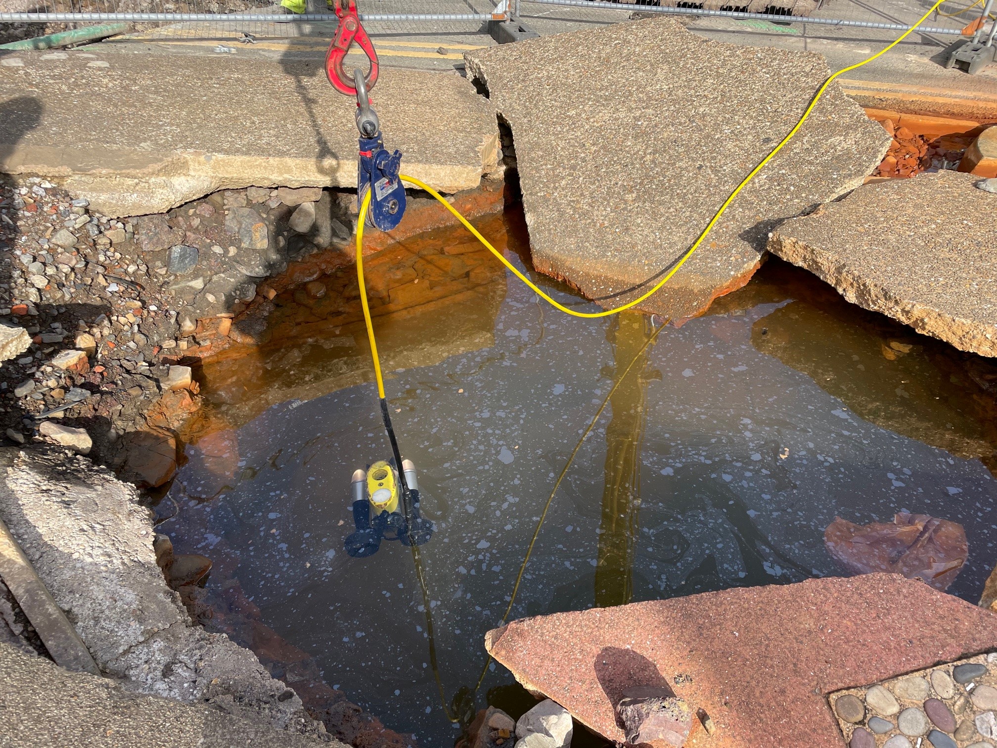
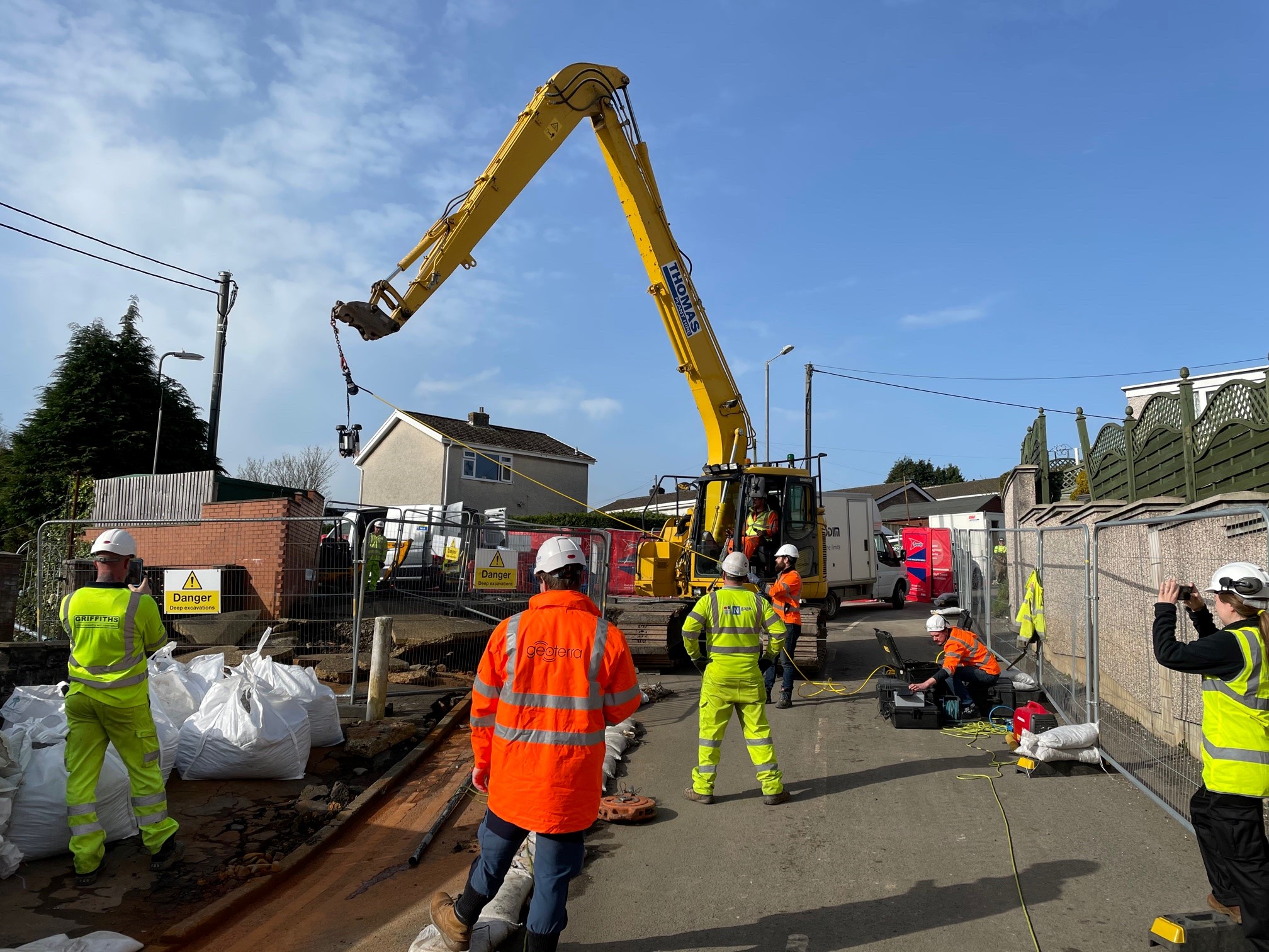
Due to the shaft and adit being flooded, a multibeam sonar survey was the only viable option to survey the void.
Before we deployed the sonar, essential checks were carried out using FLODIM’s Explorer G2 to inspect the integrity of the void. This included assessing the depth of the void, confirming the presence of water, and determining whether conditions were suitable for the deployment of the sonar.
Once conditions were confirmed as suitable, we lowered FLODIM’s multibeam sonar down the centre of the shaft to capture a fully georeferenced, 360-degree domed survey of the void.
In addition, a 3D laser scan survey of the terrain above the historic mine shaft and adit was carried out using a Leica RTC 360 laser scanner to accurately determine the position of the void in relation to the surface and above-ground features.
Both surveys were georeferenced to OSGB 36 National Grid.
What We Provided the Client
Geoterra delivered the following to the client:
- Combined georeferenced 3D point cloud model of the subsurface and surface features for viewing in Cloud Compare.
- Comprehensive written report setting out our findings.
- An updated topographical plan.
Using the survey data, the MRA was able to effectively plan and implement remediation works to secure the mine shaft and stabilise the surrounding ground. The findings also informed a long-term strategy for managing water from nearby mine workings and excess mine water from prolonged rainfall, helping to reduce the risk of future ‘blow out’ events and protect nearby properties.