3D Laser Scan Survey of a Pedestrian Bridge Understructure
Horstforth, Leeds
A 3D laser scan survey of a Grade II listed former toll bridge in Horsforth, Leeds for WSP Consulting Engineers
The Brief
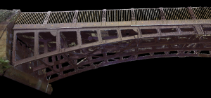
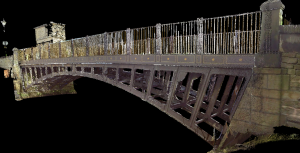
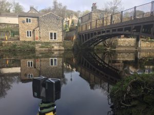
Geoterra was appointed by WSP Consulting Engineers to carry out a 3D laser scan survey of the top and understructure of a Grade II listed former toll, now a pedestrian bridge at Newlay Lane, Horsforth.
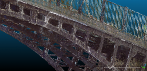
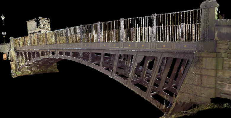
The survey data was required by WSP Consulting Engineers to enable them to assess the understructure of the bridge and its condition as part of a programme of refurbishment work, and to tie it into the 3D model as a whole.
The Solution
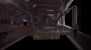
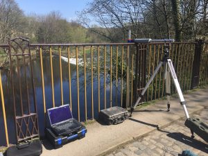
Surveying the understructure of the bridge was difficult due to the location above the River Aire limiting the use of many surveying methods.
Geoterra’s experienced geospatial engineers utilised a specialist FARO laser scanner inverted and suspended over the side of the bridge to carry out the 3D laser scan survey of the understructure. The FARO was also used to scan the top part of the bridge in order to generate a complete 3D model of Newlay Bridge.
The surveys were geo-referenced to OSTN 15 National Grid.
The Deliverables
Geoterra provided WSP Consulting Engineers with a geo-referenced 3D laser scan point cloud of the bridge and adjacent river banks in RCS/RCP & DXF, E57 and LAS for viewing in Cloud Compare.