Clifton Hall Tunnel Subsurface Laser Scan Survey
Swinton, Greater Manchester
Subsurface 3D laser scan surveys of a disused railway tunnel for site investigation and remediation.

The Brief
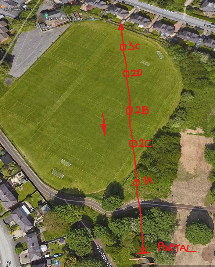
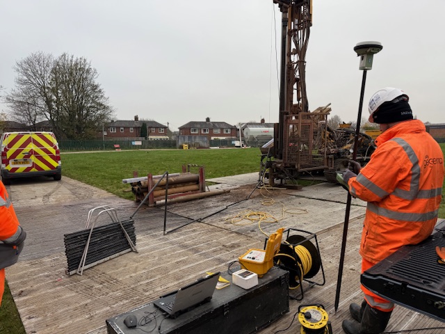
Geoterra was engaged by M&J Drilling on behalf of AmcoGiffen and Jacobs Consulting Engineers to carry out a series of 3D laser scan surveys of the disused Clifton Hall Tunnel beneath Swinton Football Club in Swinton, Greater Manchester. The data collected was required in order to assess and safely remediate underground voids below the main pitch and nearby properties.
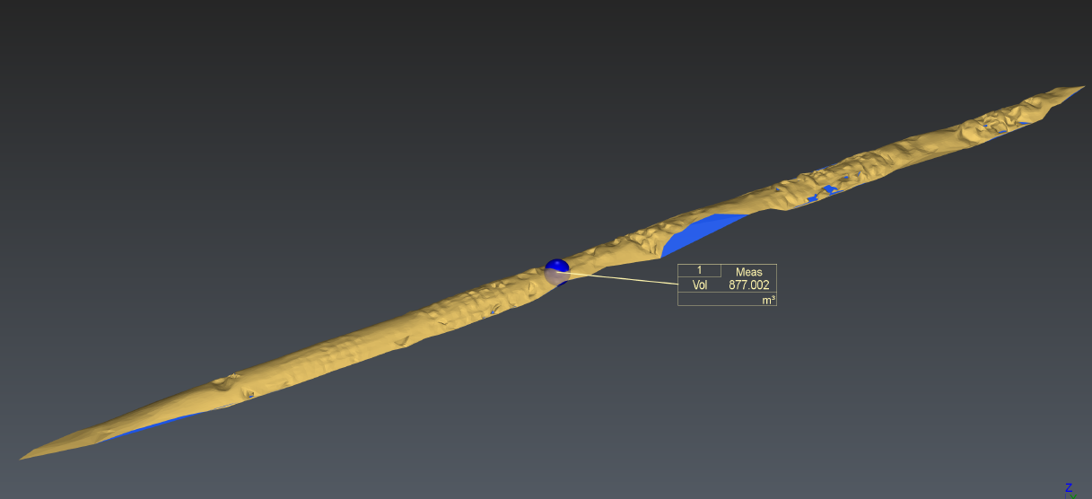
The purpose of the survey was to locate and map the disused railway tunnel voids beneath Swinton Football Club and residential areas along Barton Road. Accurate 3D data was required to calculate the volume of voids and enable M&J Drilling to plan and carry out a safe grout infill programme.
Technology Used
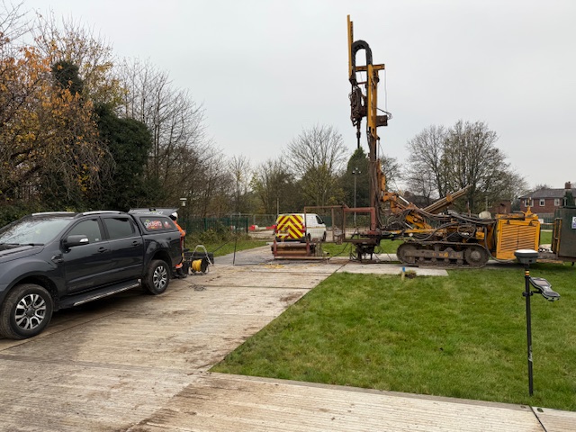
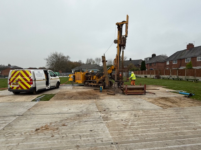
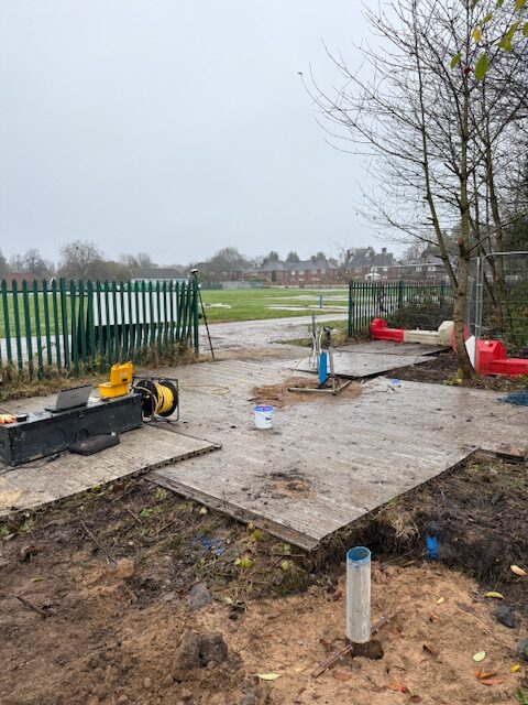
Geoterra’s experienced geospatial engineers used a specialist C-ALS laser scanner, deployed via 100mm vertical boreholes drilled from the surface. Additional internal tunnel imagery was captured using the onboard infra-red CCTV system.
- C-ALS laser scanner for geo-referenced 3D subsurface scanning
- Onboard CCTV for video inspection of voids
- Data referenced to OSTN15 National Grid
Survey Execution
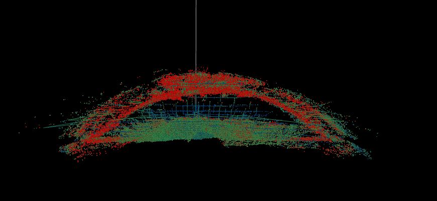
Access was achieved via five vertical borehole entry points. At each location, Geoterra carried out precision 3D laser scans to map the tunnel’s shape, size, and orientation. All data was captured in high resolution and geo-referenced for integration into existing site models.
What We Provided the Client
Geoterra delivered the following to M&J Drilling, AmcoGiffen and Jacobs Consulting Engineers:
• Geo-referenced 3D laser scan point cloud of the disused tunnel
• Accurate volume calculations for each tunnel void and full scanned sections
• Updated topographical survey plan
• Navisworks-compatible dataset for visual analysis and planning
This enabled M&J Drilling to plan and execute full void infill before any further works were carried out on site.