Aerial LiDAR and Photogrammetry Survey of Witton Landfill
Northwich, Cheshire
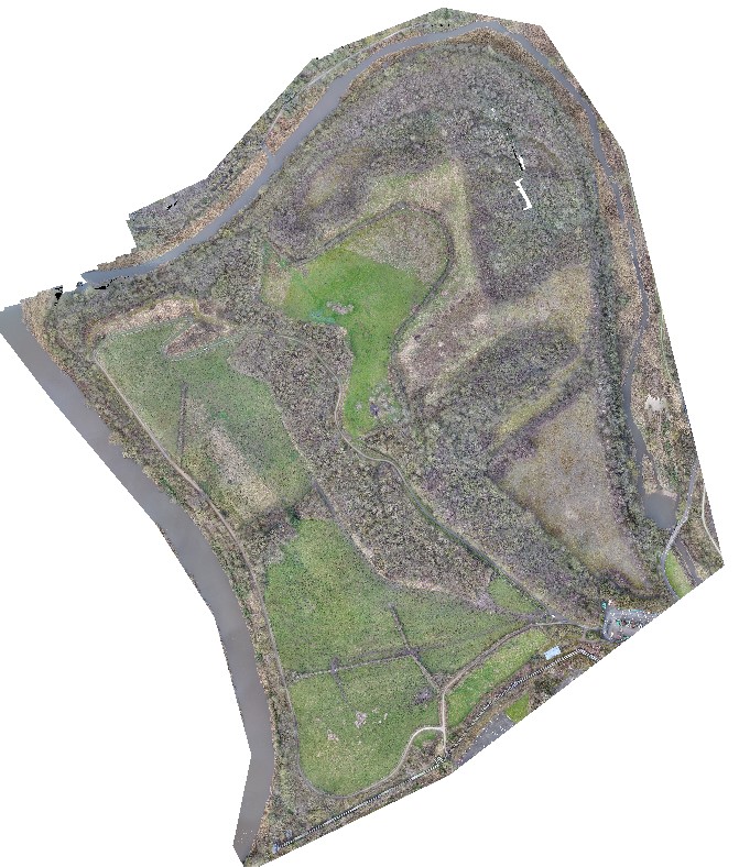
A UAV LiDAR and photogrammetry survey of a former landfill and refuse site in Northwich for Coopers Geo-Environmental Engineers and Cheshire West & Cheshire Council.
The Brief
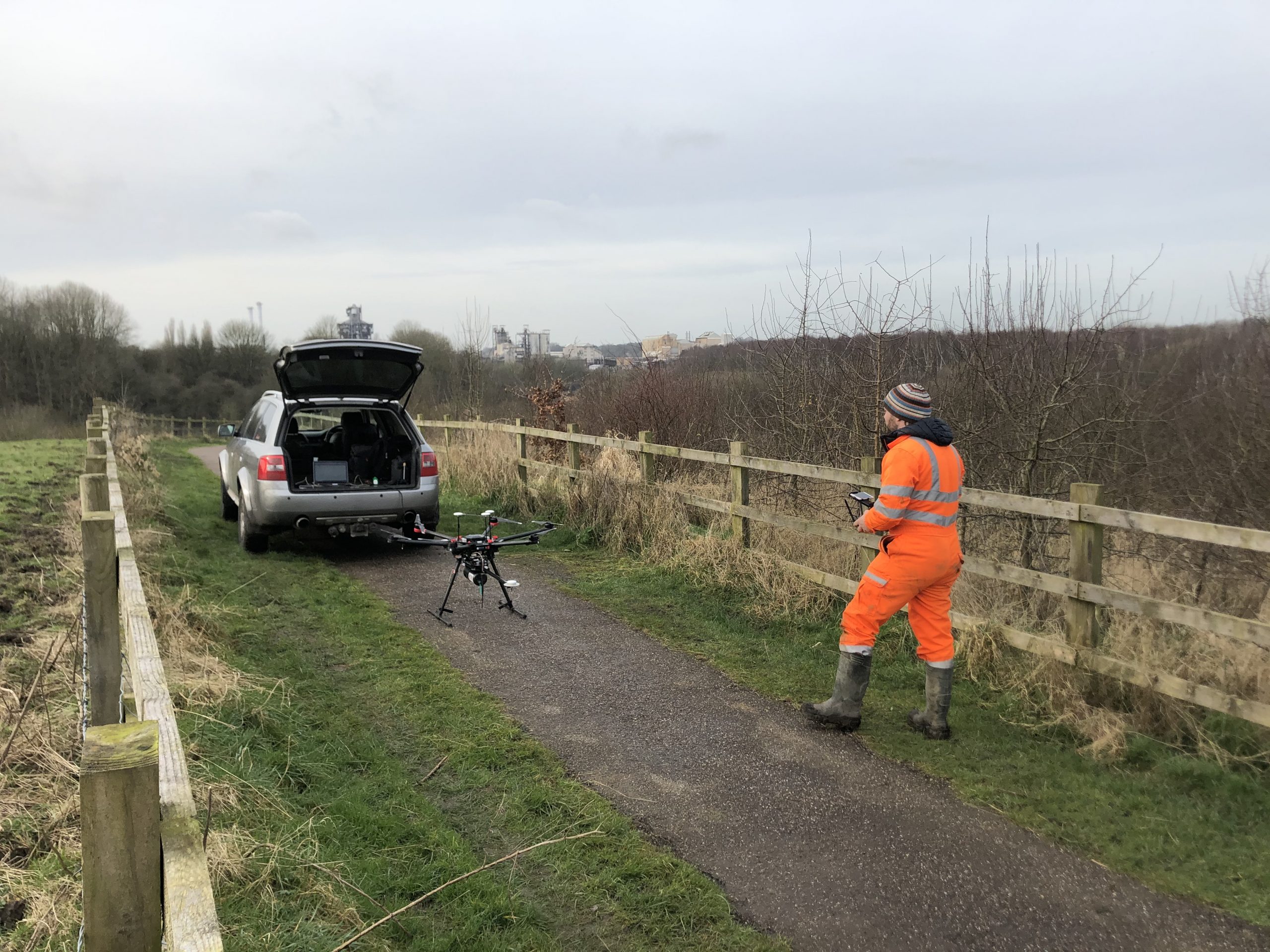
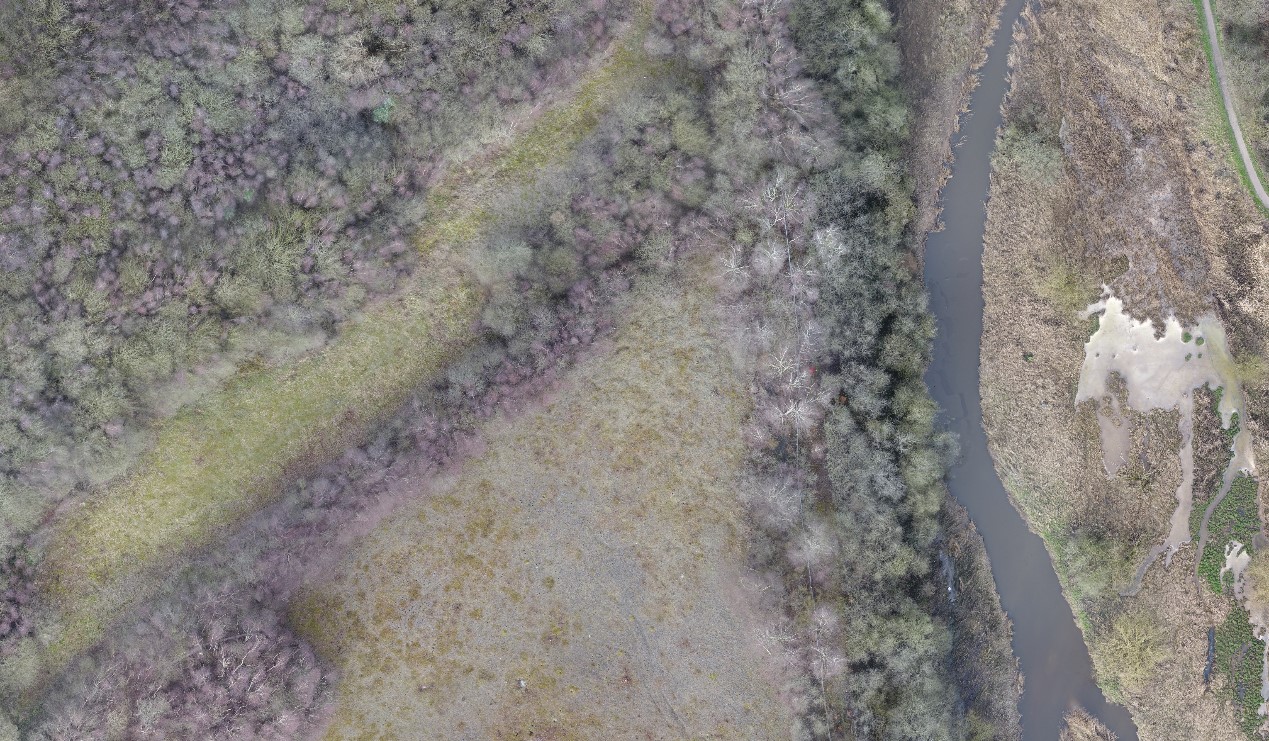
Geoterra was appointed by Coopers and Cheshire West & Cheshire Council to carry out a UAV survey using photogrammetry and low-level LiDAR techniques on a former refuse and landfill site adjacent to the River Weaver in Carey Park, Northwich.
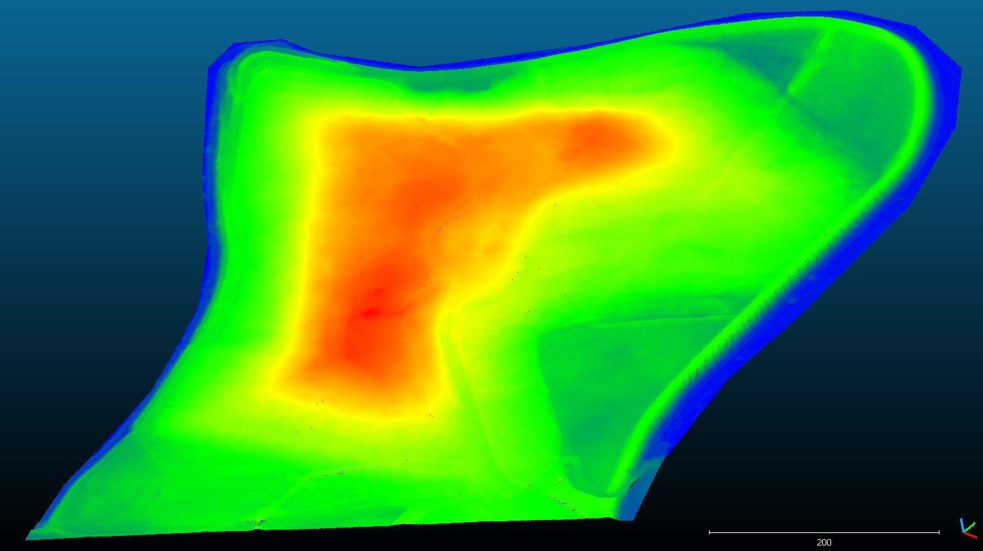
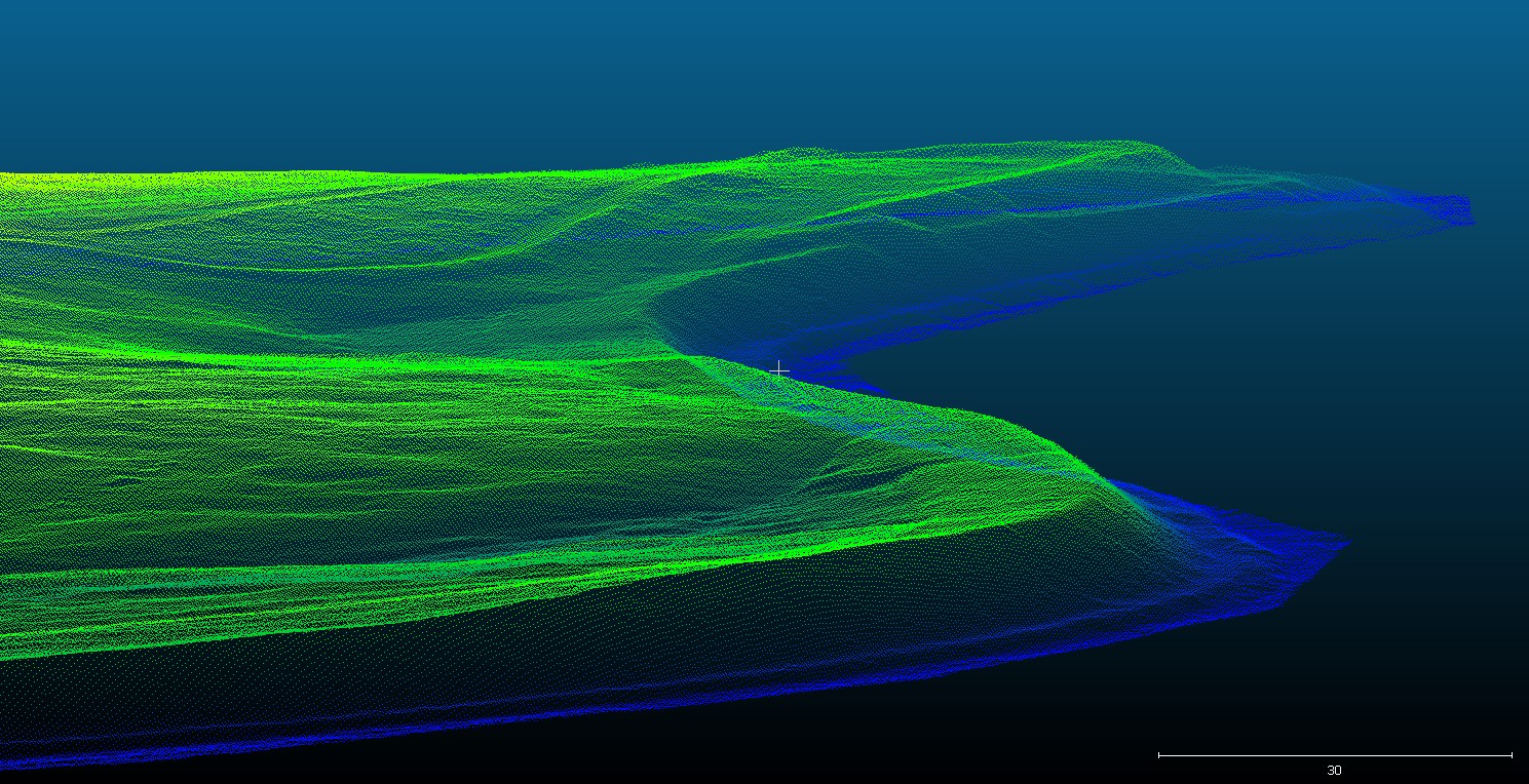
The survey data was required by both Coopers and Cheshire West & Cheshire Council to enable them to generate a 3D model of the site and monitor the former landfill especially the river embankments adjoining the River Weaver. Previous topographical surveys were carried out using lines every 100m, which could have missed significant detail within the site.
The Solution
Geoterra’s experienced geospatial engineers in collaboration with our partners FlyThru utilised a bespoke heavy lift UAV equipped with a high definition DSLR camera and Velodyne LiDAR sensor to fly over the former landfill and refuse site, generating a large multipath multi return laser scan point cloud. The point clouds were then post-processed to produce an extracted vegetation ‘bare earth’ Digital Terrain Model. A DJI Phantom UAV was used equipped with a high definition DSLR camera also to complete the photogrammetry survey of the same area flown with the UAV LiDAR.
Ground control points were set up across the site and surveyed to OSGB 36 National Grid.
The Deliverables
Geoterra provided Coopers and Cheshire West & Cheshire Council with a range of key deliverables including a Digital Terrain Model, Ortho-rectified mosaic photography TIF, contour plan and a 3D LiDAR point cloud in CSV and LAS formats.