A UAV LiDAR and Photogrammetry Survey of King George V Memorial Embankment
Cornwall
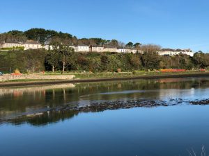
A UAV LiDAR and photogrammetry survey of King George V Memorial Embankment facing the tidal estuary in Cornwall for Cormac Consulting.

The Brief
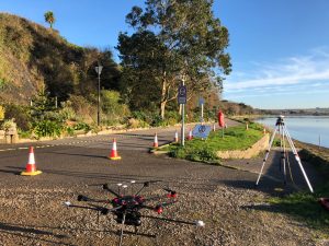
Geoterra was appointed by Cormac Consulting to carry out a UAV survey using photogrammetry and low-level LiDAR techniques on a residential/leisure land, which had moderate low-level vegetation cover at the time of the survey adjacent to the tidal estuary at Hayle, Cornwall.
The survey data was required by Cormac Consulting to enable them to assess the ongoing landslide risk faced on the Memorial Embankment as normal topographical survey methods proved unsuccessful.
The Solution
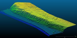
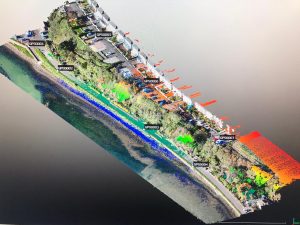
Geoterra’s experienced geospatial engineers in collaboration with our partners FlyThru utilised a bespoke heavy lift UAV equipped with a high definition DSLR camera and Velodyne LiDAR sensor to fly over both the embankment and adjacent area, generating a large multipath multi return laser scan point cloud. The point clouds were then post-processed to produce an extracted vegetation ‘bare earth’ Digital Terrain Model. A DJI Phantom 4 Pro UAV was used equipped with a high definition camera also to complete the photogrammetry survey of the same area flown with the UAV LiDAR.
Ground control points were set up across the site and surveyed to OSGB 36 National Grid.
The Deliverables
Geoterra provided Cormac Consulting with a range of key deliverables including a Digital Surface Model, Digital Elevation Model, Ortho-rectified mosaic photography TIF, contour plan and a 3D LiDAR point cloud in CSV and LAS formats.