News Article
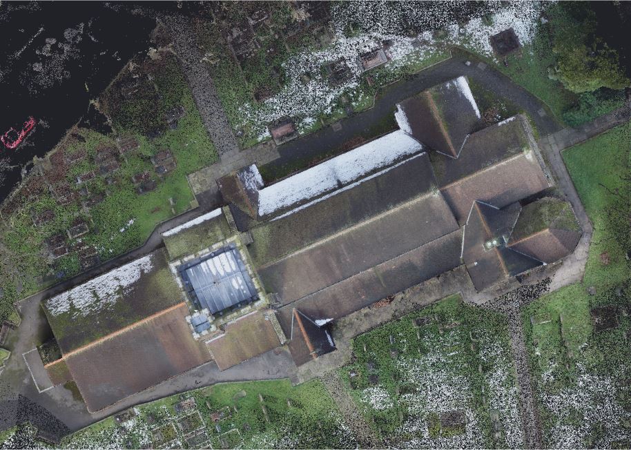
UAV photogrammetry survey of St John’s Church » Hartford Church – Top View
WP_Post Object
(
[ID] => 1147
[post_author] => 2
[post_date] => 2021-02-20 12:03:56
[post_date_gmt] => 2021-02-20 12:03:56
[post_content] =>
[post_title] => Hartford Church - Top View
[post_excerpt] =>
[post_status] => inherit
[comment_status] => closed
[ping_status] => closed
[post_password] =>
[post_name] => hartford-church-top-view
[to_ping] =>
[pinged] =>
[post_modified] => 2021-02-20 12:03:56
[post_modified_gmt] => 2021-02-20 12:03:56
[post_content_filtered] =>
[post_parent] => 1144
[guid] => https://www.geoterra.co.uk/wp-content/uploads/2021/02/Hartford-Church-Top-View.jpg
[menu_order] => 0
[post_type] => attachment
[post_mime_type] => image/jpeg
[comment_count] => 0
[filter] => raw
)