Geoterra subsurface laser scan survey unveils chalk mine voids under primary school
A north-west London primary school was recently closed temporarily on the discovery of an old unknown chalk mine under its school, confirmed by survey data captured by Geoterra.
Pinner Wood Primary School recently hit the headlines after Harrow Council deemed there to be an “unacceptable risk” that the ground beneath the school could become unstable.
The early warning sign that the school grounds may be unstable came from the sighting of several mine roof collapses within the surveyed voids.
Geoterra in partnership with consulting engineers Peter Brett Associates were appointed by the school’s local authority, Harrow Council, to carry out a geological survey to determine the extent of the problem.
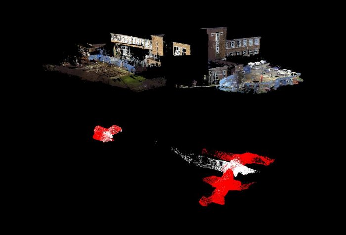
Using the Faro Focus 3D, we carried out a laser scan survey of the school building exterior and grounds, together with a C-ALS subsurface laser scan survey of several chalk tunnel voids, which are believed to date back to the 1800’s.
Geoterra provided Harrow Council with geo-referenced laser scan survey data and a 3D model mapping the location of the chalk tunnel voids in relation to the school buildings. A subsurface laser scan survey was the only way to identify these unmapped and unknown chalk tunnels that are beneath the school buildings.
The school remains closed with further site investigations to be carried out.
For further information about our full subsurface laser scanning capabilities, call Geoterra Managing Director, Mark Hudson on 01606 75755 or email.


