3D Laser Scan Survey of Sandstone Rockface Adjacent to Railway Line
Trinity Gardens, Frodsham, Cheshire
A 3D laser scan survey of a sandstone rockface and surrounding area situated adjacent to the Manchester to Chester railway line.

The Brief
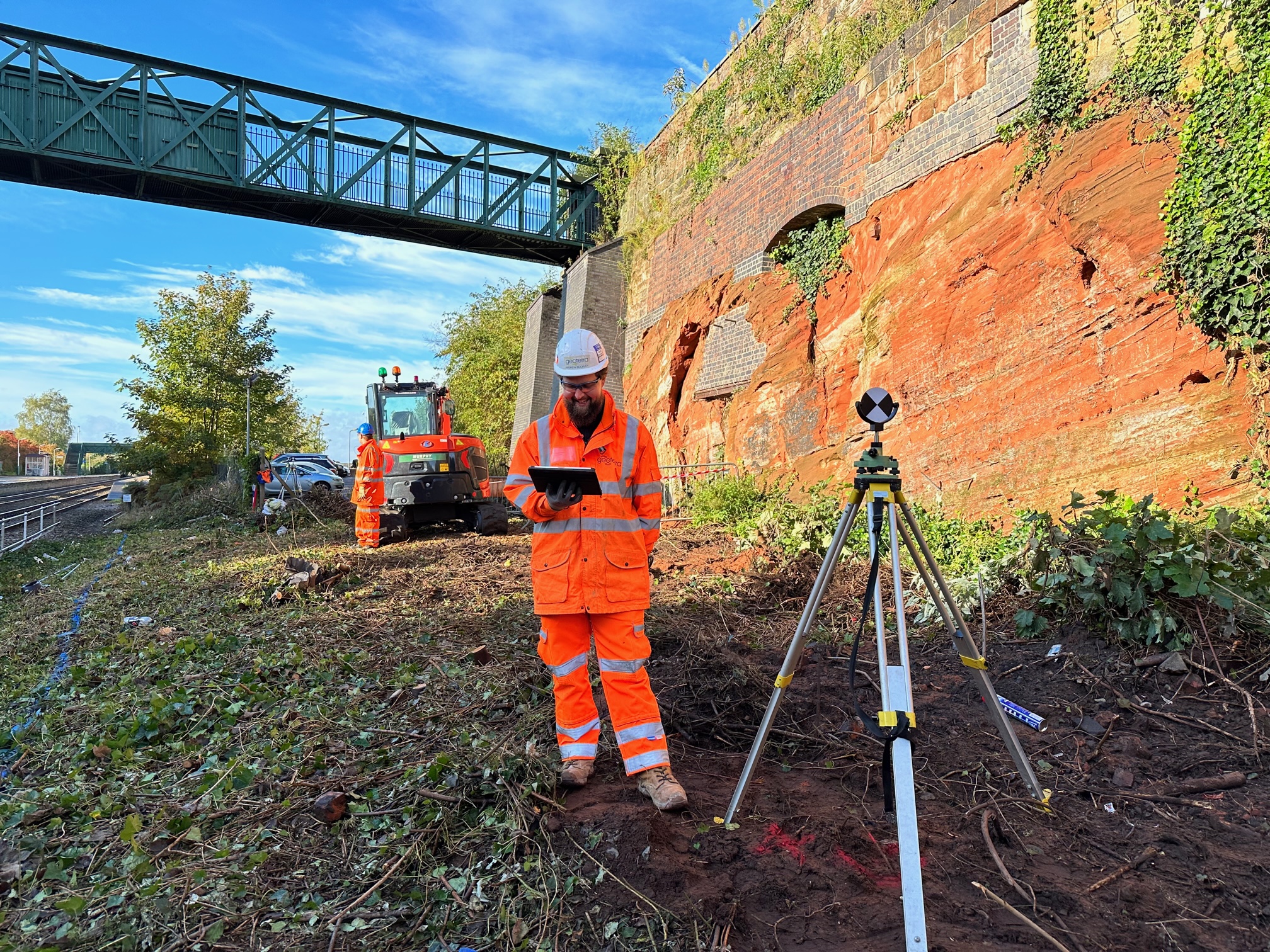
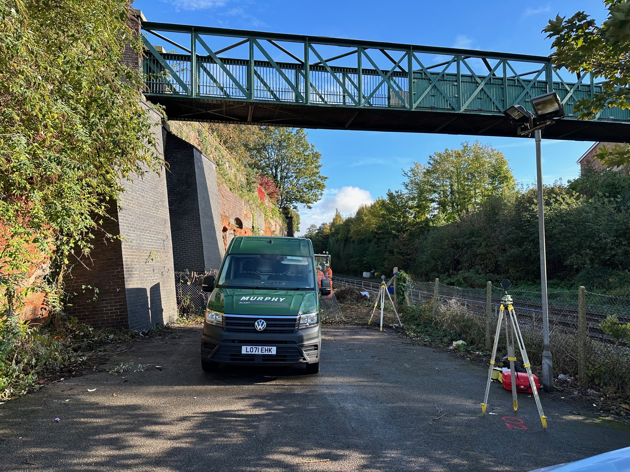
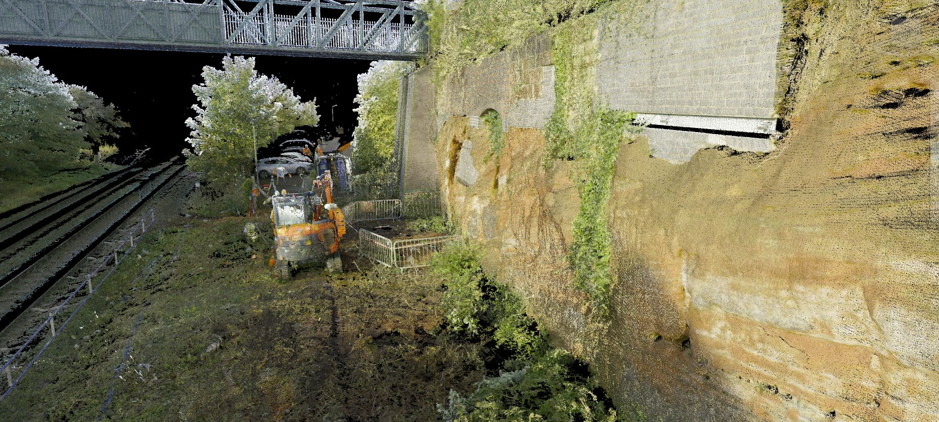
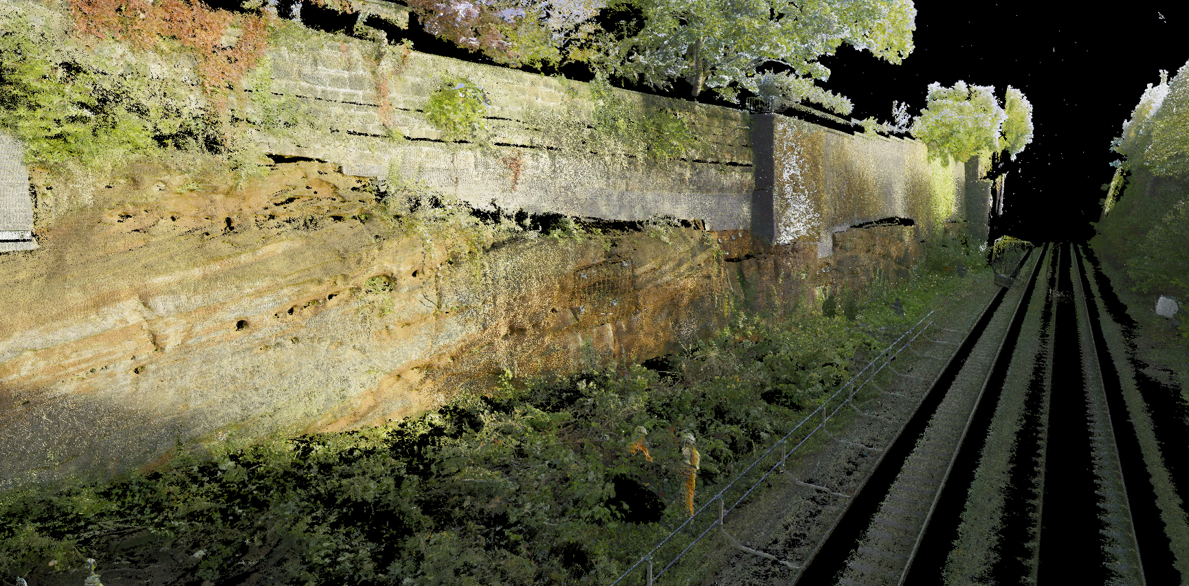
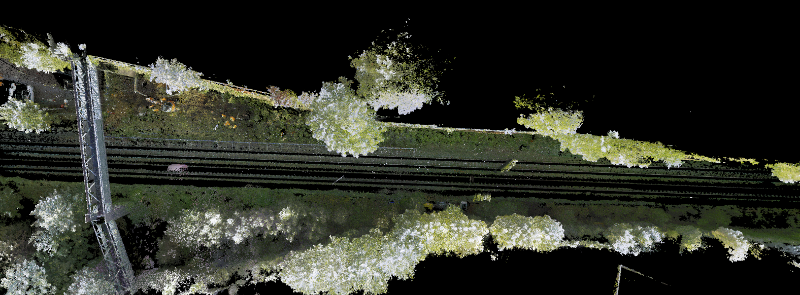
Geoterra was appointed by Murphy Group and Coffey Geotechnics to conduct an extensive 3D laser scan survey of a sandstone rock face and surrounding area. The survey area spanned approximately 100 meters along the primary railway line from Manchester to Chester, located in Frodsham, Cheshire.
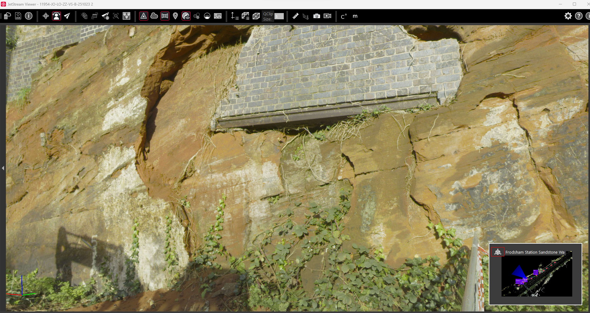
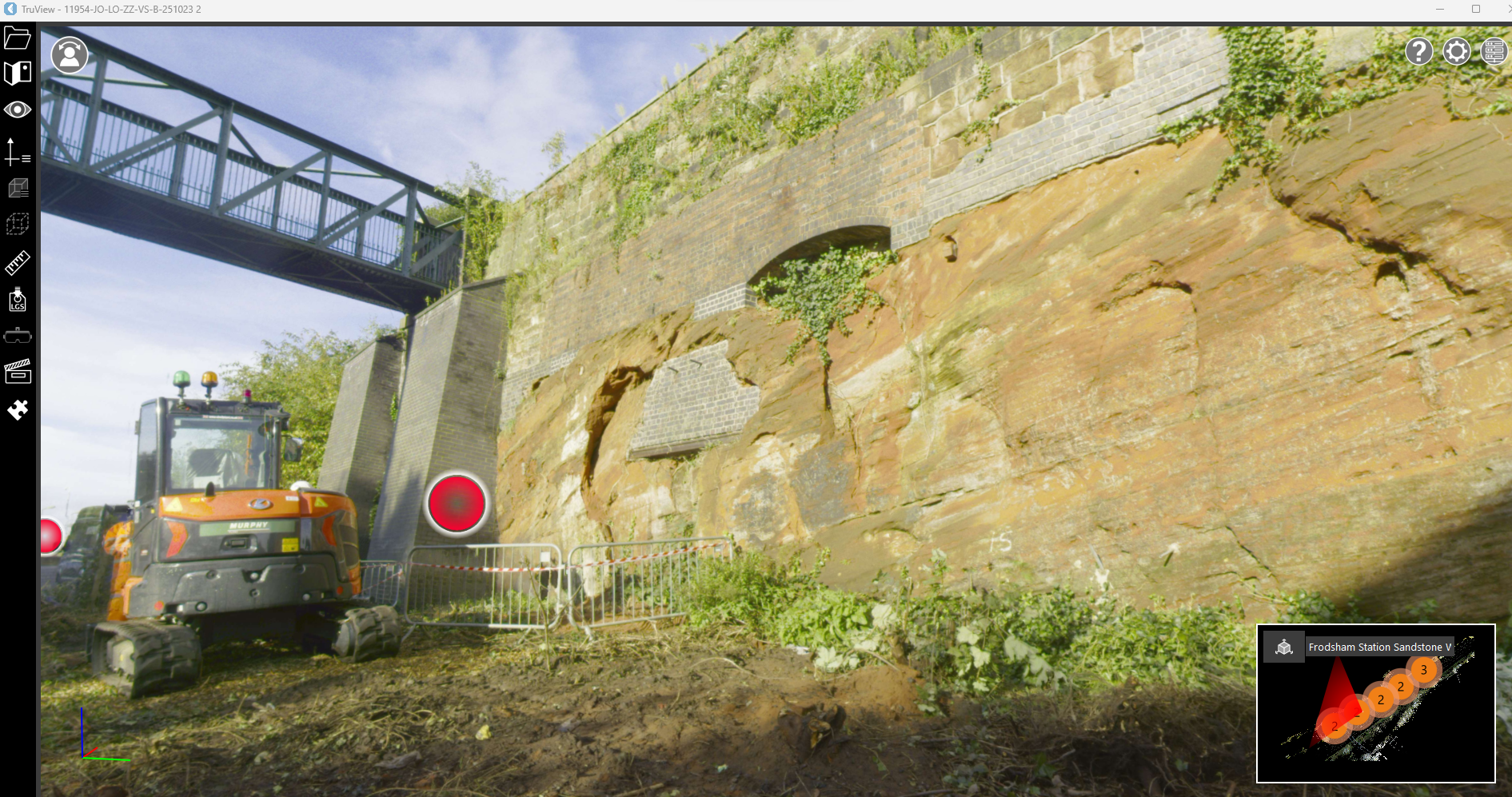
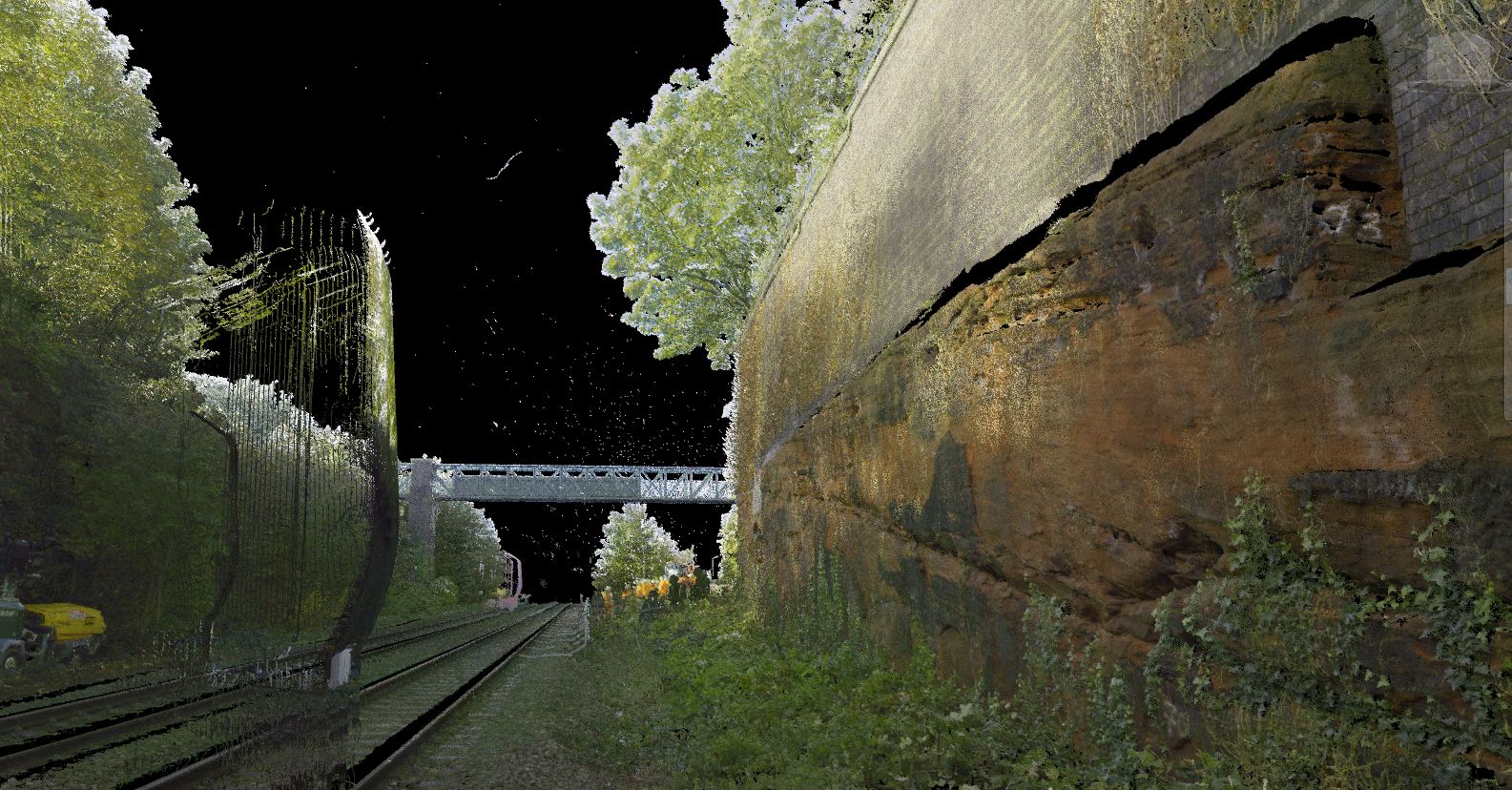
The purpose of this survey was to provide the clients with detailed data for assessing the condition of the rock face, particularly in response to a recent rockfall incident near Frodsham Railway Station. The incident involved a significant portion of sandstone detaching and moving towards the railway line, posing a potential risk of a major derailment if undetected.
Following the survey, the collected data would aid in identifying any other vulnerable areas along the sandstone cutting prone to similar events. A comprehensive HD colour laser scan was conducted not only of the rock face but also of the surrounding terrain, railway lines, and the support structures of the overbridge. This detailed, geo-referenced information would be crucial for future analysis by Coffey Geotechnics Geotechnical Engineers, enabling them to assess risks and plan necessary preventive measures effectively.
The solution
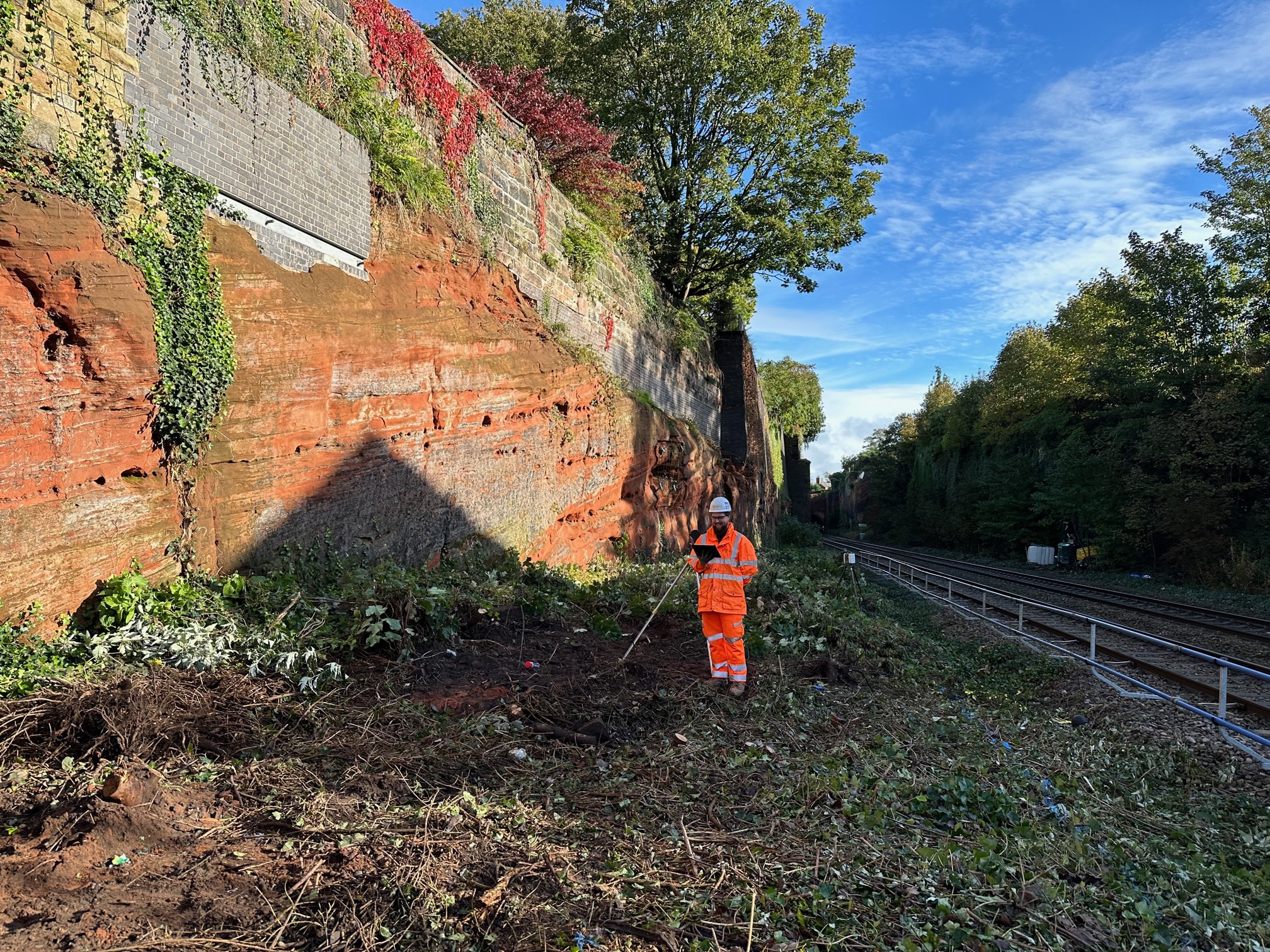
Geoterra’s solution involved deploying skilled geospatial engineers equipped with a specialised Leica RTC 360 laser scanner positioned strategically adjacent to the sandstone rock face and railway line. We conducted 3D laser scans at intervals of every 10 meters to ensure comprehensive coverage of the entire sandstone cliff face, capturing every intricate feature.
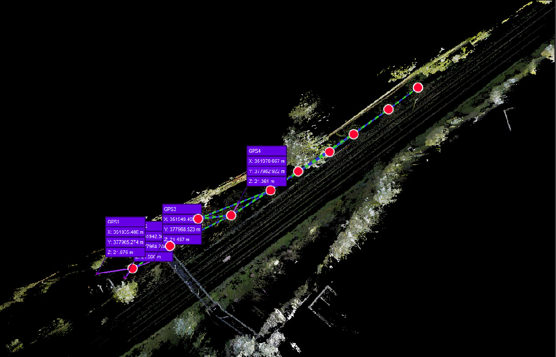
Additionally, 3D laser scans were performed at key locations such as the pedestrian walkway and car park, aiming to create a comprehensive 3D model encompassing the rock face and walkway above the railway tracks. Precise survey control points were installed both at the beginning of the cutting and midway along the survey area to ensure accurate spatial referencing.
All surveys were georeferenced to the OSGB36 National Grid.
The deliverables
Geoterra delivered a comprehensive set of key deliverables to both Murphy Group and Coffey Geotechnics. This included:
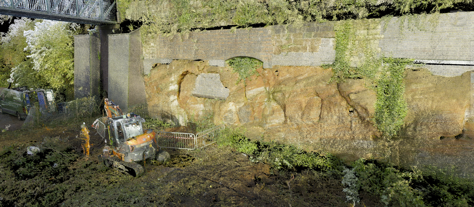
- Full 3D Coloured Laser Scan Point Cloud: Geoterra provided a detailed 3D point cloud captured from the laser scans. This point cloud contained precise spatial information about the sandstone rock face, surrounding terrain, railway lines, and other relevant features.
- HD Imagery: High-definition imagery captured during the scanning process was also included in the deliverables. This imagery provided additional visual context and detail to complement the 3D point cloud data.
The deliverables were provided in multiple file formats including LAS, RCP, and LGS. These formats are compatible with various software platforms commonly used in the industry such as CivilCAD 3D, Navisworks, Leica Jetstream, and Leica Truview.
By providing these deliverables, Geoterra ensured that Murphy Group and Coffey Geotechnics had access to comprehensive and easily accessible data for their analysis and decision-making processes.