Underground 3D laser scan survey of second sinkhole and bell pit on playing field
Wooburn Green, Buckinghamshire
An underground 3D laser scan survey of a second sinkhole and bell pit to appear on Sappers playing field.
The Brief
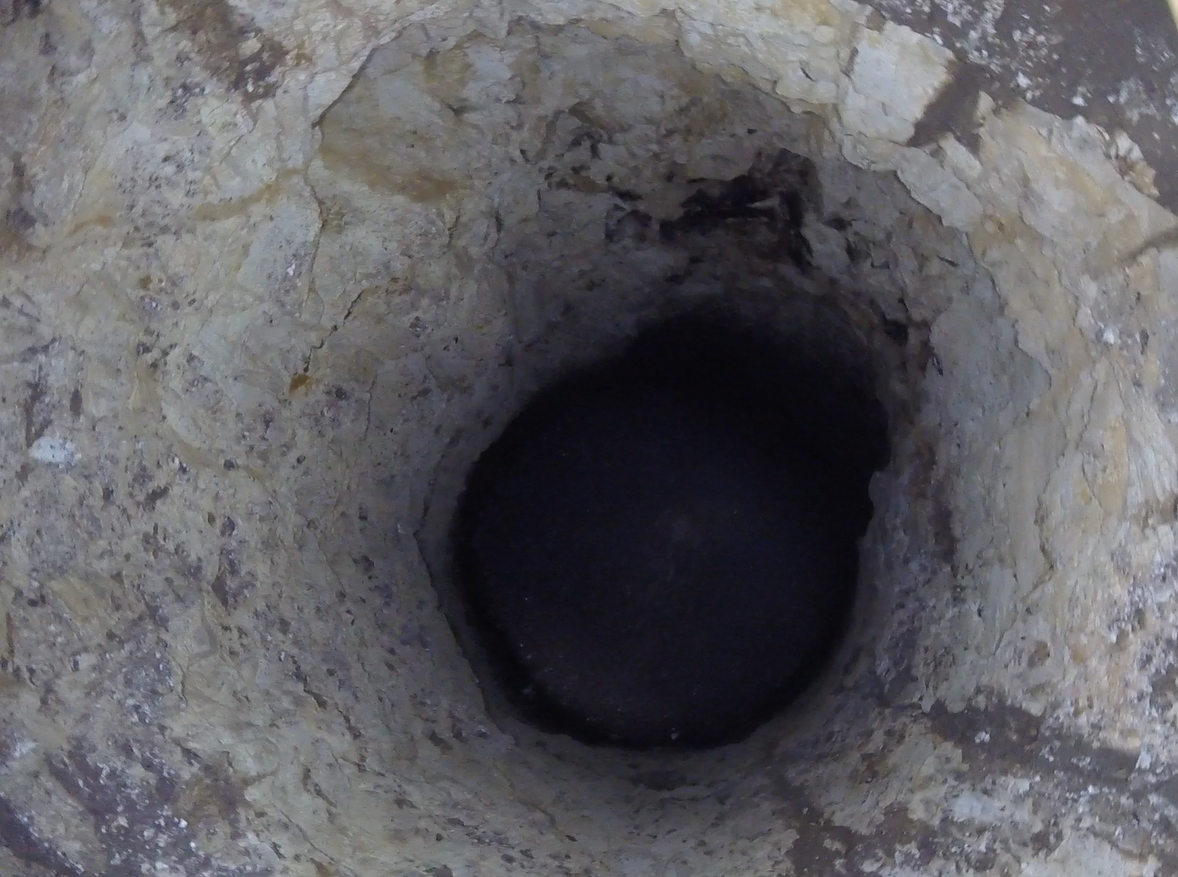
In February 2020, Geoterra surveyed a sinkhole and bell pit that had appeared on Sappers Field in Wooburn Green. This sinkhole and bell pit was backfilled and remediated by Soil Engineering in 2022.
Prior to being a playing field, the site was formerly used for making bricks with clay being excavated from a deep bell pit for the manufacturing process. When the site was decommissioned, the area was backfilled with waste. Army sappers were then brought in and covered the site with soil to create a playing field.
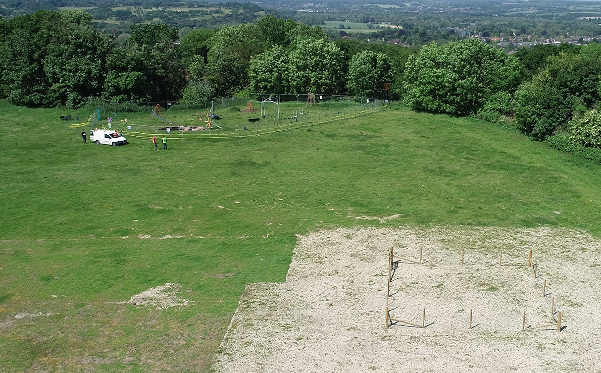
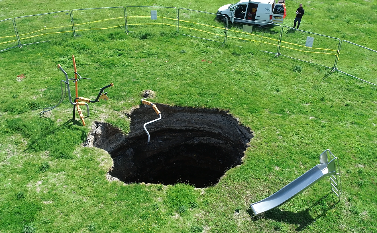
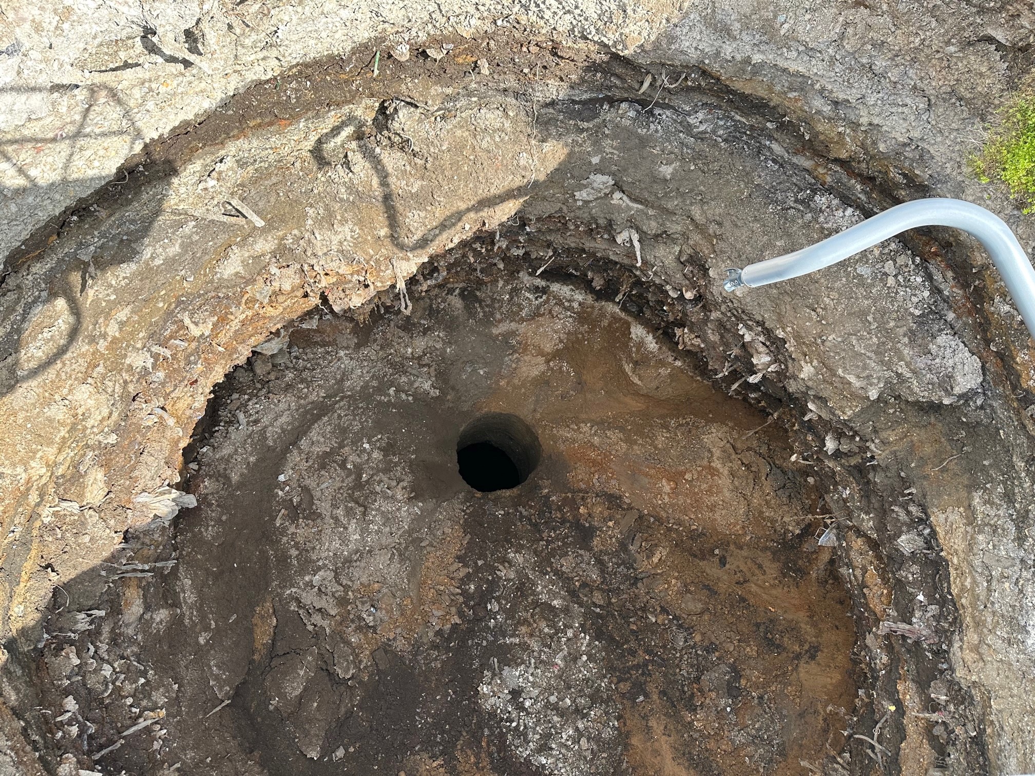
However, in May 2023, a further sinkhole appeared on the playing field and the playfield was closed for public safety.
Geoterra was appointed by Yellow Sub Geo Consultants and Buckinghamshire County Council to carry out an underground 3D laser scan survey to determine the depth, size and extent of the second sinkhole and bell pit on the site.
The new sinkhole appeared approximately 200m from the first, located beneath the playground, with the bell pit being 35m deep.
Following a full geographical survey of the playing field, carried out by Terradat in 2020 a programme of intrusive investigation surveys were planned to understand the anomalies found.
The solution
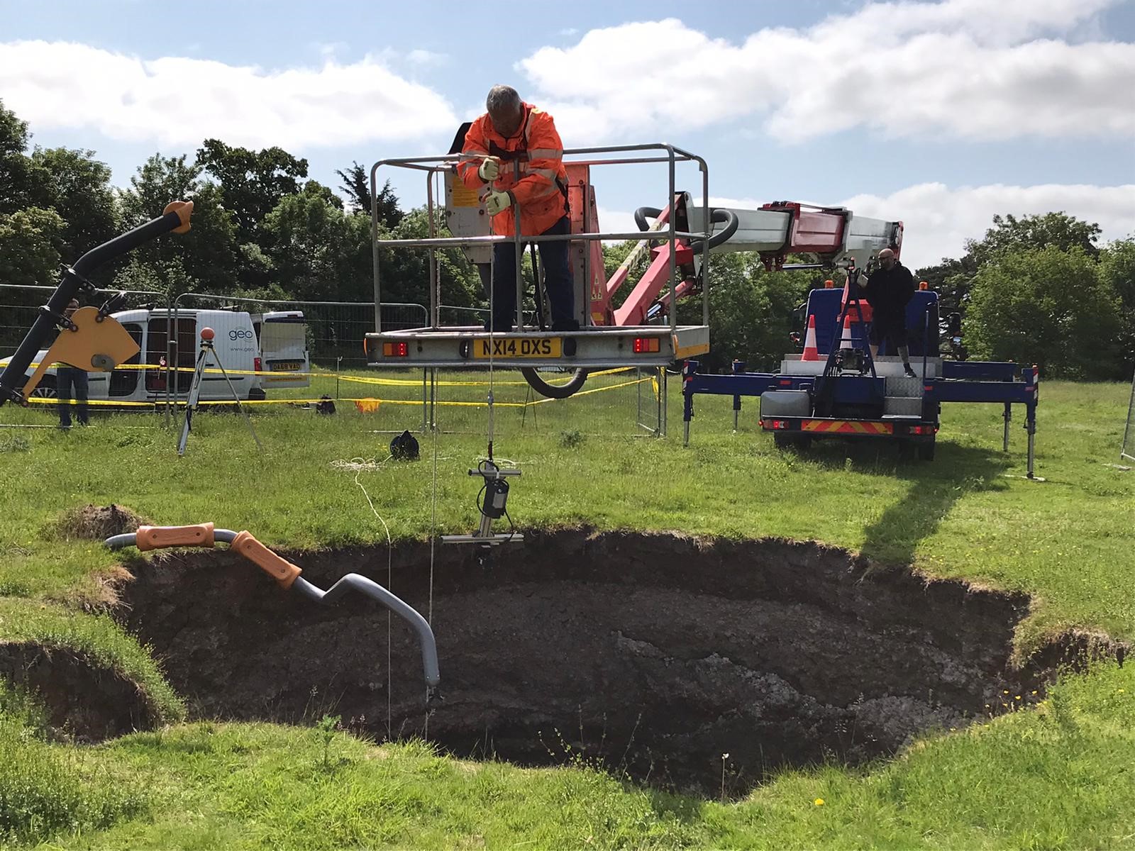
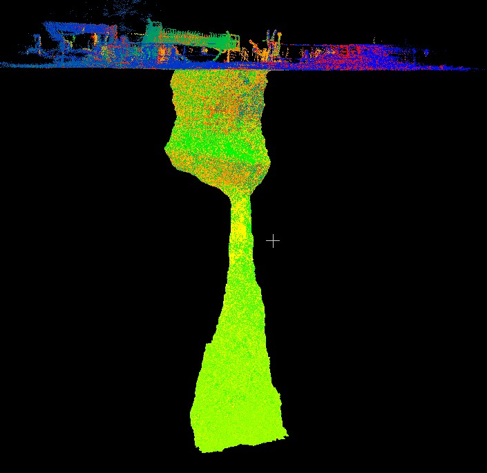
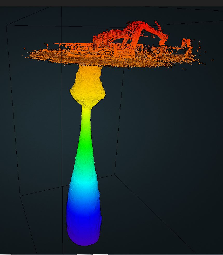
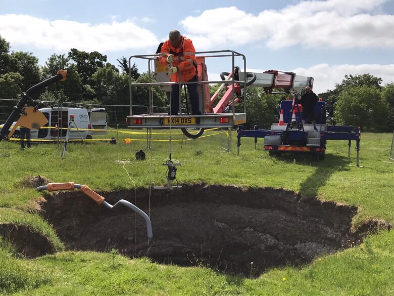
Using the GeoSLAM ZEB REVO laser scanner, combined with the ZEB Cam, we carried out a surface 3D laser scan survey of the second sinkhole and bell pit
The same survey technology was used to carry out the survey of the void. Access below surface was provided by using a long-reach boom arm from a portable MEWP to a depth of 35m.
The survey was geo-referenced to OSGB OSTN15 National Grid.
The deliverables
Geoterra provided the clients with a combined geo-referenced 3D laser scan point cloud and HD video of both the playing field surface and the void.
The laser scans were supplied in RCS/RCP and LAS formats for viewing as a 3D model in Navisworks.
A mesh model was also created together with a volume calculation.
The resulting survey data could then be analysed by the consulting engineers to determine the best possible remediation solution for this second sinkhole.