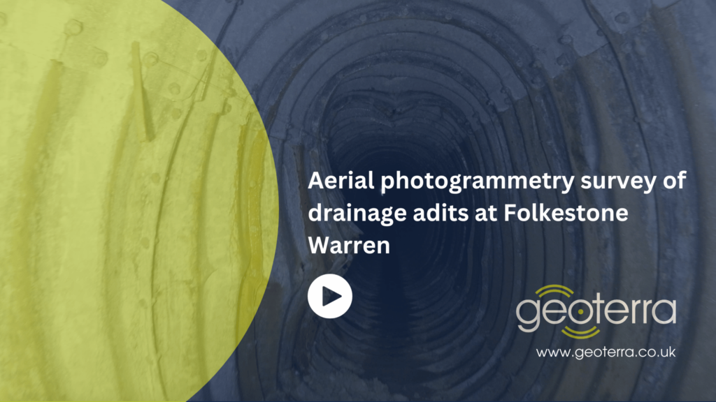
Aerial photogrammetry survey of 21 underground drainage adits
Folkestone, Kent
A remote access aerial photogrammetry survey of 21 drainage adits beneath a rail mainline.
The Brief
Folkestone Warren is an area of land prone to landslides. In December 1915, a severe landslip at Folkestone Warren, known as The Great Fall, resulted in train derailments and continued rail movement on the Dover to London South Eastern mainline following the incident.
The area of land at Folkestone Warren has a quite complex geology, formed of chalk overlying clay. All landslides in the area are activated by rainfall.
Landslips have been a major feature since the line opened in 1844.
In addition to other strategies that Network Rail has put in place to minimise the risk of landslides to its rail infrastructure in that area, many years ago, 21 drainage adits were constructed underneath Folkestone Warren. This was to drain the Warren of excessive ground water to prevent landslides occurring that would compromise the rail line.
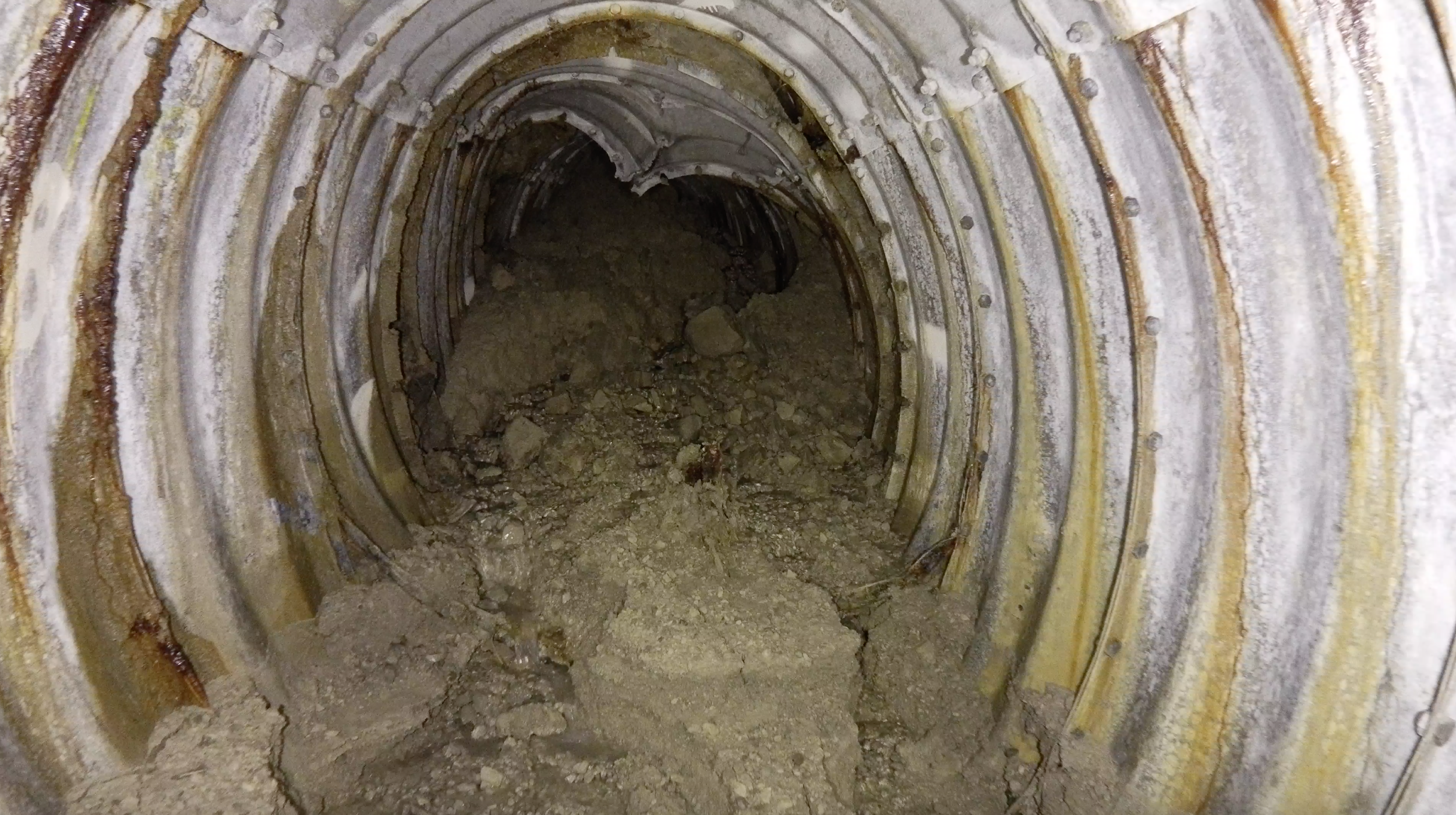
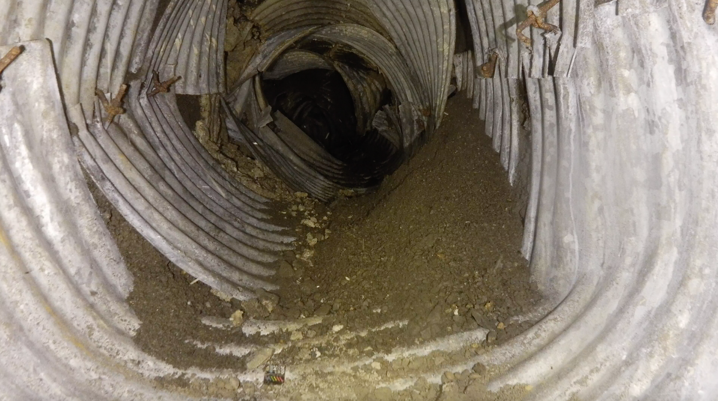
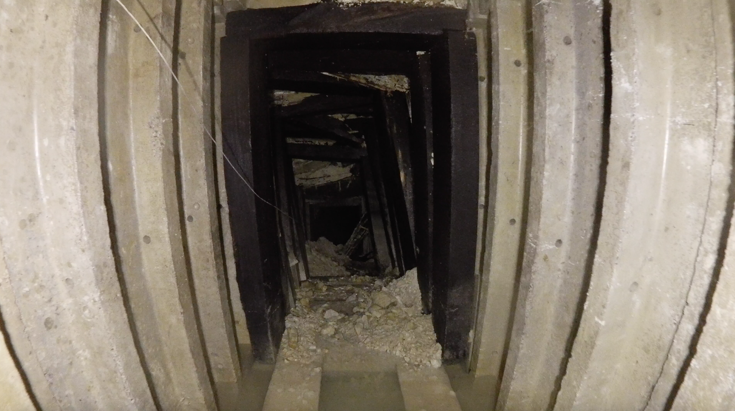
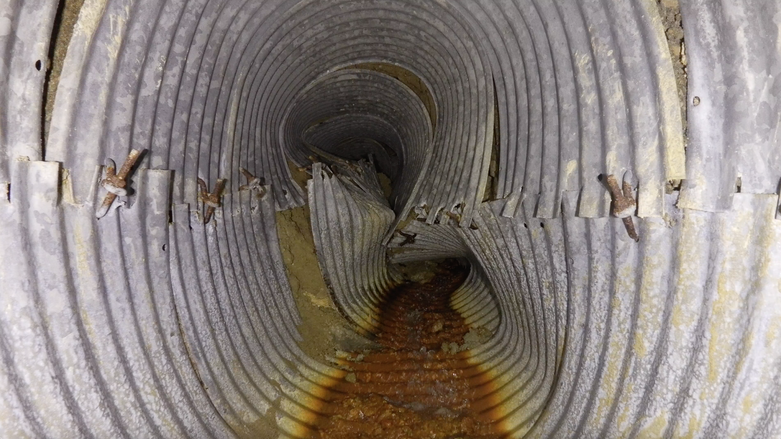
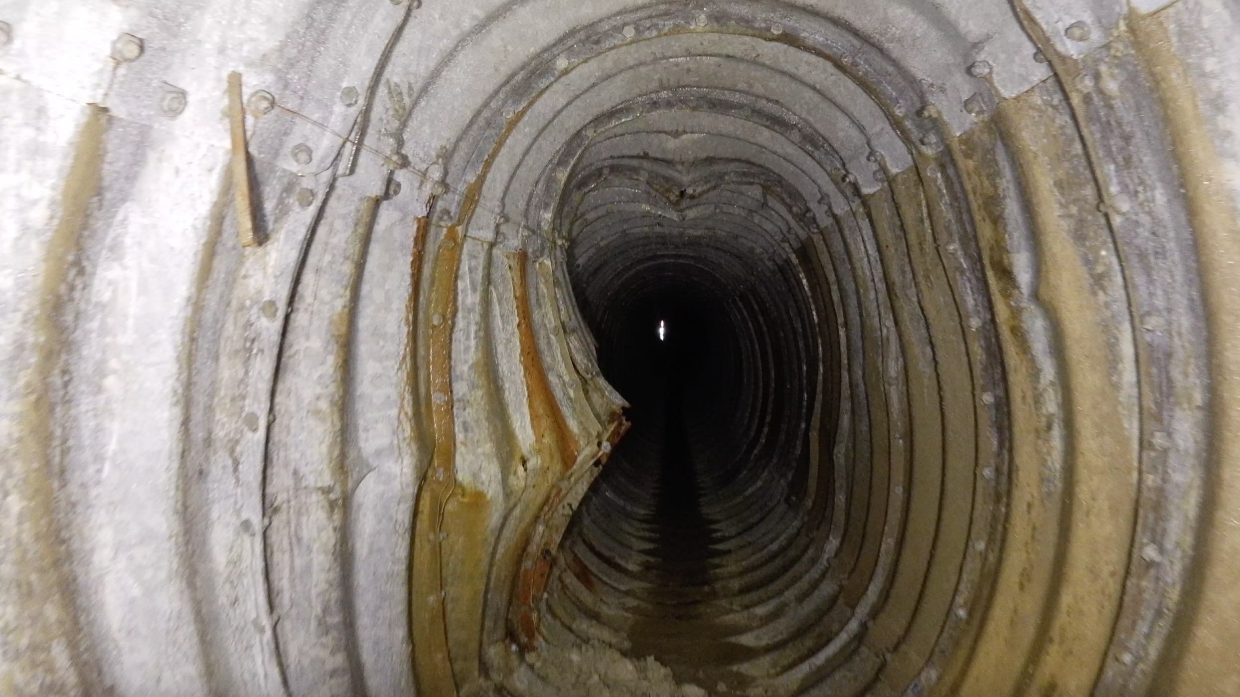
The drainage adits, however, had not been assessed for many years and Network Rail had concerns about their structural integrity.
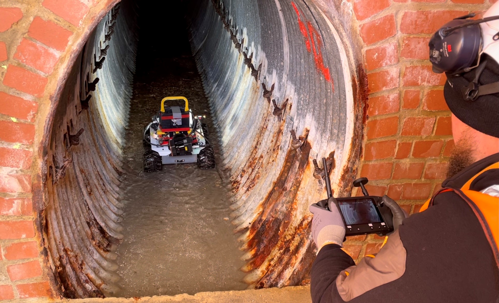
Geoterra was appointed by Balfour Beatty on behalf of Network Rail to carry out a remote access aerial photogrammetry survey of all underground drainage adits to determine their location, alignment, and condition.
Previous attempts had been made to survey the adits using CCTV cameras onboard tractor units but was unsuccessful due excessive debris in the inverts.
The Solution
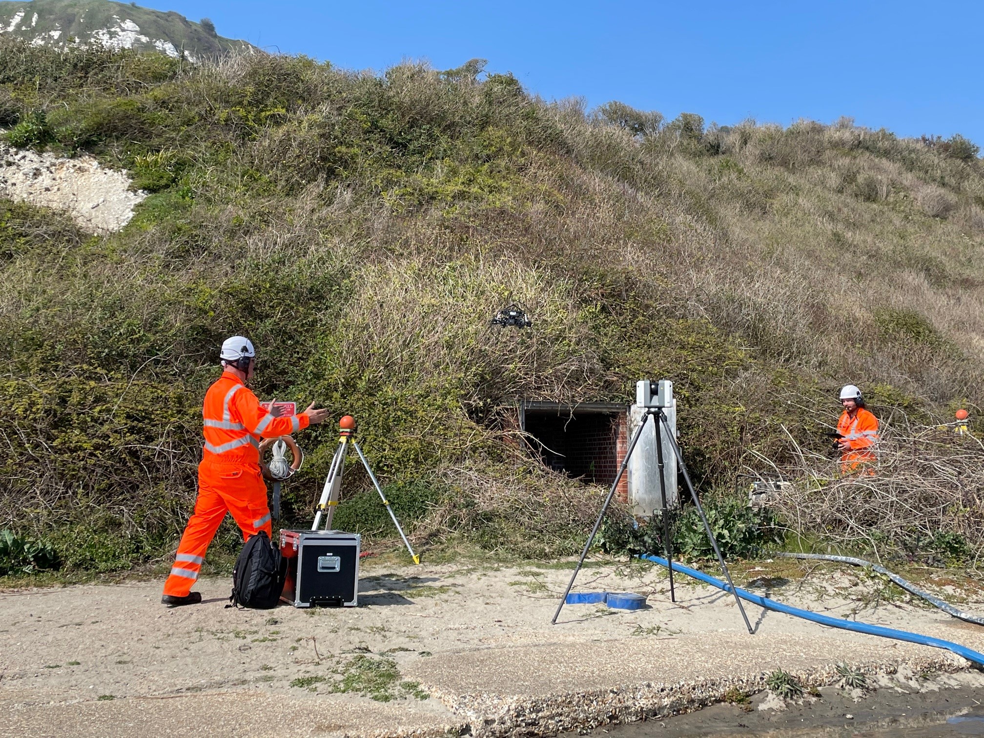
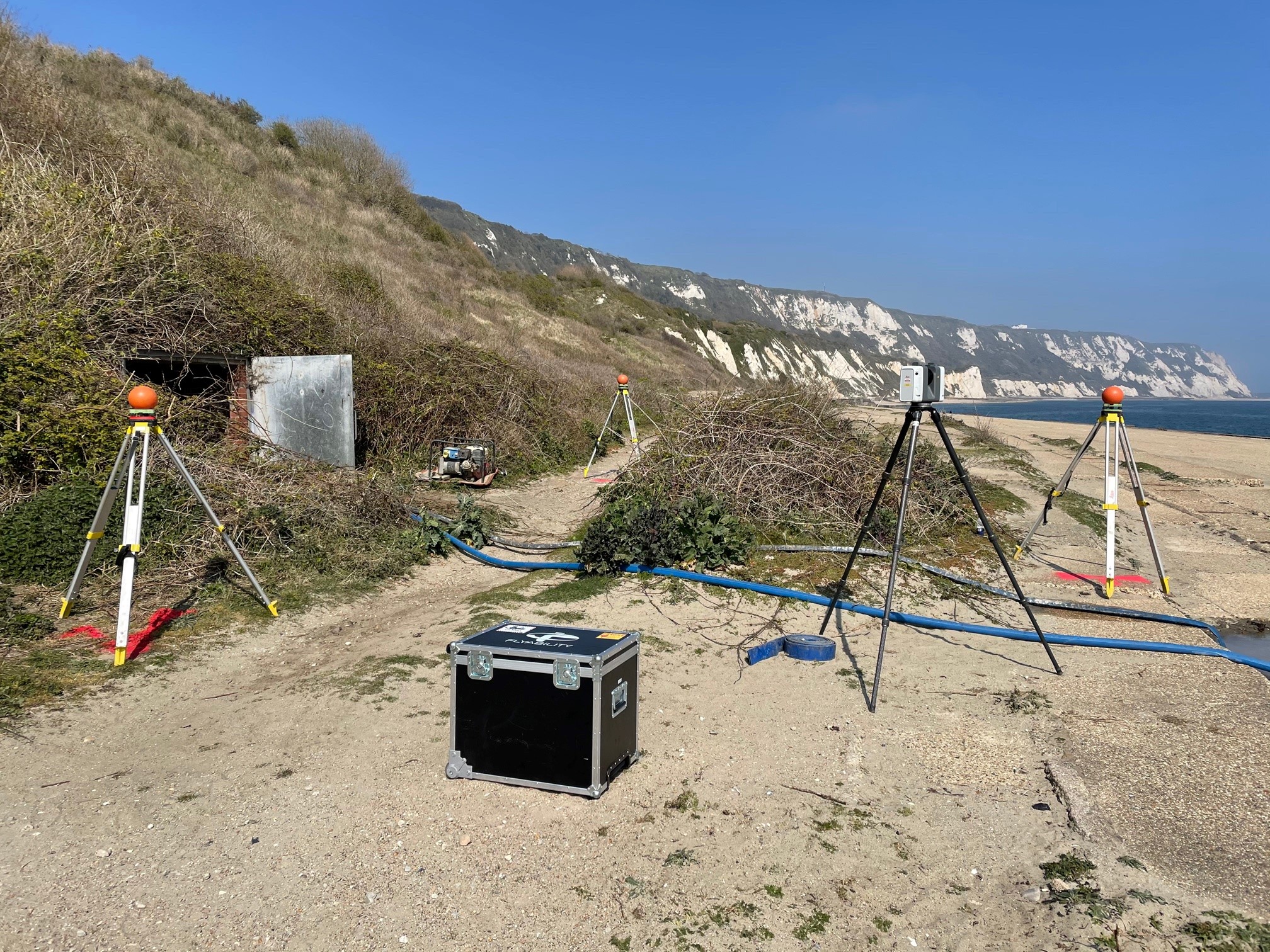
Geo-referenced laser scan targets were installed adjacent to each drainage adit portal. Using the Leica RTC 360 Laser Scanner, we carried out a 3D laser scan survey of each portal and the surrounding locale.
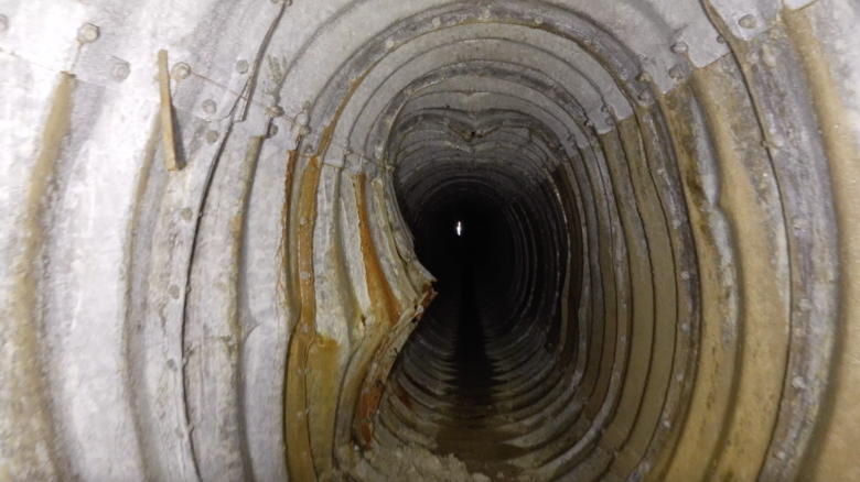
Using the Elios 2 Drone, we completed a fly-through in each drainage adit to capture a series of videos which would be used to create a 3D photogrammetry model.
For areas of the adits where the drone could not fly due to low-hanging features and obstructions, we deployed a remote operated vehicle.
By combining these three land surveying techniques, we ensured that every feature of the adits was surveyed to provide the client with complete and accurate survey data.
In addition to the underground, remote access survey, we also carried out an aerial photogrammetry survey of Folkestone Warren and the rail line from above, again geo-referenced to OSG836 National Grid. This survey was completed using the DJI M300 UAV fully equipped with a DJI P1 HD camera.
The Deliverables
We provided our clients with a combined geo-referenced 3D point cloud model of all 21 adits and the overlaying surface. This was supplied in RCS, RCP and DXF for viewing in Navisworks, as well as ortho-rectified mosaic photography in TIF.
As a result of the survey data we provided, several of the adits were found to be in poor condition. Using the survey data, our clients were able to make informed decisions to refurbish or replace the drainage adits in order to maintain adequate drainage on the Warren, therefore reducing the risk of landslides and ensuring the safety of rail passengers.

Watch this video: