Aerial LiDAR and Photogrammetry Survey of River Usk Embankment
River Usk, Newport
A UAV LiDAR and photogrammetry survey of the storm-damaged River Usk embankment at St Julian Inn, Newport for Newport Council and Capita
The Brief
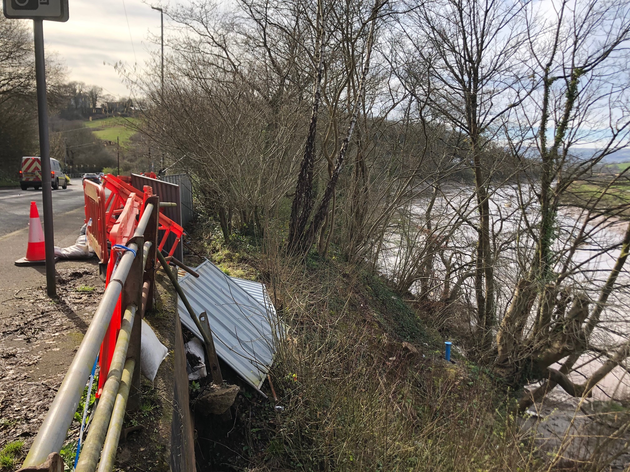
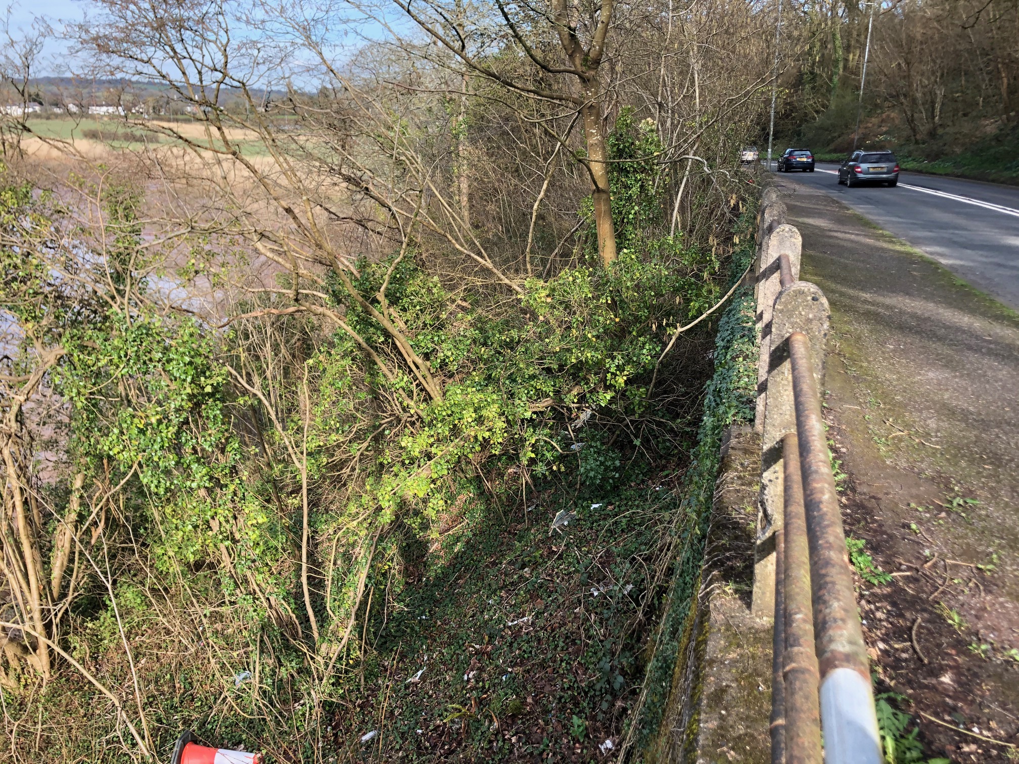
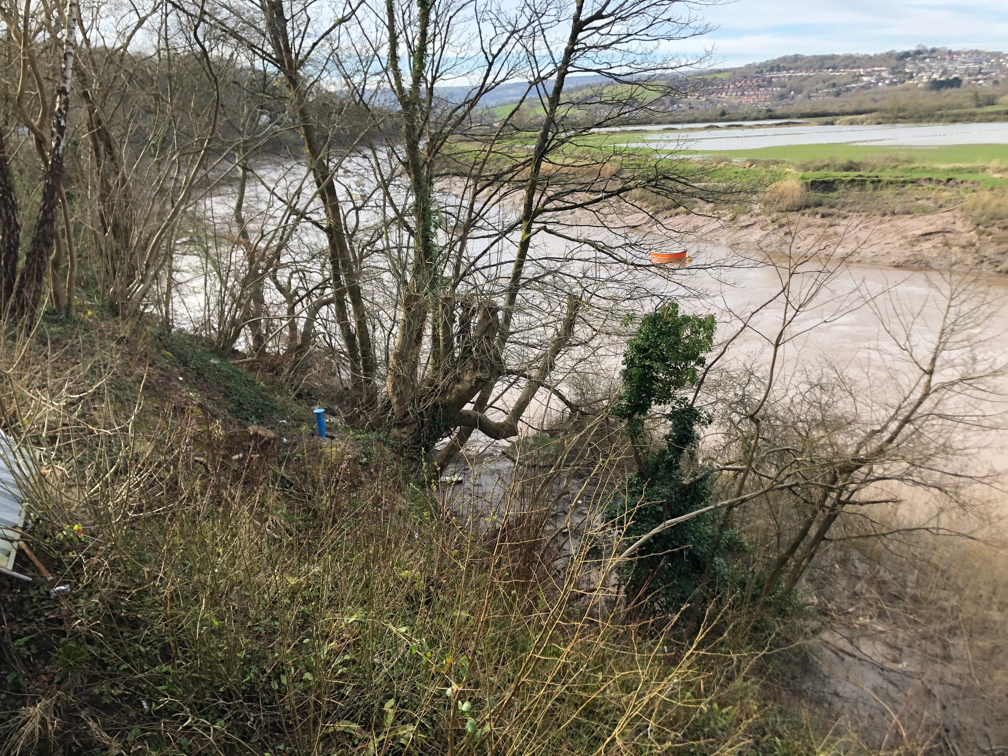
Geoterra was appointed by Newport Council and Capita Property & Infrastructure to monitor a stretch of River Usk embankment for movement using a low-level UAV LiDAR and photogrammetry survey of several phases at monthly intervals. This would be an ongoing process in conjunction with several borehole inclinometers at the site adjacent to St Julian Inn, Newport.
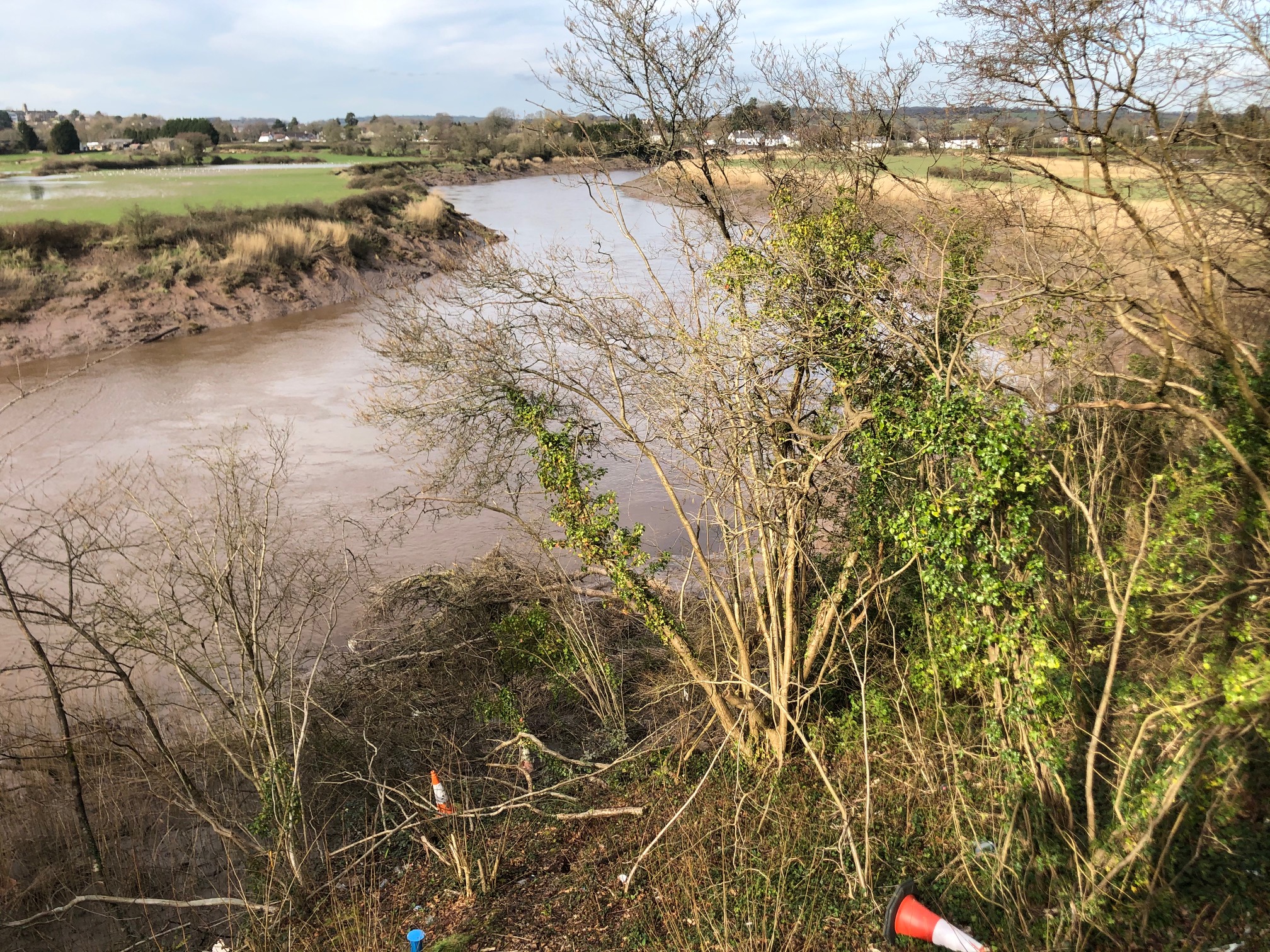
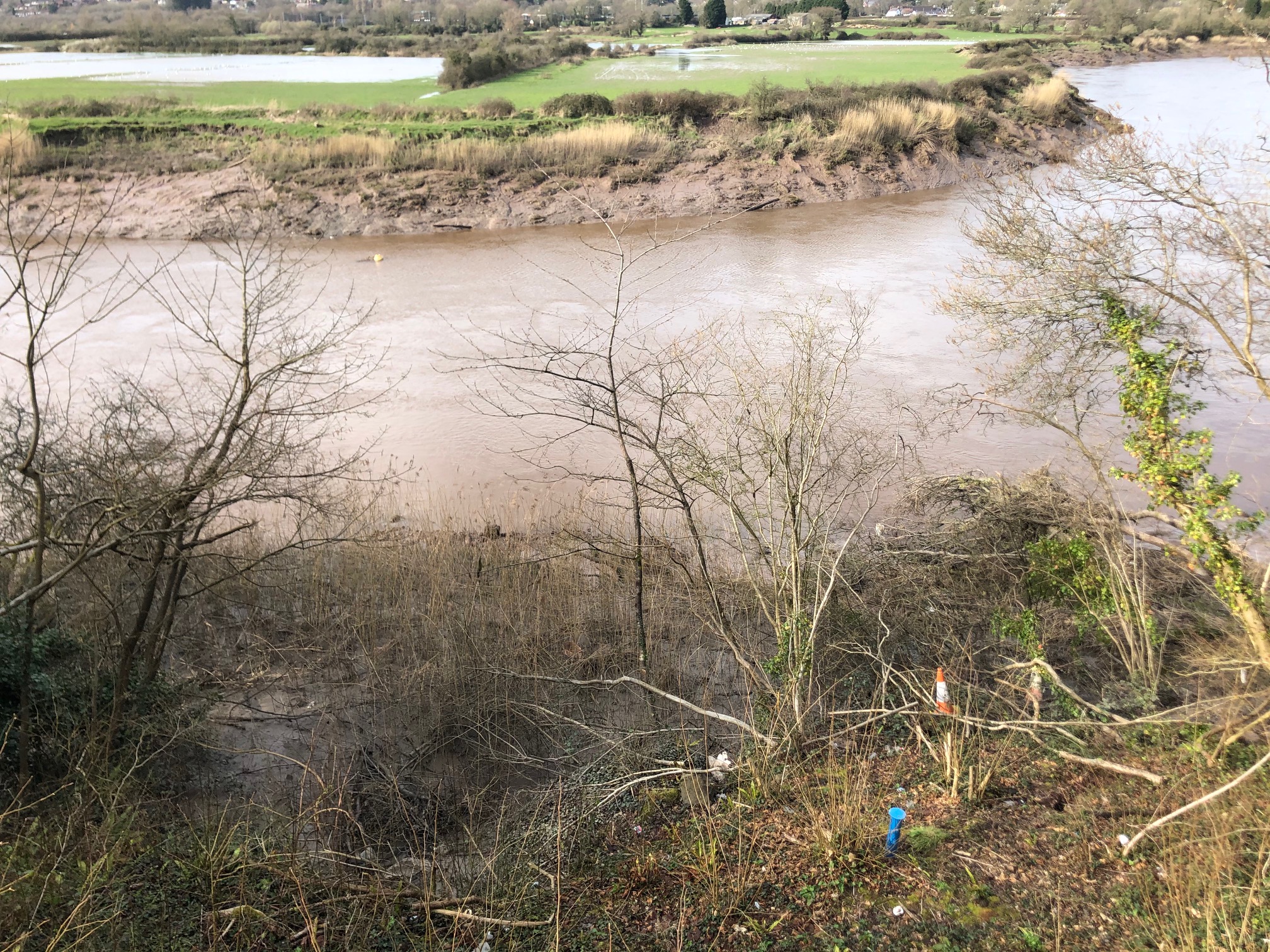
The survey data was required by both Newport Council and Capita as recent storms coupled with the high river levels and high tides the river embankment has been undercut and threatening the possible collapse of the B4596 and St Julian Inn. The survey data will enable them to generate a 3D model of the site and monitor the whole river embankment adjoining the River Usk.
The Solution
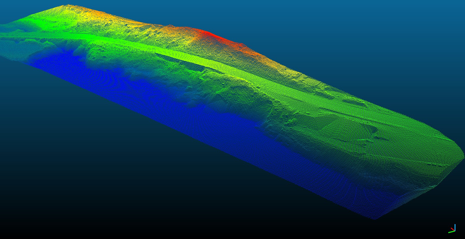
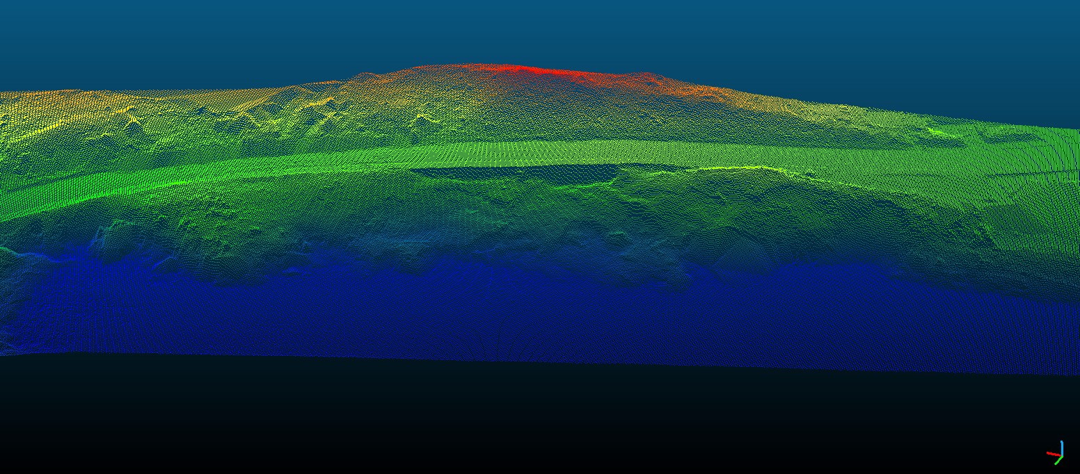
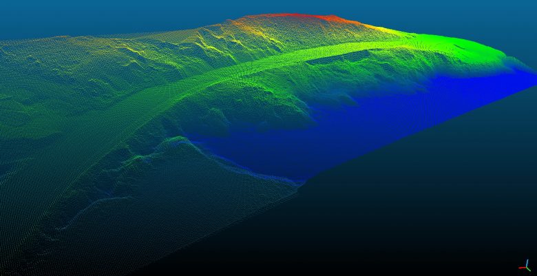
Geoterra experienced geospatial engineers in collaboration with our partners FlyThru utilised a bespoke heavy lift UAV equipped with a high definition DSLR camera and Routescene LiDAR system to fly over the river embankment and adjacent site, generating a large multipath multi return laser scan point cloud. The point clouds were then post-processed to produce an extracted vegetation ‘bare earth’ Digital Terrain Model for base readings. A DJI Phantom UAV was used equipped with a high definition DSLR camera also to complete the photogrammetry survey of the same area flown with the UAV LiDAR.
Ground control points were set up across the site and surveyed to OSGB 36 National Grid.
The Deliverables
Geoterra provided Newport Council and Capita with a range of key deliverables including a second extracted Digital Terrain Model, which was compared to the first using Cloud Compare software.
An isopachyte of any differences between the two surveys was then produced to give coloured contour bands to highlight any movement that may have occurred over areas of ground as opposed to individual spots. Finally, ortho-rectified mosaic photography TIF, contour plan, and a 3D LiDAR point cloud in CSV and LAS formats were also produced.