Tylorstown Landslide UAV LiDAR & Photogrammetry Survey
Tylorstown, Rhondda Valley, South Wales
A UAV LiDAR and photogrammetry survey of a landslide in Tylorstown for The Coal Authority, Capita and Rhondda Cyon Taf Council
The Brief
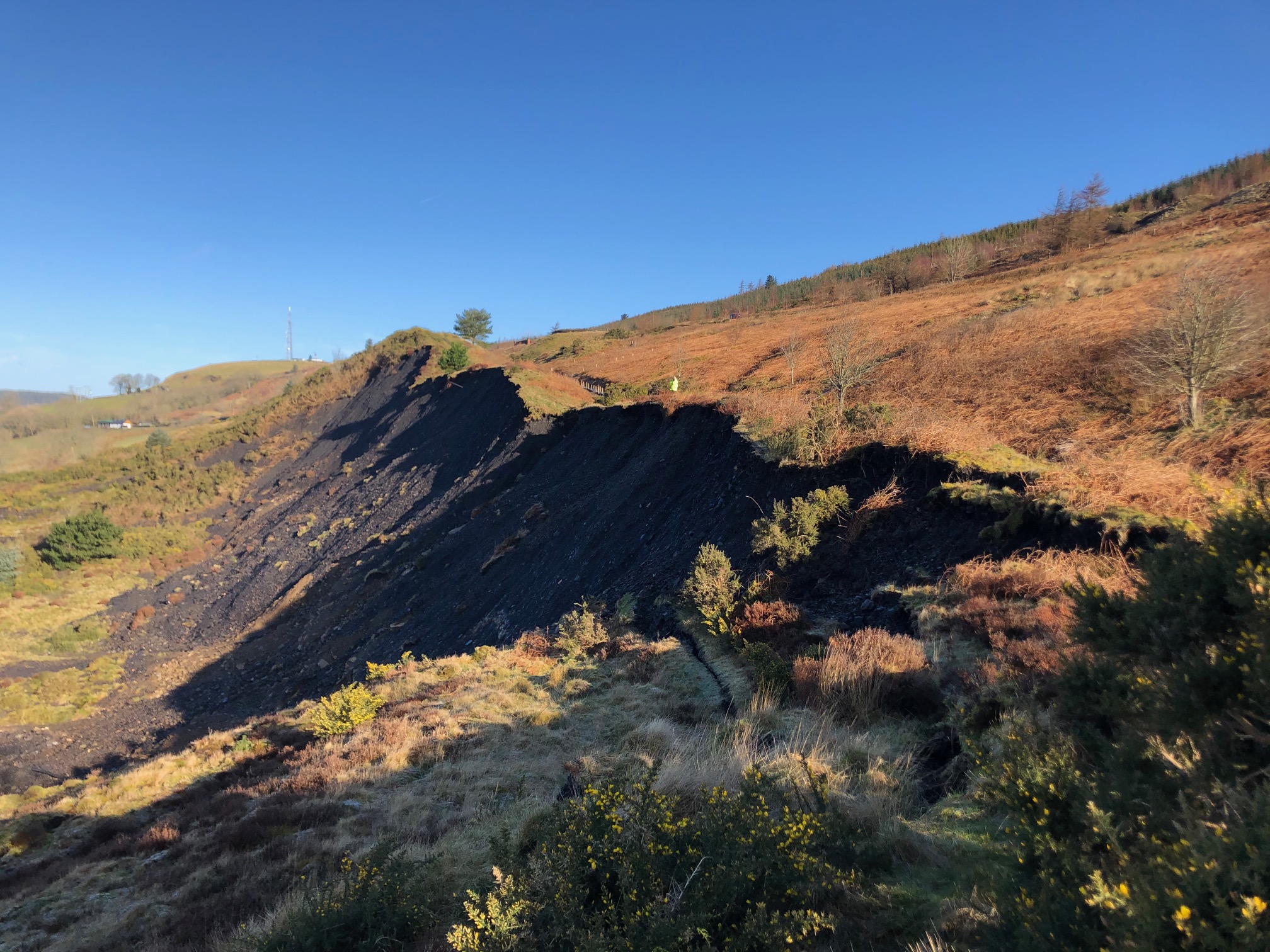
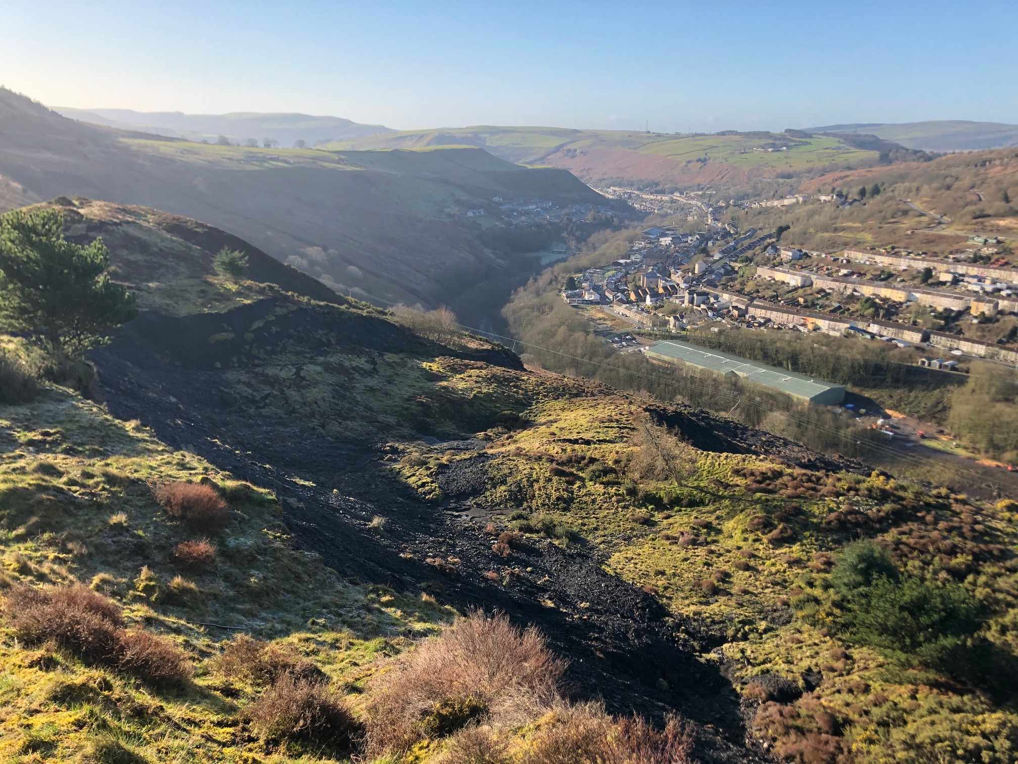
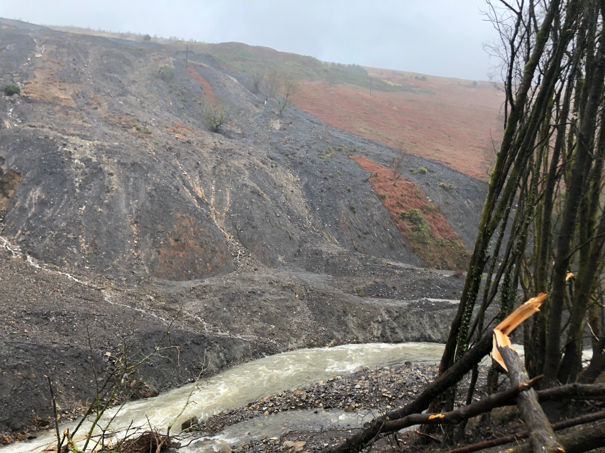
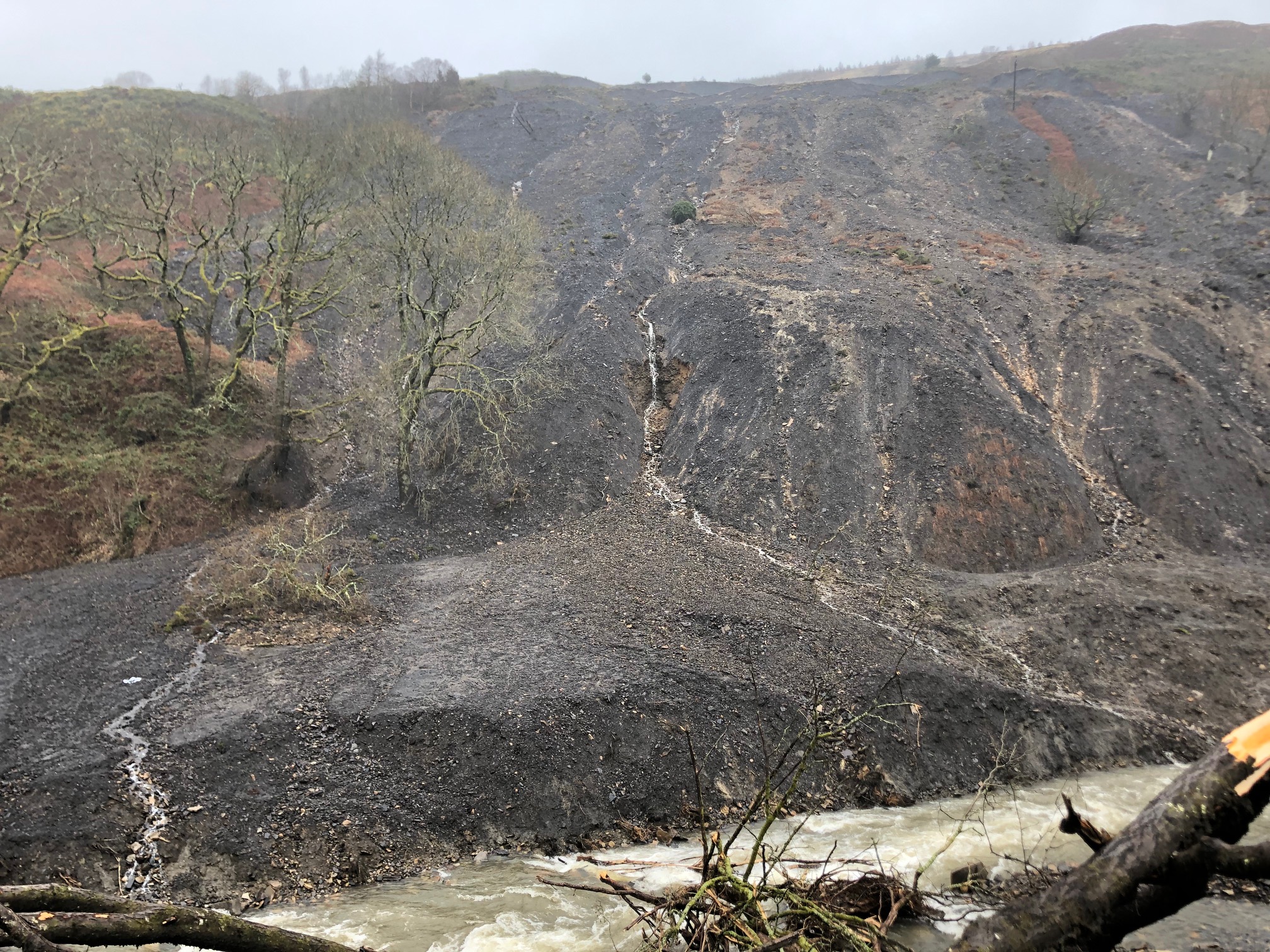
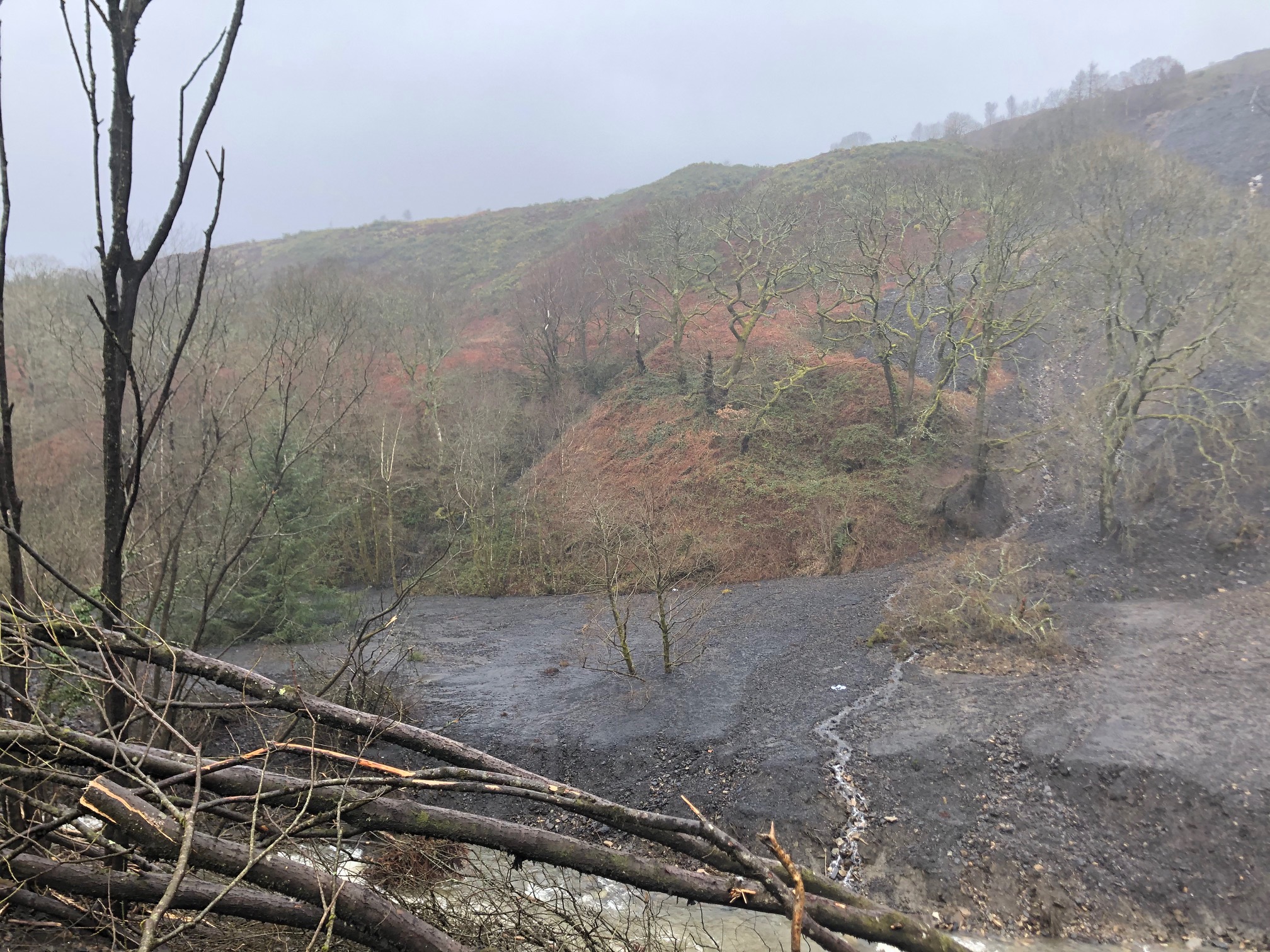
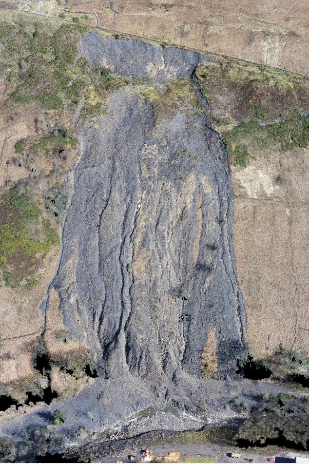
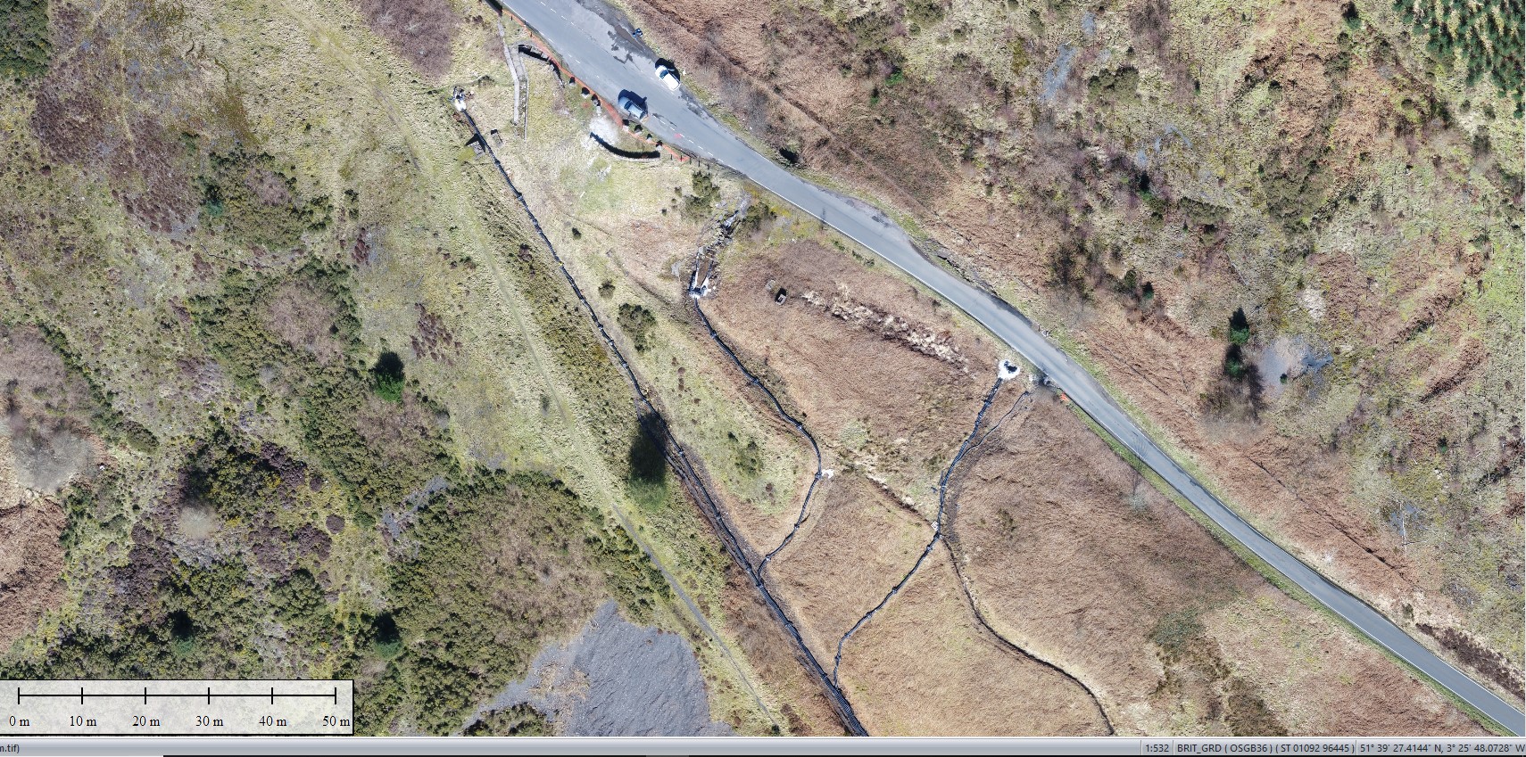
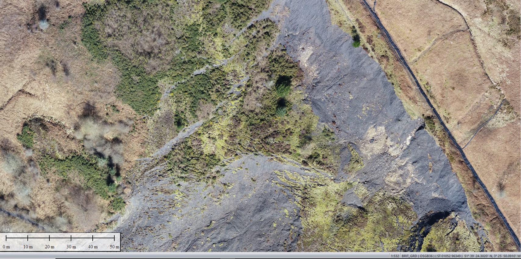
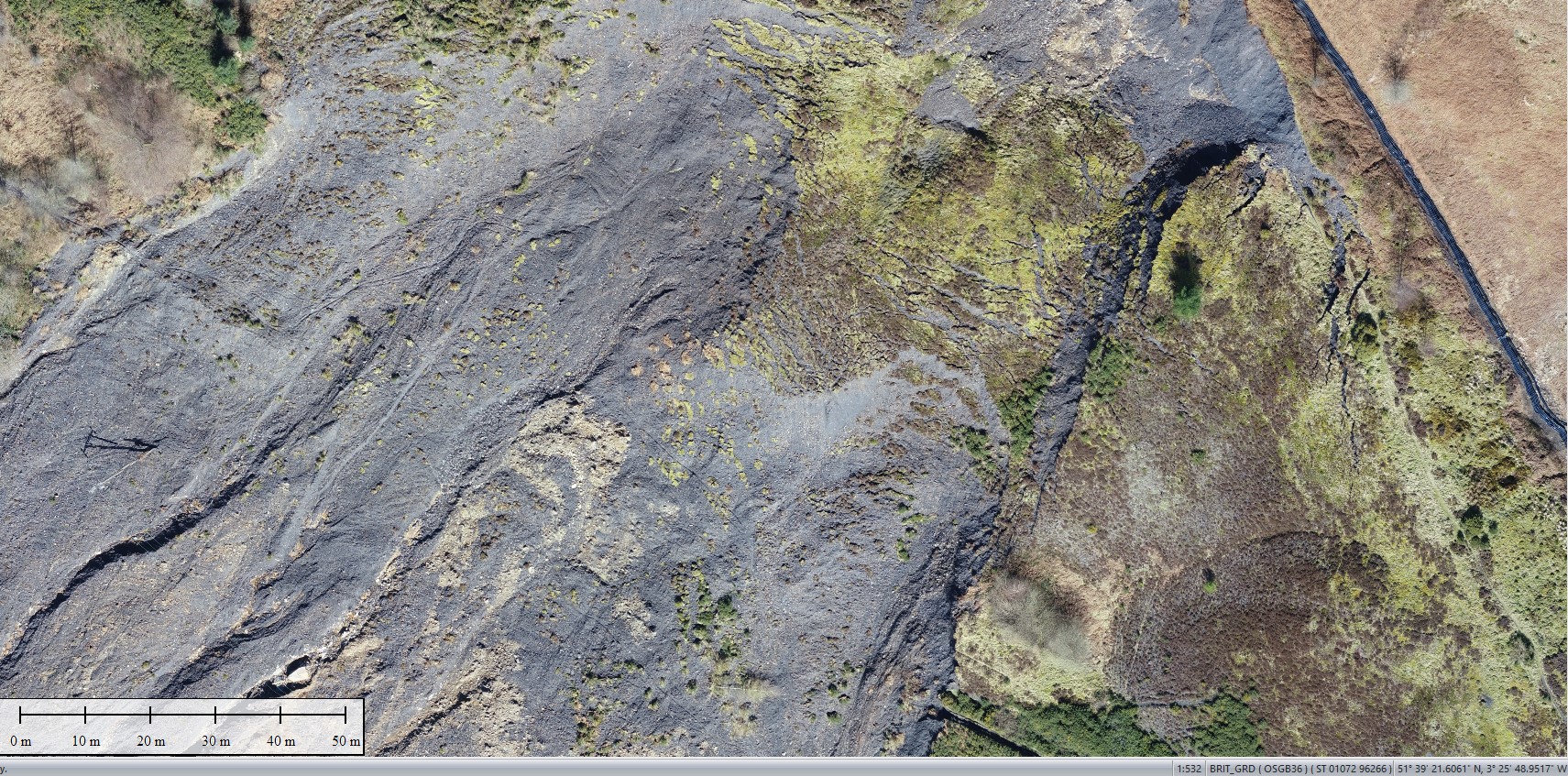
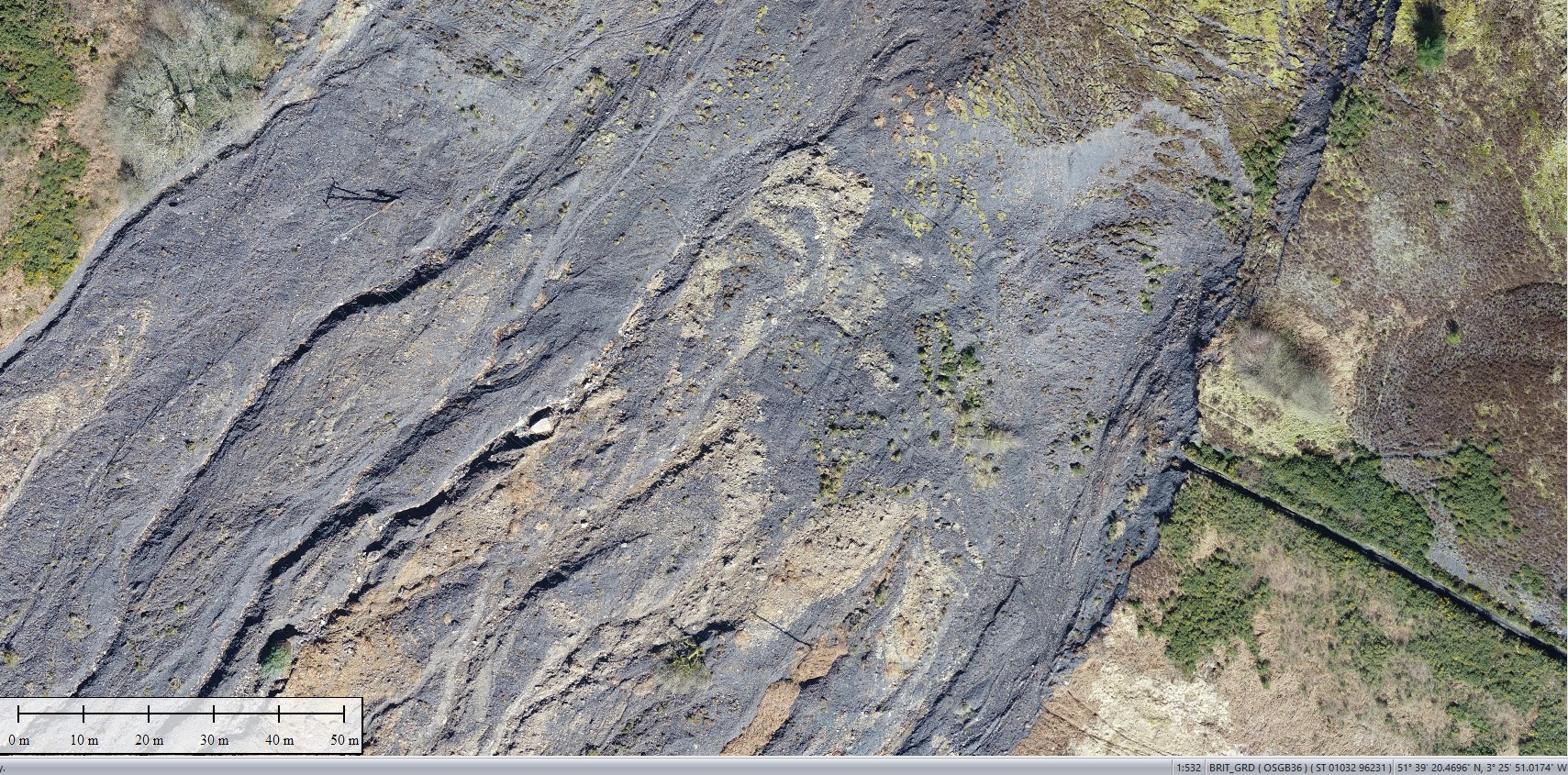
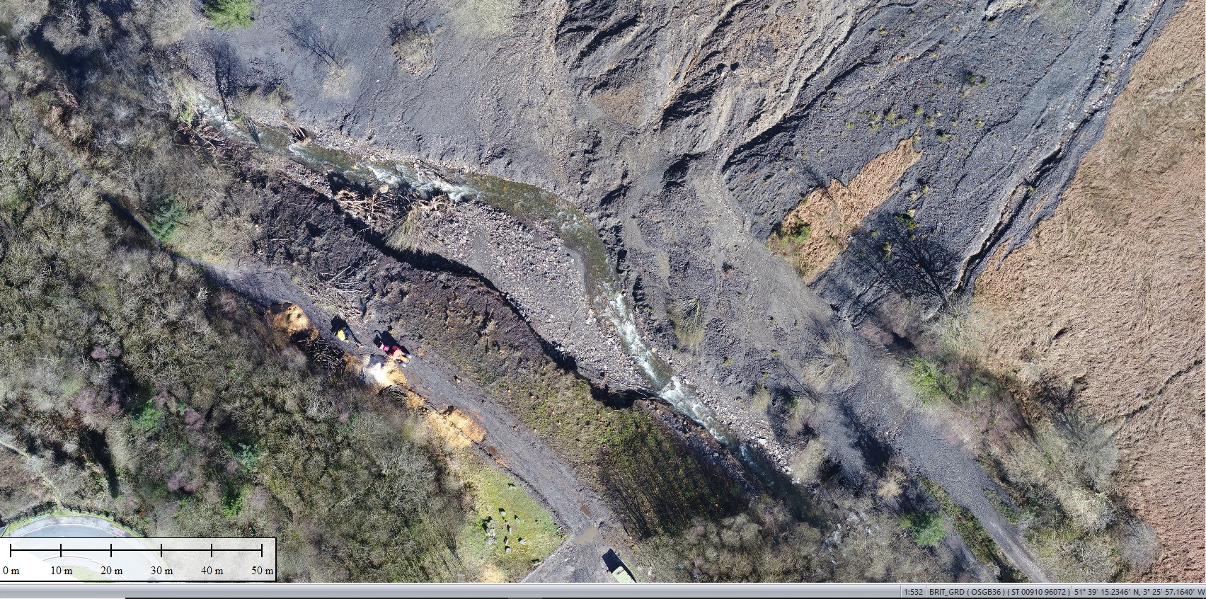
Geoterra was appointed by The Coal Authority, Capita and Rhondda Cyon Taf Council to carry out a UAV survey using both low-level LiDAR techniques and photogrammetry on a landslide that occurred on a historic legacy coal tip, together with adjacent old coal mine tips following a period of heavy rainfall in Tylorstown, South Wales.
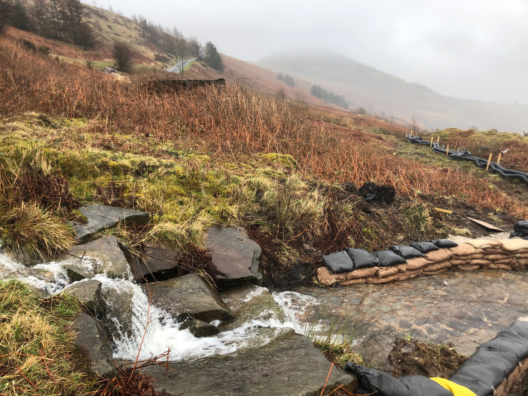
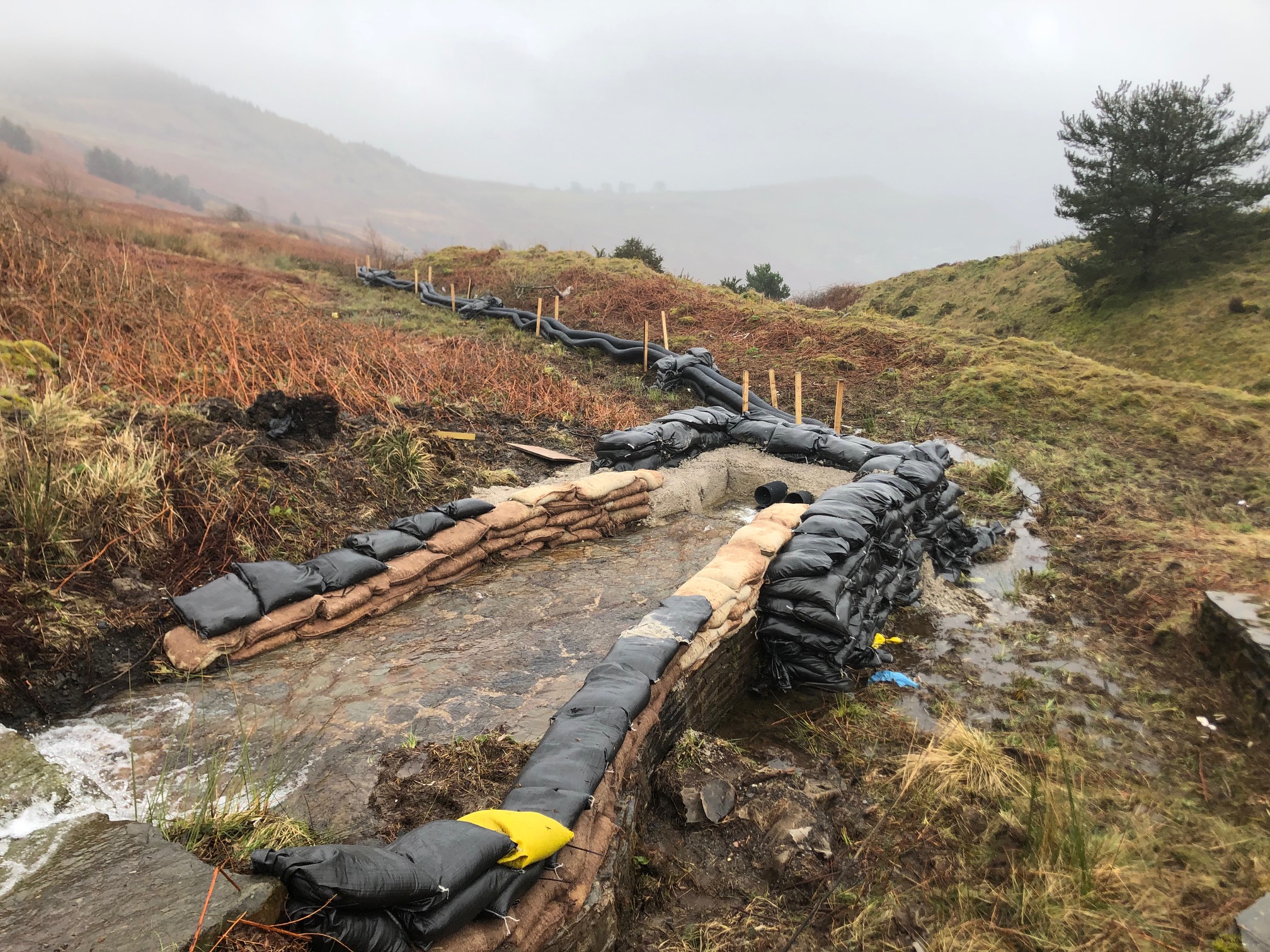
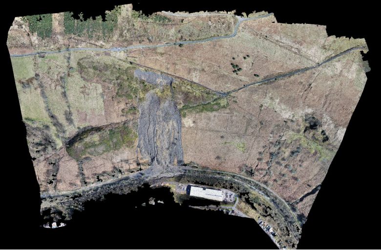
The survey data was required by The Coal Authority, Capita and Rhondda Cyon Taf Council to enable them to design remediation works and allow them to be undertaken before any further landslides occur. Following this survey, the UAV method could then be utilised at over 1500 legacy coal tips located across the Welsh Valleys, some of which will now need to be inspected on a regular basis.
The Solution
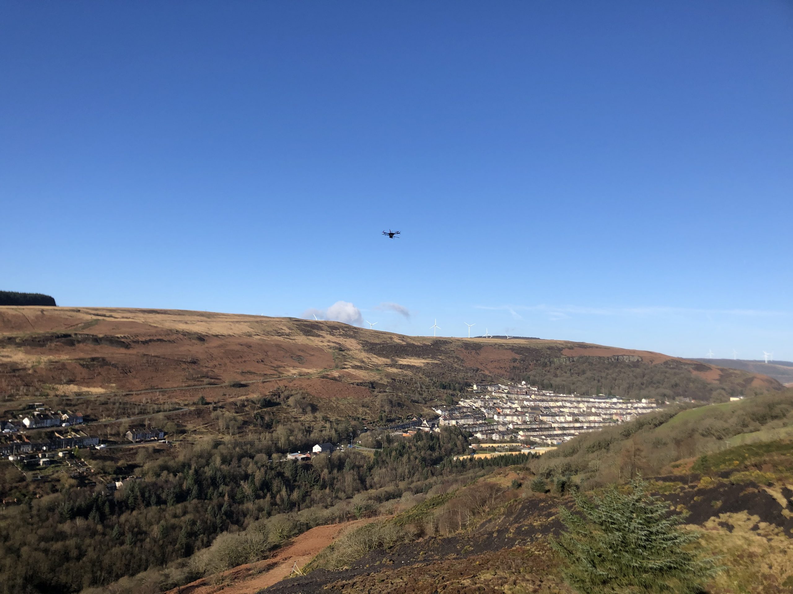
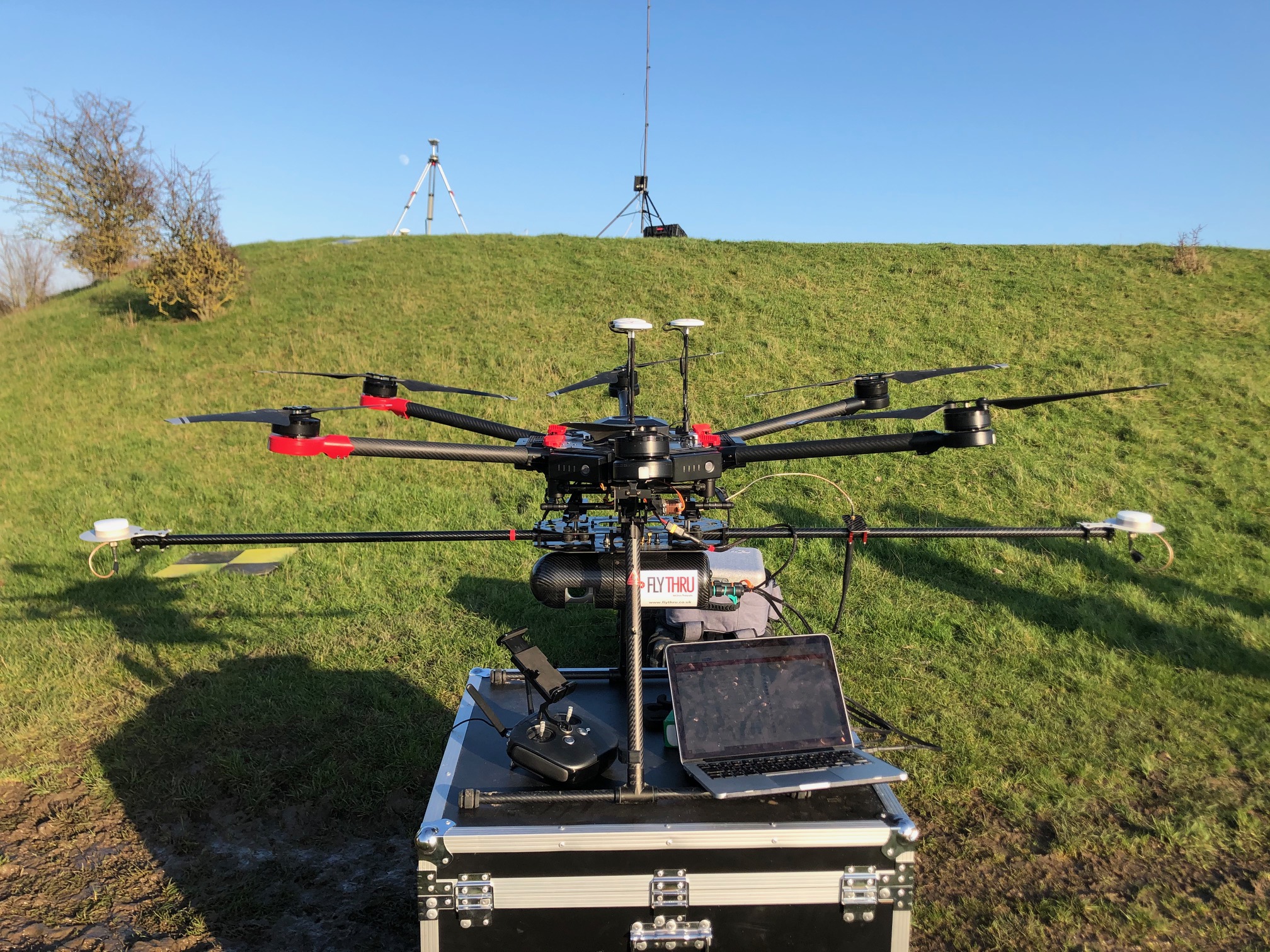
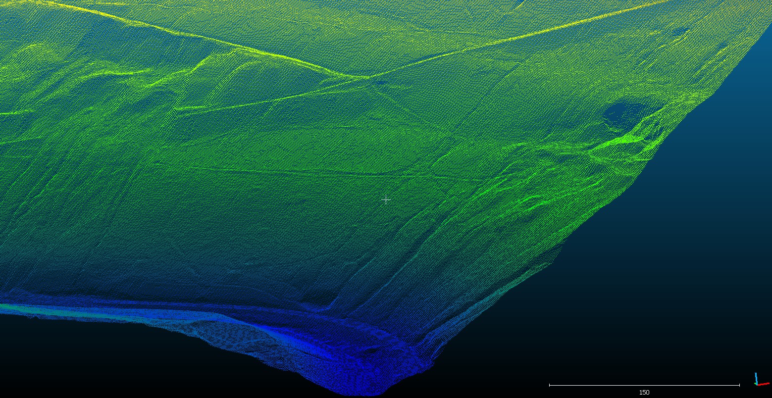
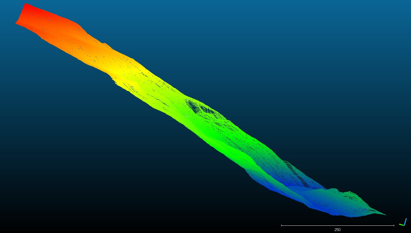
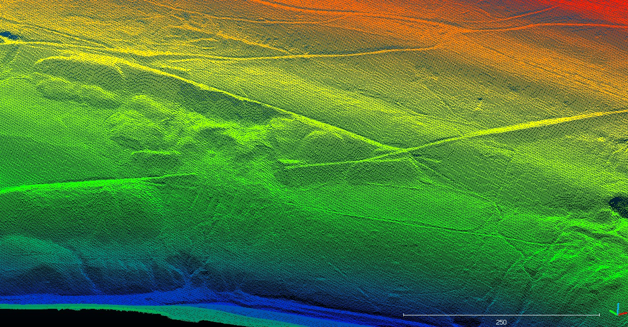
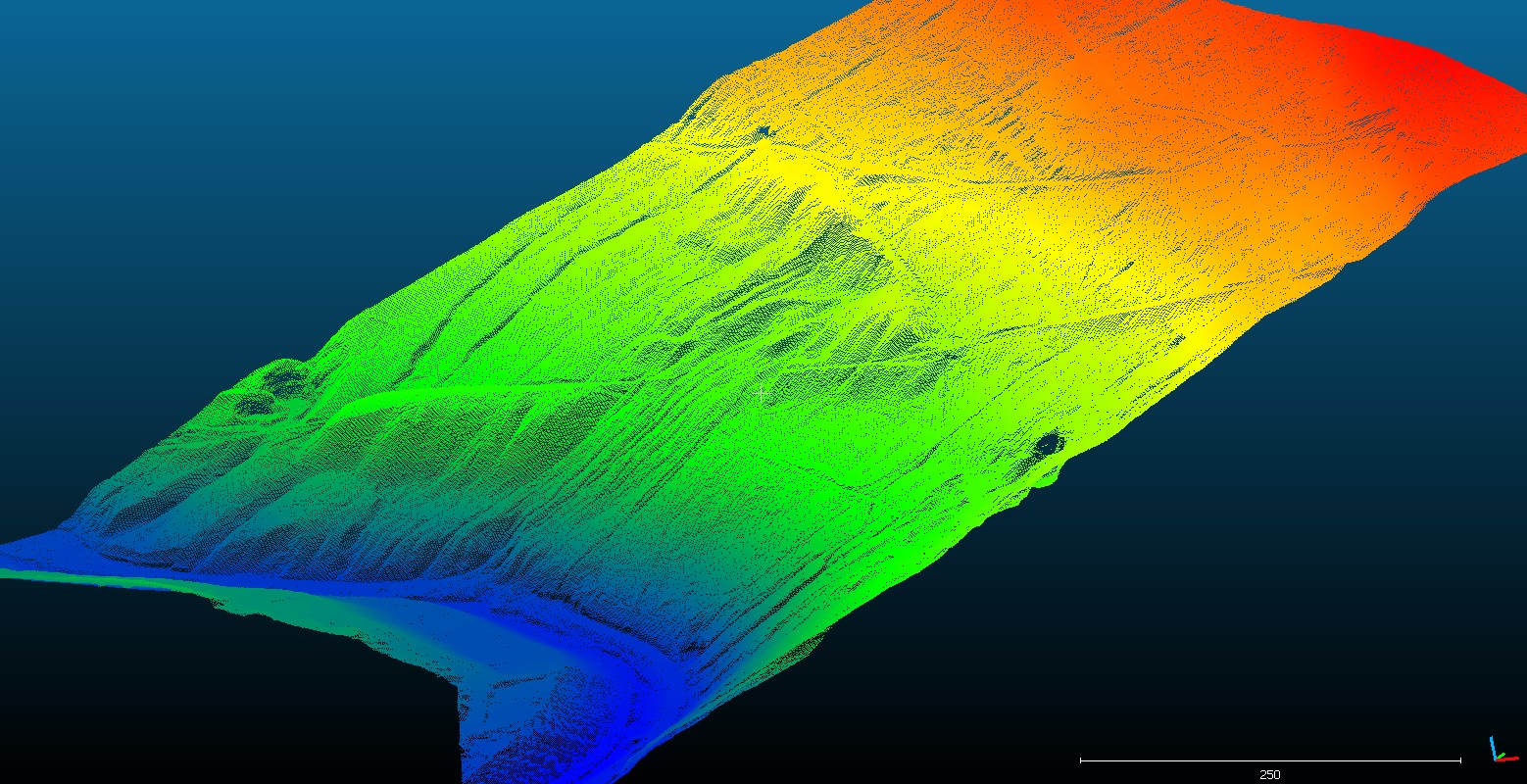
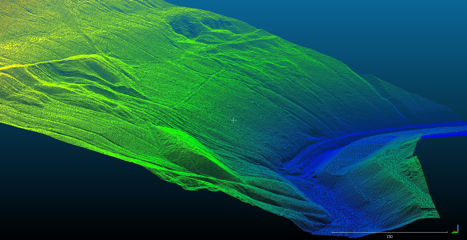
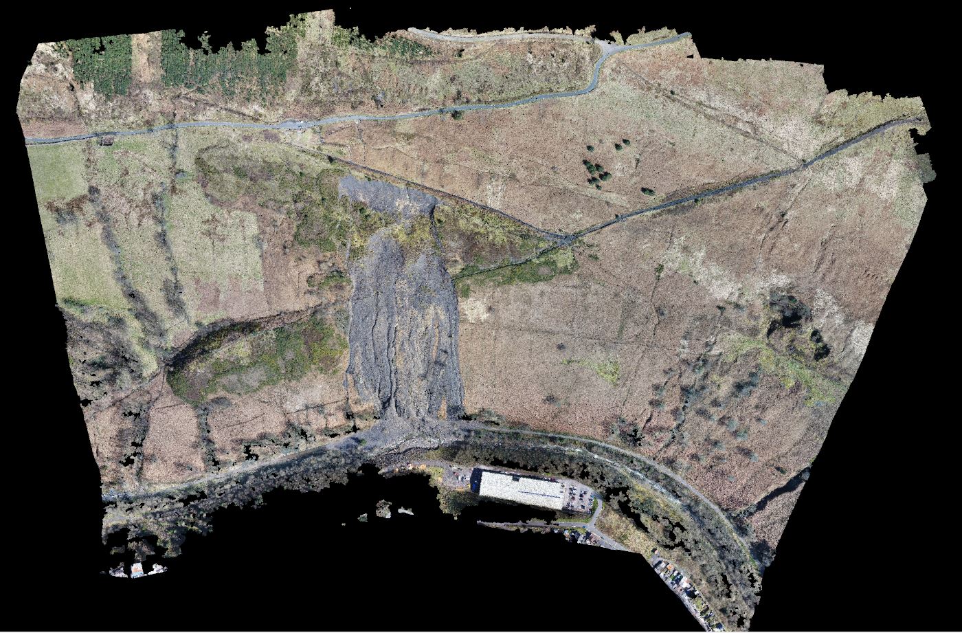
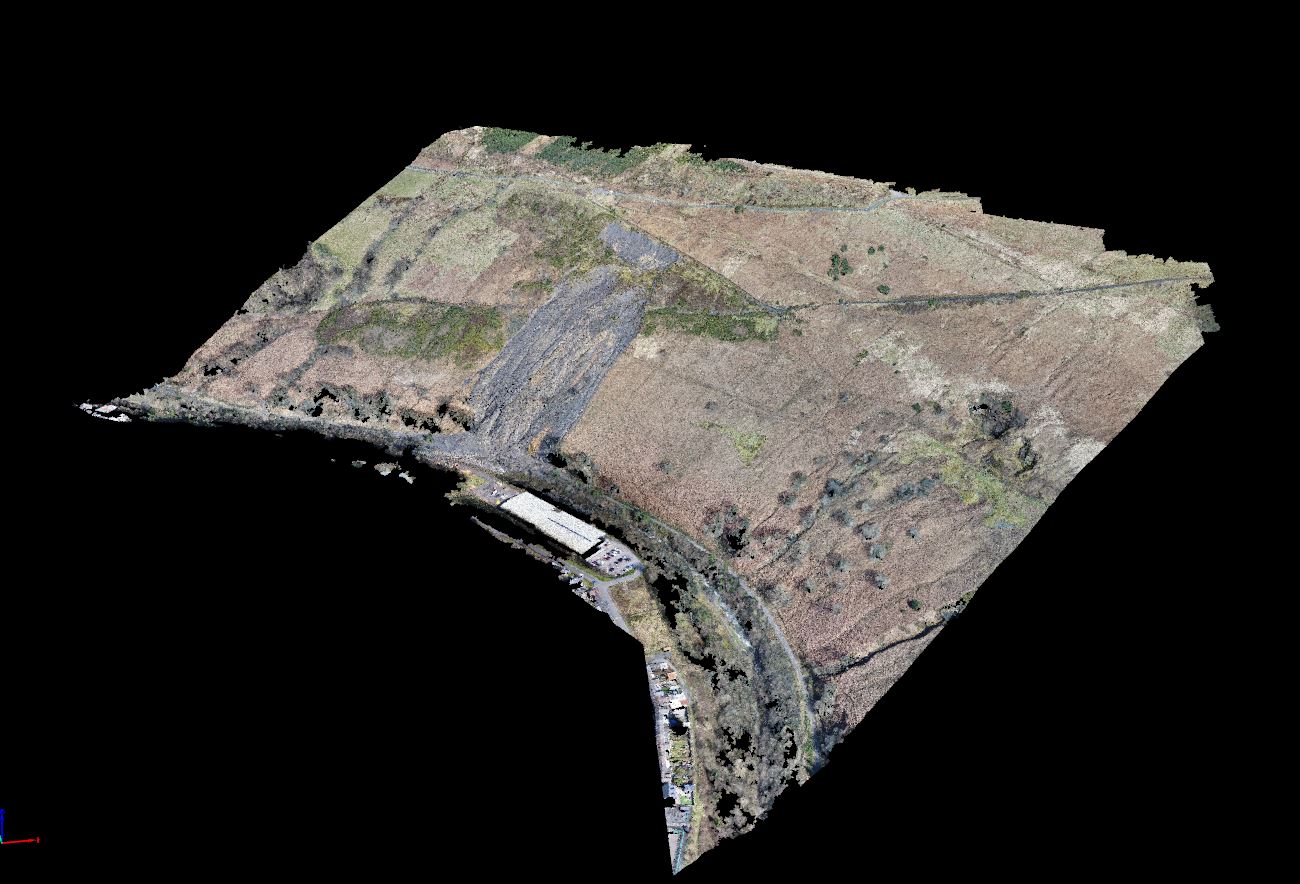
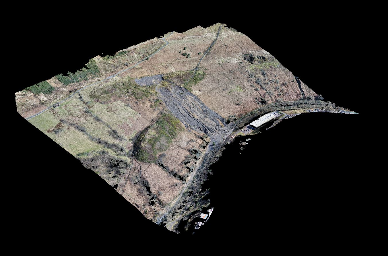
Geoterra’s experienced geospatial engineers, in collaboration with our partners FlyThru, utilised a bespoke heavy lift UAV equipped with a high definition DSLR camera and Routescene LiDAR sensor to fly over both the landslide and adjoining valley area generating a large multipath multi return laser scan point cloud. The point clouds were then post-processed to produce an extracted vegetation ‘bare earth’ Digital Terrain Model. The site was also flown with a DJI Phantom 4 UAV equipped with a high definition DSLR camera generating a series of photographs for the photogrammetry part of the survey and create a single ortho mosaic of the entire site.
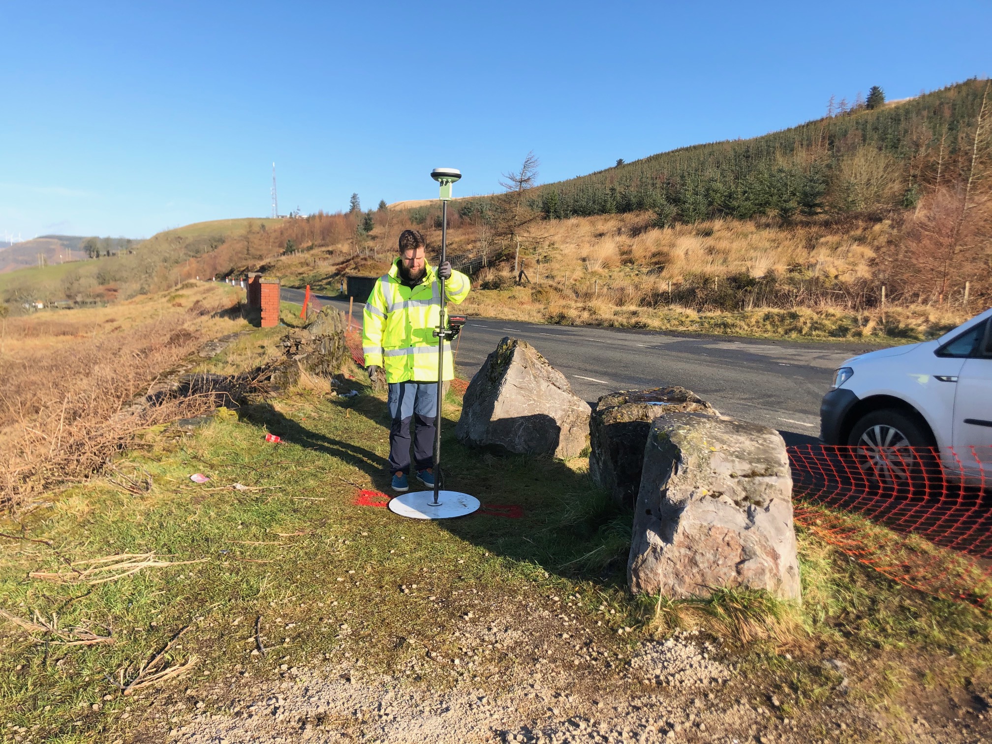
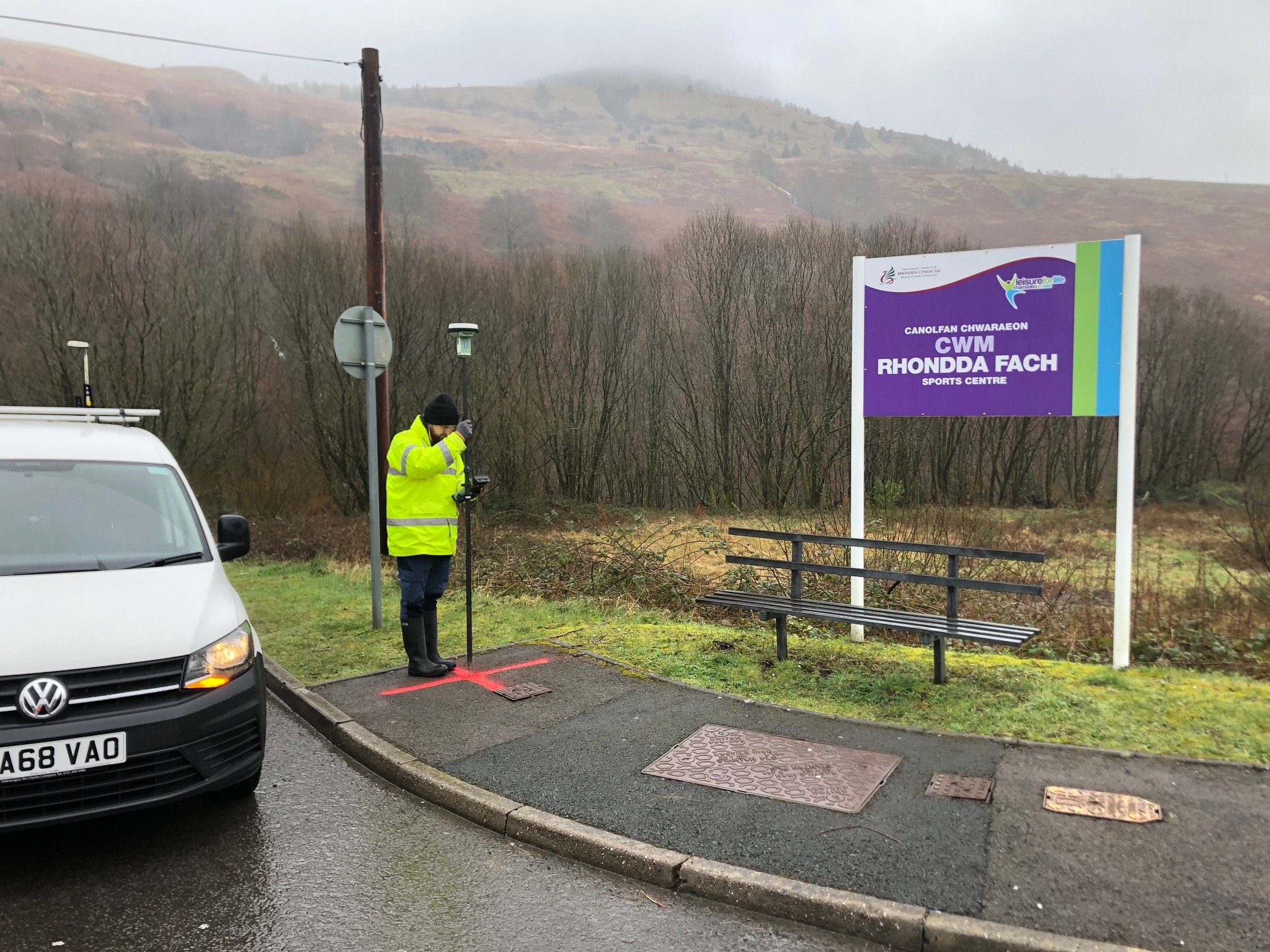
Ground control points were set up across the site and surveyed to OSGB OSTN15 National Grid.
The Deliverables
Geoterra provided The Coal Authority, Capita and Rhondda Cyon Taf Council with a range of key deliverables including a Digital Terrain Model, ortho-rectified mosaic photography TIF, contour plan and a 3D LiDAR point cloud in CSV and LAS formats to enable detailed analysis for design considerations to be made for remediation works to then be undertaken as quickly as possible.