Drainage Culvert Survey Beneath East Coast Main Line
Stanborough Park, Welwyn Garden City, Hertfordshire
A combined above and below ground survey of a brick-built drainage culvert beneath East Coast Main Line track for AMCO Giffen and Network Rail.
The Brief
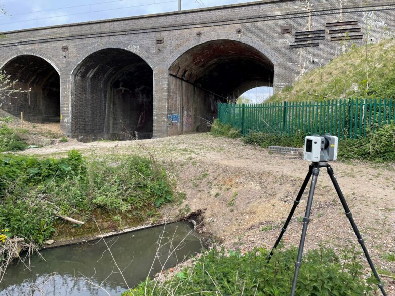
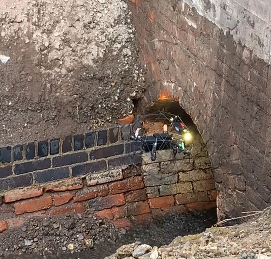
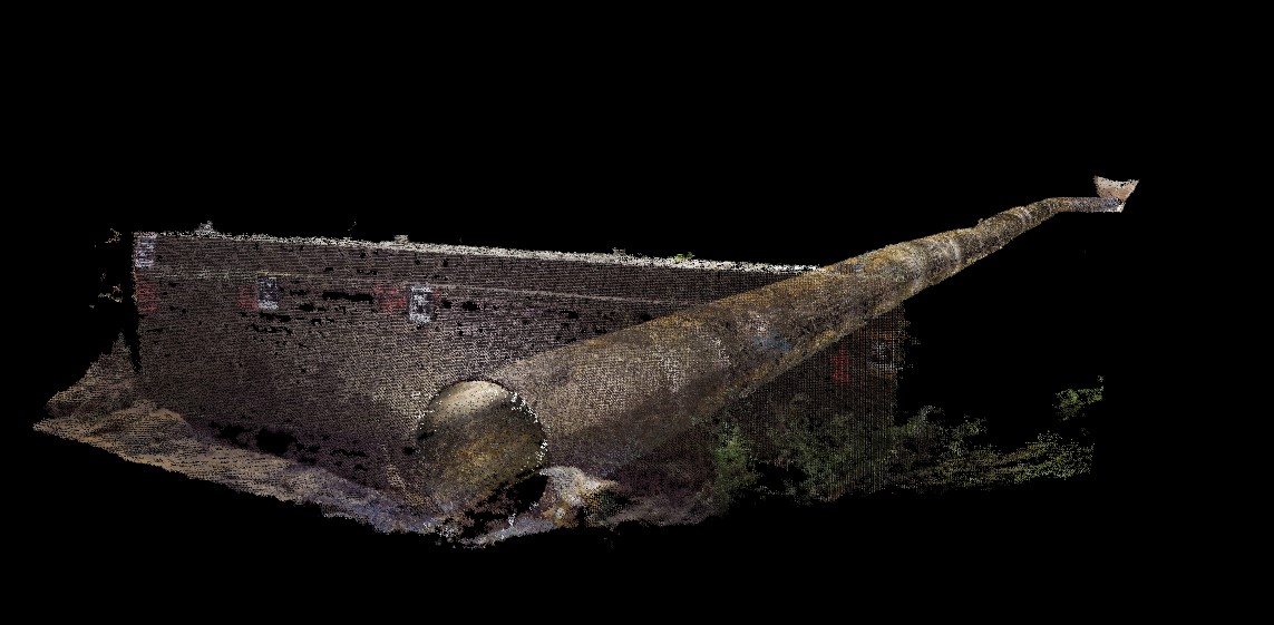
Geoterra was appointed by AMCO Giffen and Network Rail to carry out a 3D topographical laser scan survey of the surface, and a subsurface laser scan and remote UAV photogrammetry survey of a brick-built drainage culvert. This culvert had been located underneath part of the East Coast Main Line at Stan borough Park near to Welwyn Garden City in Hertfordshire.
The survey data was required by the client to enable them to assess the location and alignment of the culvert. In addition, they required an assessment of the culvert’s condition as it was deemed to be poor due to the lack of water draining through the feature correctly.
Due to the culvert experiencing a large flow of water and its presence beneath a busy rail line, it was vital to assess the culvert to ensure that it was competent and a subsidence event unlikely.
The survey data would also be used to design a GRP liner which was to be installed within the existing culvert to aid drainage at the site.
The Solution
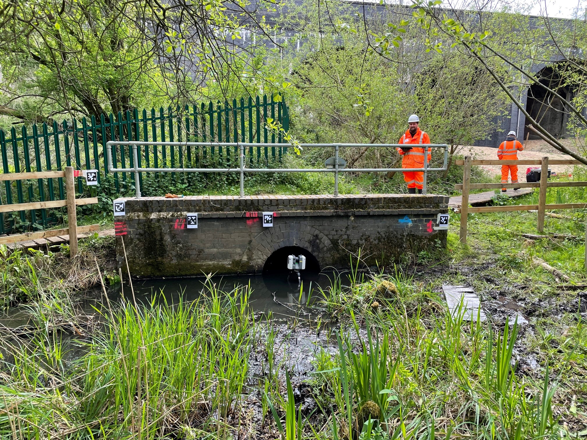
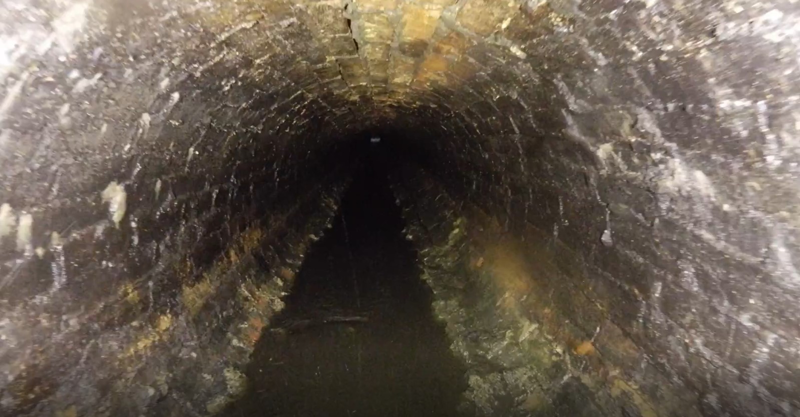
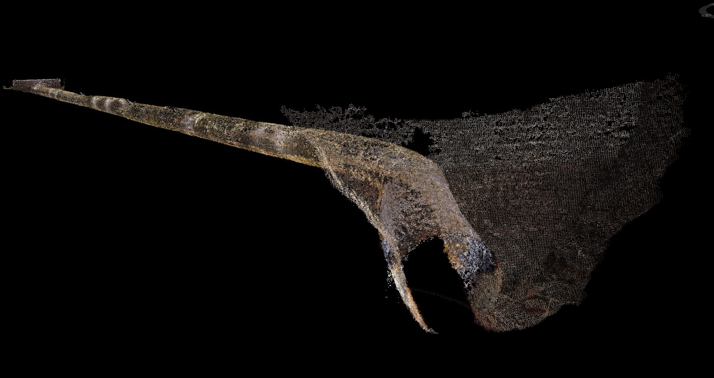
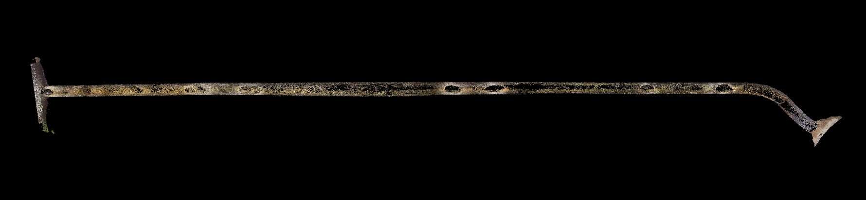
Prior to arrival on site, AMCO Giffen cleared both the intel and outlet portals, and jetted the culvert itself to remove debris and silt to ensure accurate mapping of the culvert was achieved.
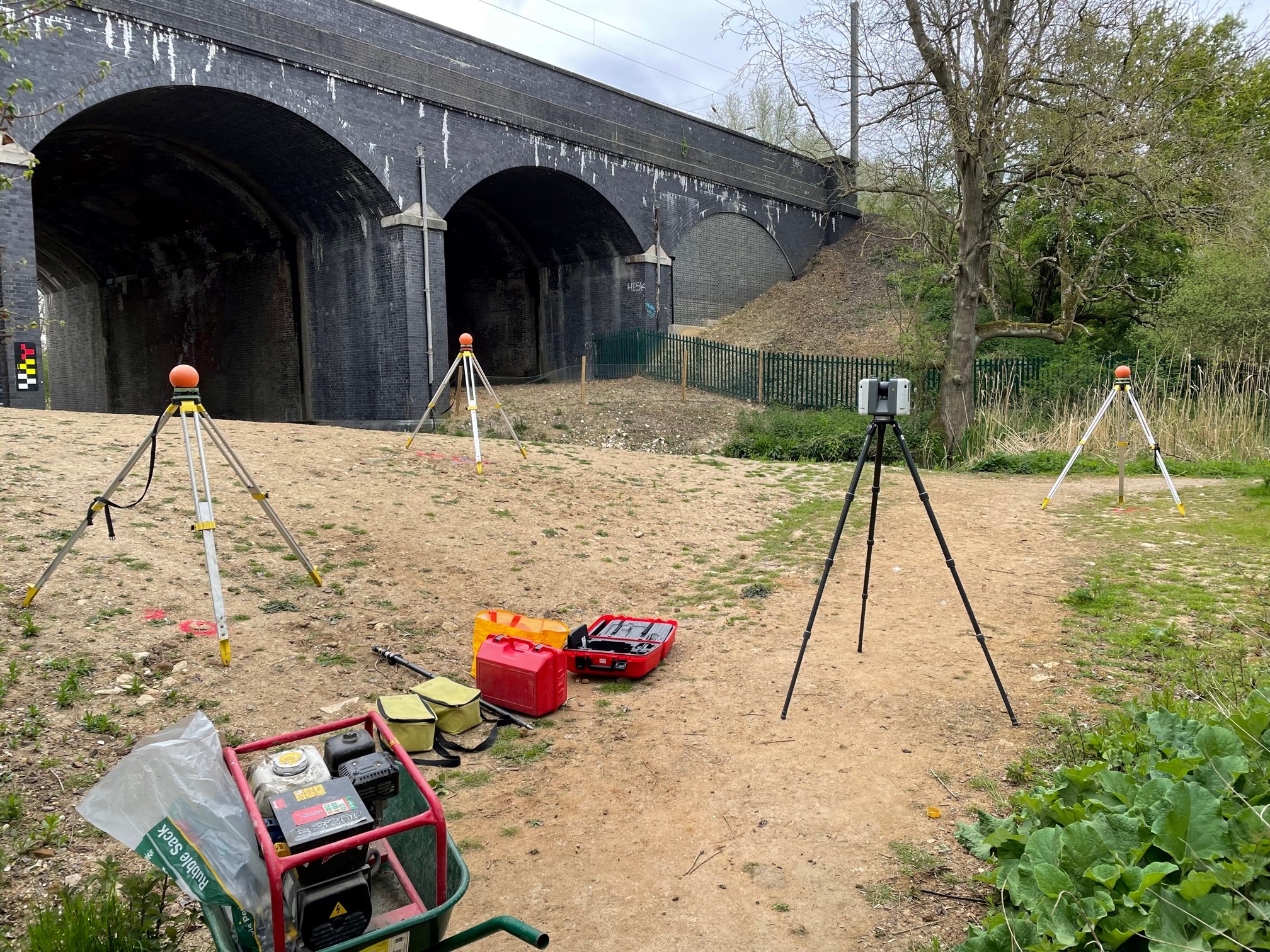
We installed geo-referenced laser scan targets adjacent to the culvert inlet portal, located next to the River Lea. Our team of geospatial engineers used a specialist Leica RTC 360 laser scanner to carry out a 3D laser scan of the surface locale to the inlet portal and included around the viaduct to the outlet portal.
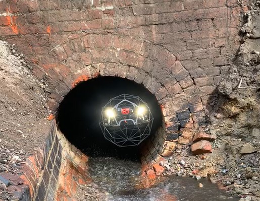
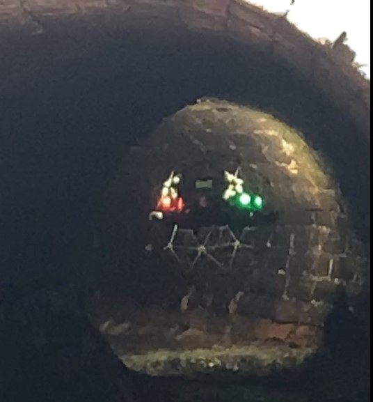
Together with our partners Flythrough, we then used the ELIOS 2 UAV to fly through the drainage culvert from the inlet portal access point to take a series of videos. These videos would be used to create a 3D photogrammetry model during post- processing.
By utilising both survey techniques, we could ensure that every feature of the drainage culvert beneath the rail line would be surveyed in order to provide the client with a complete 3D model of the subterranean feature. The surveys were geo-referenced to OSGB OSTN15 National Grid.
The Deliverables
Geoterra provided AMCO Giffen and Network Rail with a combined geo-referenced 3D laser scan point cloud model of the drainage culvert and surface locale, in RCS/RCP & LAS for viewing in Navisworks. The clients were also provided with an updated topographical plan and HD flythrough video.

Watch this video: