UAV LiDAR Survey of a Railway Cutting on the Chiltern Rail Line
Harbury, Warwickshire
A UAV LiDAR and HD ortho photography survey of a railway cutting on the Chiltern line for Coffey Geotechnics, The Murphy Group and Network Rail.
The Brief
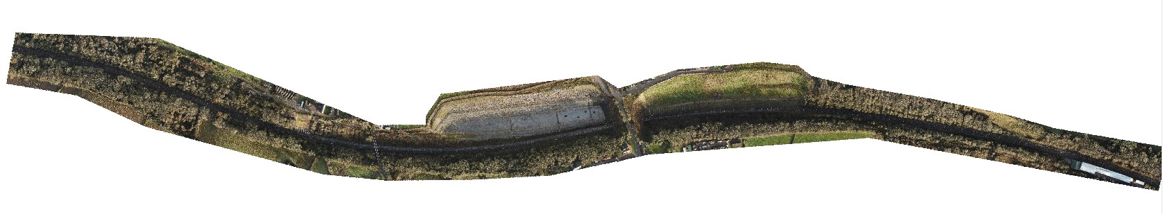
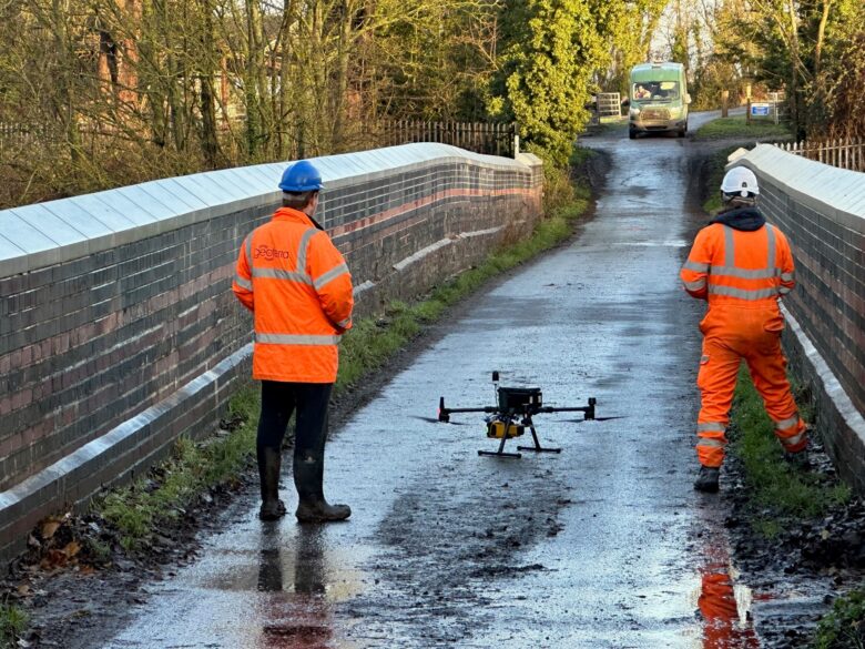
Geoterra was appointed by Coffey Geotechnics, The Murphy Group and Network Rail to complete a UAV aerial survey of a railway cutting on the Chiltern line in Harbury, Warwickshire. They required both low level LiDAR survey and a HD ortho photography survey to provide them with the survey data required.
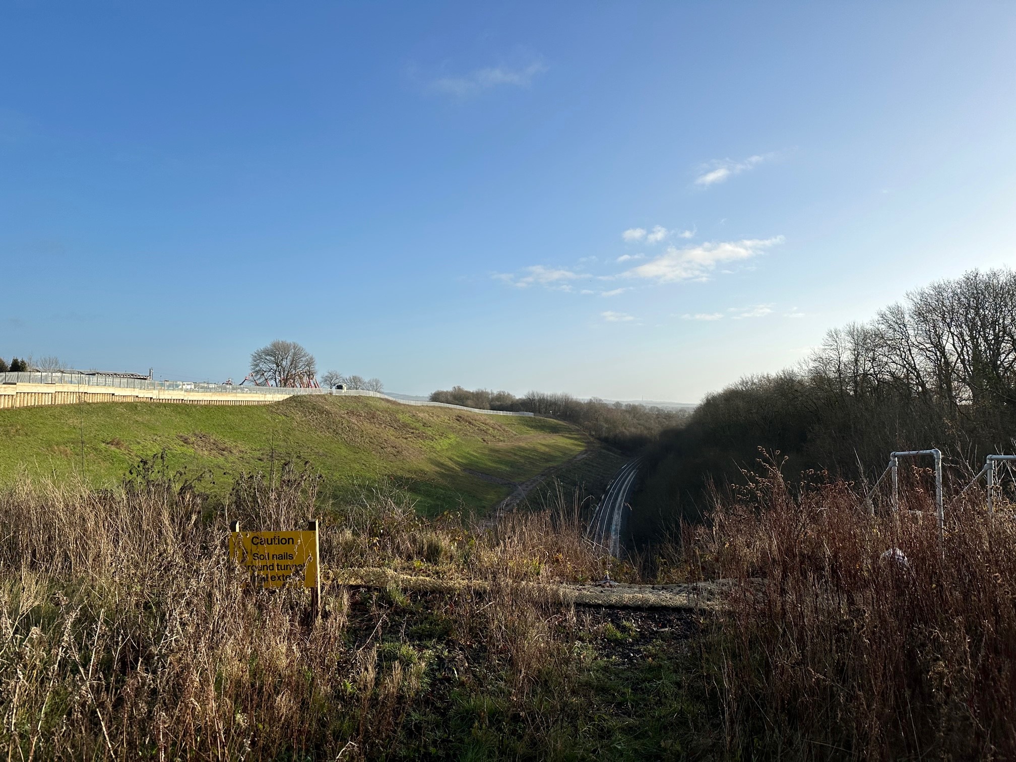
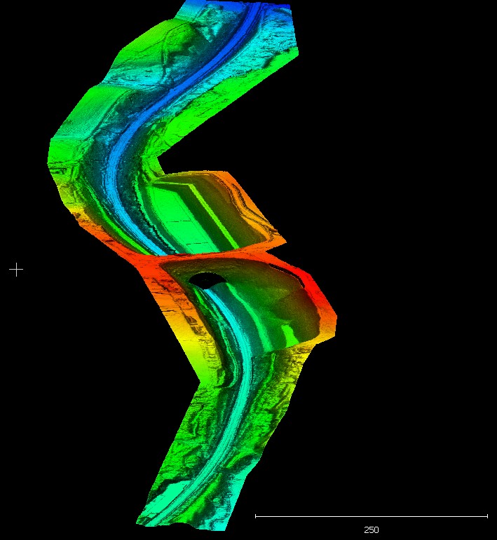
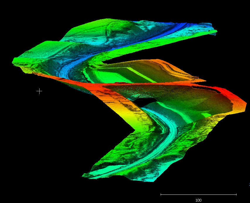
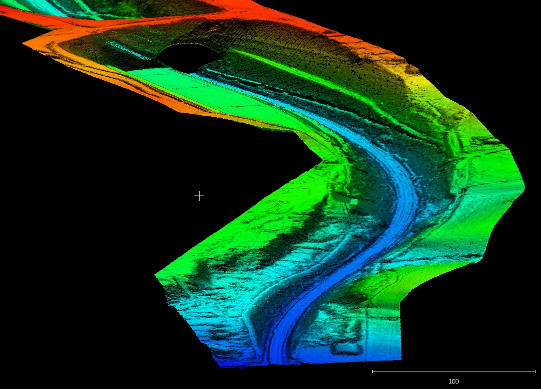
Designed by Brunel in 1852, this railway cutting had been an area of concern for Network Rail for some time. The area is renowned for its geological features which are not conducive for stable railway cuttings.
In recent years, a number of failures have occurred along the cutting which had been accompanied by multiple phases of remedial works.
The survey data required by the clients was to enable their geotechnical engineering team to fully understand the slope dynamics along the cutting and to effectively plan the future advanced slope stabilisation works to prevent any future failures.
The Solution
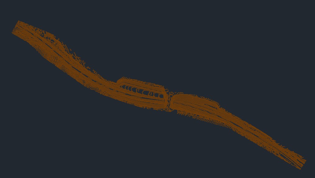
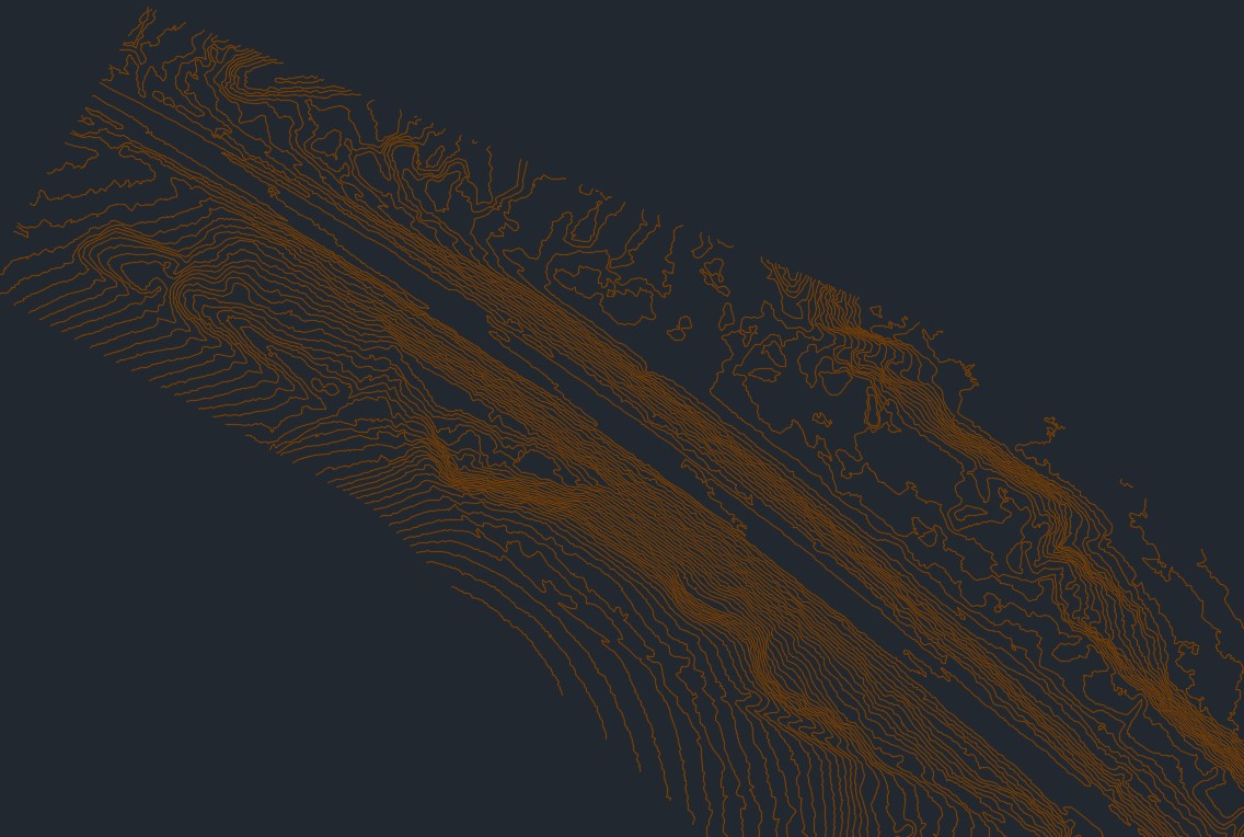
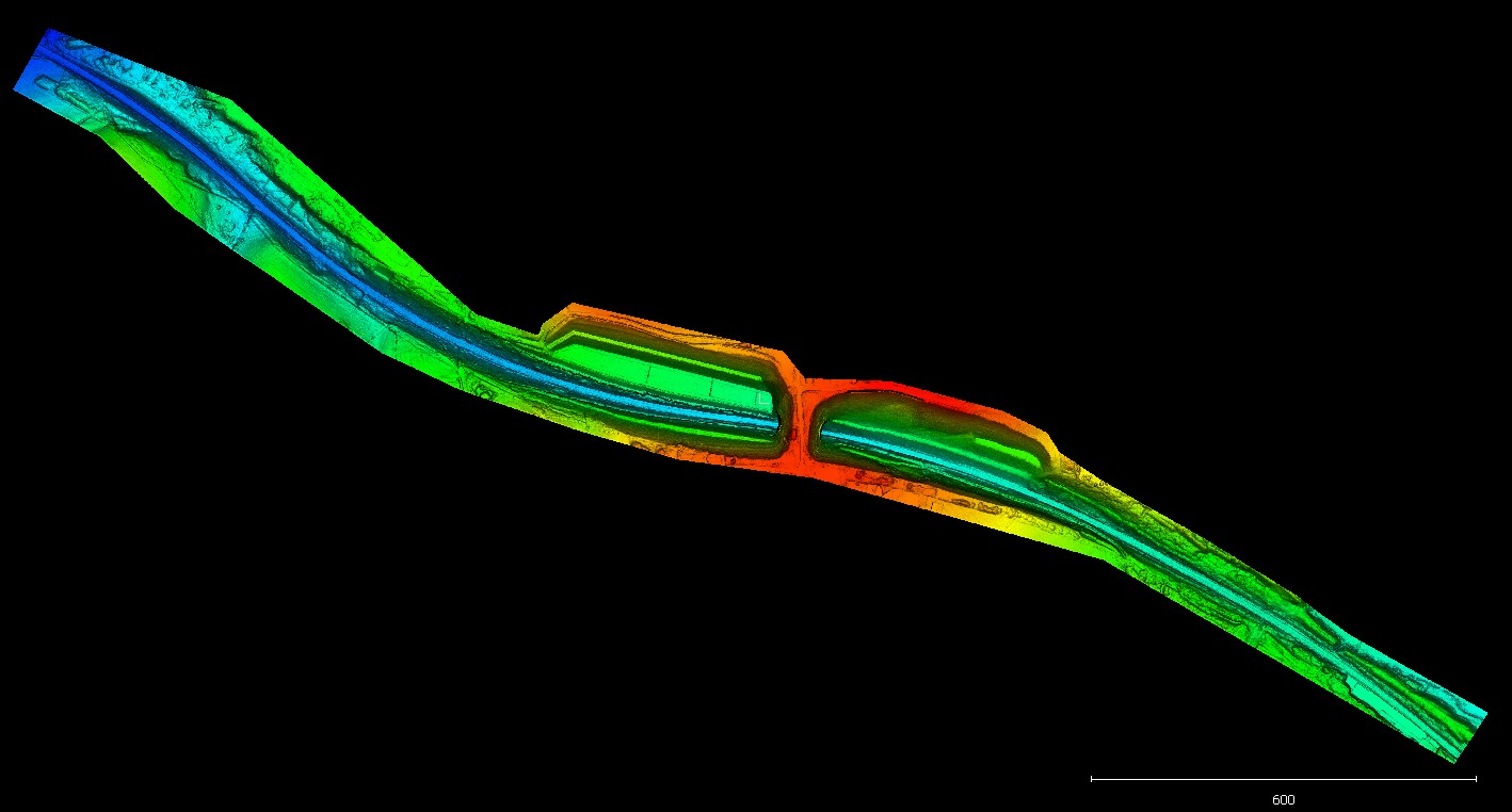
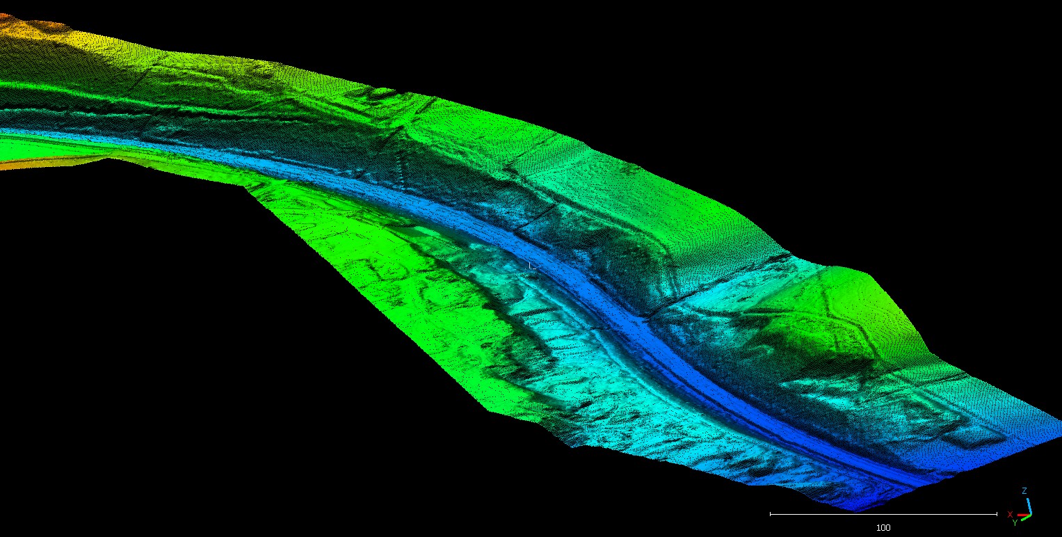
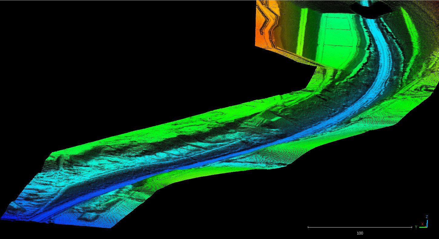
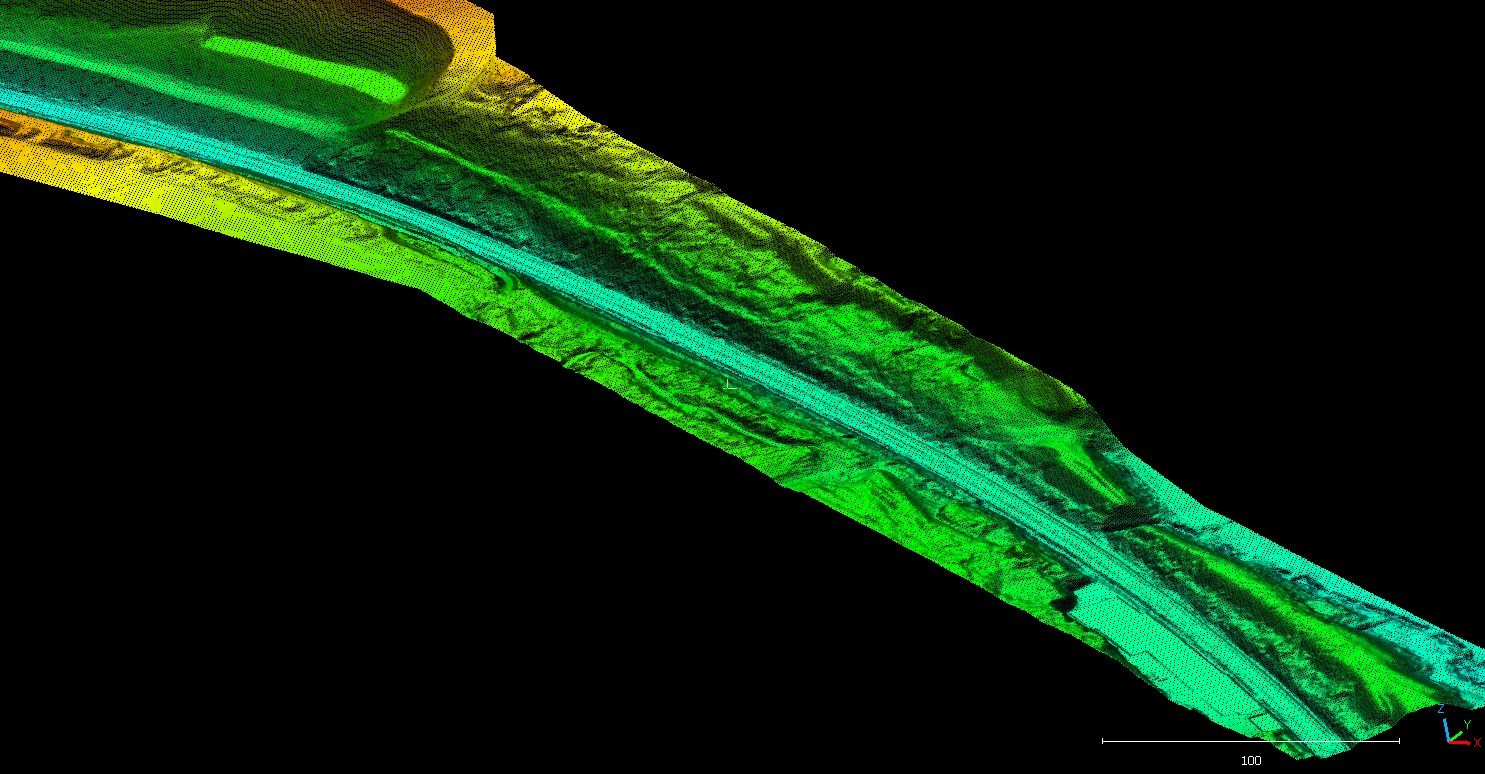
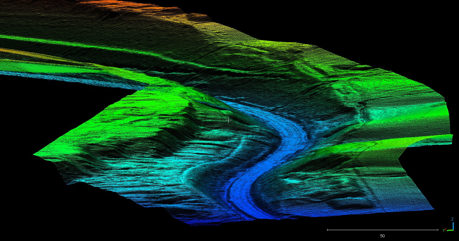
Geoterra’s experienced team of geospatial engineers in collaboration with our partners, Flythrough used a DJI M300 UAV equipped with a Yellowscan LiDAR sensor to fly over both the railway cutting and adjacent rock face generating a large multi- path, multi-return laser scan point cloud.
The point clouds were then post-processed to produce an extracted vegetation bare earth Digital Terrain Model.
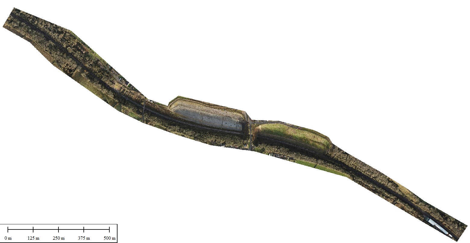
The site was then flown once more with the DJI1 M300 UAV equipped with a HD DJI P1 camera to generate a series of photographs for the ortho photogrammetry section of the survey. All works we carried out on site in just one day.
Ground control points were set up across both sites and surveyed to OSGB36 National Grid.
The Deliverables
We provided our clients, Coffey Geotechnics, The Murphy Group and Network Rail with the following:
· A bare earth Digital Terrain Model through the vegetation and worked areas at 0.2m, 0.5m and 1m grid intervals in LAS, XYZ, and DXF point cloud formats.
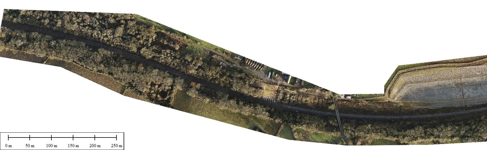
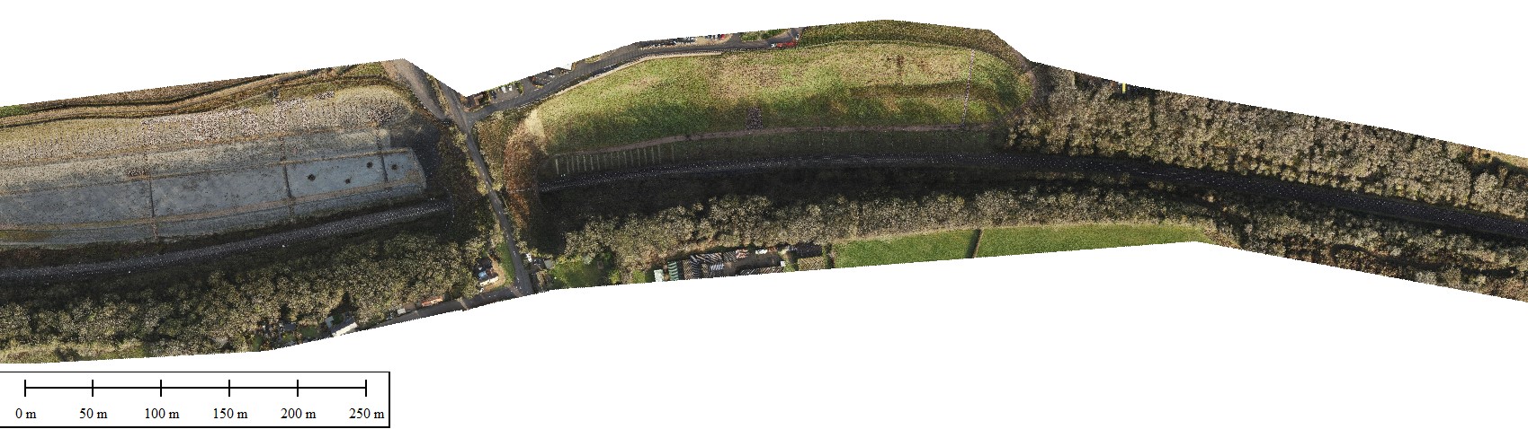
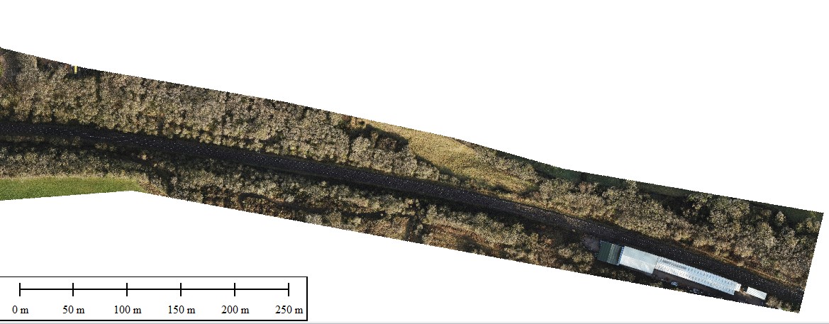
· An ortho photography mosaic overlay of the railway cutting and railway line in multiple resolutions.