News

14May

Aerial Surveys Geoterra 
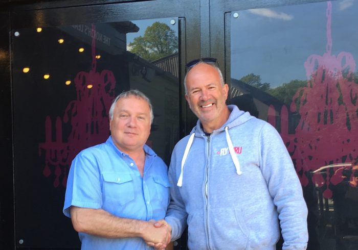
Geoterra partner with aerial survey mapping and inspection specialists, FlyThru

Geoterra is delighted to announce a new strategic partnership with FlyThru, specialists in aerial surveys and inspections using fixed-wing and multi-rotor UAV technology. Geoterra offers clients a range of aerial survey mapping and inspection solutions by partnering with industry leading service providers. That is why we have agreed to partner with FlyThru. They are highly…

13May

Subsurface Laser Scan Survey Mine Shaft 
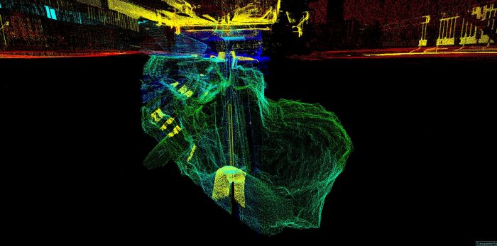
Geoterra carry out urgent subsurface laser scan survey following major road collapse in Scotland

Following a major ground collapse on Kilbowie Road in Clydebank, our emergency response team were called to site by ground investigation experts Soil Engineering and The Coal Authority to carry out an urgent subsurface laser scan survey of an unrecorded mine shaft. If you’re familiar with Clydebank, you will be aware that Kilbowie Road is a…

02Apr

Subsurface Laser Scan Surveys 
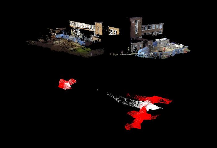
Geoterra subsurface laser scan survey unveils chalk mine voids under primary school

A north-west London primary school was recently closed temporarily on the discovery of an old unknown chalk mine under its school, confirmed by survey data captured by Geoterra. Pinner Wood Primary School recently hit the headlines after Harrow Council deemed there to be an “unacceptable risk” that the ground beneath the school could become unstable.…

14Mar

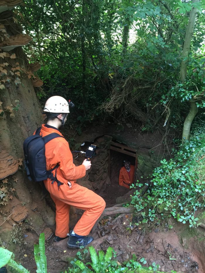
Geoterra invests in the GeoSLAM REVO & REVO CAM to extend mobile mapping capability

We are pleased to announce that Geoterra has launched a new Indoor Mobile Mapping service by investing in the GeoSLAM ZEB-REVO and ZEB-CAM hand-held mobile mapping system. Designed to be carried by a single operative, the GeoSLAM ZEB-REVO is a sophisticated hand-held laser scanning system used to capture survey data by simply walking around or…

28Oct

Subsurface Laser Scan Survey Hidden structural subsurface void laser scan surveys

Geoterra’s specialist geospatial engineering services are being called upon on a regular basis as more subsurface voids are being discovered; not just below ground after a drill bit disappears into a cavern, but increasingly into civil structures all over the UK and beyond. Geoterra have recently been working with the Northern Rail Alliance Skanksa BAM…

29Sep

Under Bridge Survey Geoterra innovation – new under bridge survey launched

We are pleased to announce the launch of a new under bridge laser scan survey solution. The challenges of bridge surveys Bridge structures over rivers and canals present many challenges for surveyors. The main problem is how to access those hidden areas underneath a bridge structure that we cannot see from the banks. Yes, you…