Remote Access Survey - Projects
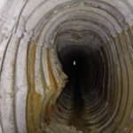
Historic Lead Mine Adit and New Drainage Tunnel 3D Laser Scan Survey
Geoterra was appointed by civil engineers, Walters Group, to carry out an above- and below-ground 3D laser scan survey of a historic lead mine adit (Adit 9) and a newly installed drainage tunnel connecting to the adit. Walters Group... Read more
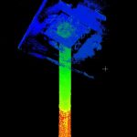
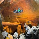
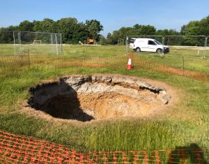
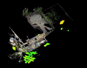
Subsurface Laser Scan and Multibeam Sonar Survey of Former Historical Coal Mine Shaft
Geoterra was contracted by The Coal Authority to survey a partially submerged coal mine shaft in the UK. The survey aimed to assess the structural integrity of the shaft, which had partially collapsed and was filling with water after mine... Read more
Aerial photogrammetry survey of 21 underground drainage adits
Folkestone Warren is an area of land prone to landslides. In December 1915, a severe landslip at Folkestone Warren, known as The Great Fall, resulted in train derailments and continued rail movement on the Dover to London South Eastern... Read more
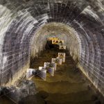
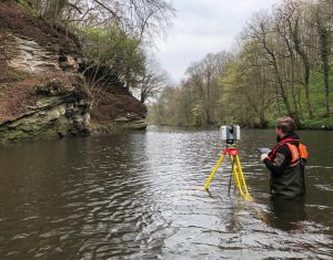
Dunford Bridge Drainage Culvert Survey
Geoterra was appointed by WSP Consultant Engineers to carry out a 3D topographical survey of a confined space drainage culvert that runs directly underneath the Trans Pennine Way at Dunford Bridge in South Yorkshire.
The survey data was required to assess... Read more
Services
News

Get In Touch
Winnington Hall
Winnington Lane
Northwich
Cheshire
CW8 4DU
Phone: +44 (0)1606 659019Fax: Not AvailableEmail: info@geoterra.co.uk


